


 144 / 192

[
] 144
the communal land tenure system and the nomadic grazing
patterns of pastoralists.
6
The security situation in Karamoja, however, has a nega-
tive impact on the mobility of pastoralists and the pastoralist
system. Pastoralists are forced to kraal their animals every
night in fear of raiders from neighbouring South Sudan and
Kenya. This practice results in overgrazing around the kraals
and underutilization of grazing far away from them.
Crop production in Karamoja is rain-fed with high potential
yields in the western districts of Abim, Napak, Nakapiripirit
and the green belt of Kaabong and Kotido. These areas are
ideally suited for rain-fed crop production due to good quality
soils and annual rainfall of more than 800 mm. The main crops
produced are sorghum, maize, millet, beans, groundnuts,
cowpeas, pigeon peas, sesame, sunflower and sweet potatoes.
Cassava is a new crop recently successfully introduced into
the region due to its drought tolerance. Intercropping with
maize, sunflower, sorghum, beans and cowpeas is a common
practice in the higher rainfall zones.
Cultivation of fields and gardens is done manually with
hoes and only the more progressive farmers utilize oxen for
cultivation. The absence of oxen as the main method of culti-
vation was evident in the eastern districts with more draught
power utilization in the western districts. Women mainly do
primary cultivation and weeding while generally men take the
lead with harvesting.
Lack of water harvesting or soil conservation practices has
resulted in poor plant growth. Cultivation only starts after the
first rains. Seeding is done on poorly prepared seedbeds with
resultant low germination and uneven plant densities. In addi-
tion, weeding is done too late and weeds compete with crops for
available soil moisture. Cultivation and seedbed preparation is
key in the successful production of crops, yet the way it is done in
Karamoja makes agriculturalists highly vulnerable to dry periods.
The disaster risk assessment methodology as proposed by
Wisner, Blaikie, Cannon and Davis
7
and adapted by Jordaan
8
was used as the framework for drought risk assessment.
Phase 1 consists of the hazard analysis, Phase 2 the analysis
of vulnerabilities and coping capacity, while Phase 3 entails
the identification of adaptation and coping strategies.
The main determinant for hazard assessment in the case of
drought is water deficit for normal production caused by too
little precipitation and too high evapotranspiration. Assessment
of these factors was based on historical meteorological data and
contributions from focus groups and other stakeholders.
Dry conditions were analysed using satellite-based monthly
rainfall estimates at 5 km
2
spatial resolution. The source of the
rainfall data was ‘CHIRPS’, a blended rainfall dataset developed
by the United States Geological Survey for the whole of Africa for
agricultural productivity and long-termdrought analysis. Macharia
prepared the precipitation anomalies for the past 10 years.
9
Analysis of the results clearly shows that below-average
precipitation is the exception rather than the rule and the
perception of droughts every second year is totally unfounded.
10
Drought vulnerability was measured using indicators for
each of the seven districts and these were grouped according
to economic, social and environmental indicators. The main
economic vulnerability indicators were extremely low crop
yields as a result of poor agricultural practices; high post-
harvest losses (40-60 per cent); market imperfections; and
high animal mortalities mainly due to animal diseases.
The traditional social structure in Karamoja elevated the
importance of social vulnerability. The main social vulnerability
indicators were cultural beliefs and practices; gender discrimi-
nation and beliefs regarding gender responsibilities for food
production; extremely low literature levels; lack of knowledge
— which resulted in poor agricultural practices; and security,
which limits the movements of pastoralists and agriculturalists.
Environmental vulnerability to drought in this case refers to
natural resources such as grazing, soil and water. Important
indicators were bush encroachment, overgrazing, water avail-
ability and soil quality.
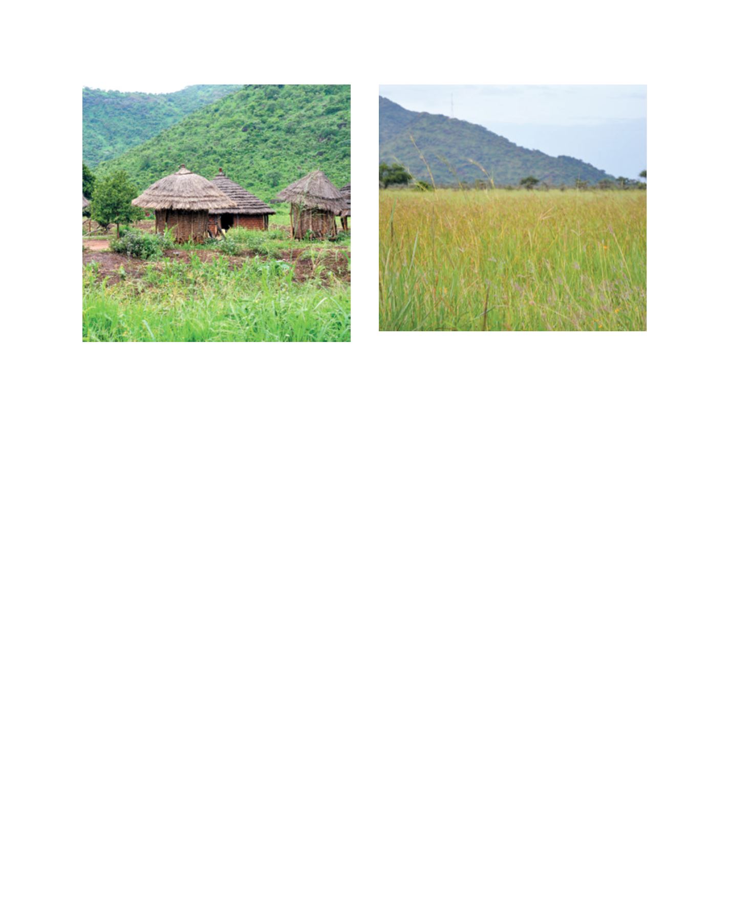
Typical grainaries
Sufficient, high quality grazing is essential to the pastoralist system, but
restocking could cause a return to overgrazing
Image: DiMTEC
Image: DiMTEC
L
iving
L
and