


 30 / 192

[
] 30
with drought and from their wear with hydraulic transmis-
sion and wind. The intensity of the weathering of rocks and
strong pedogenesis is dependent on weather conditions
(temperature, humidity). Indeed, under hot and humid
conditions, chemical weathering promotes dissolution of
the silica igneous rocks or carbonate limestone elements.
The silting processes are more important and more visible
especially in a hot and dry climate.
These processes have led to three major erosion systems in
the Niger River basin:
• the Guinean system consisting of a feed head, high erosive
power and a spreading and settling zone (Delta basin of
Mali), connected by a transport zone (between Bamako and
Segou), representing 13 per cent of the basin area
• the Sahelo-Saharan system corresponding to the Niger
loop and having a reduced internal power supply
network, unsustainable under dependence of the outlet
of the Delta basin of Mali, representing 58 per cent of the
basin area
• the Nigerian system composed of two well-watered feed
heads with high erosive power (Jos Plateau and Plateau
Yoruba for Niger River, Jos Plateau and Adamawa for
Benue river) and a wide application and sedimentation
area (confluence of oceanic region and delta),
representing 29 per cent of the basin area.
With an annual average growth rate of nearly 3 per cent the
population of the Niger basin, estimated at 113 million in
2005, will reach 160 million in 2020, including 90 million
urban and 70 million rural. The average population density
is 55 inhabitants per km² and rural population density is 37
inhabitants per km². The areas with higher population densi-
ties (30-50 inhabitants per km
2
) register intense agricultural
activities, often centred on the double production of food
crops and cash crops, including cotton. In the Niger basin it
was found that the high population densities and poor agri-
cultural practices accelerate the silting process.
The main anthropogenic factors of land degradation in the
basin include: rapid population growth (3 per cent per year),
increasing urban consumption of natural resources (40 per
cent of the population live in cities), extensive agriculture
(about 50 per cent of the active area of the Niger basin is
cultured), overgrazing (UBT 31.3 million with an annual
growth rate of 2.4 per cent), overexploitation of wood energy
and the expansion of mining activities.
Approach and intervention techniques
To cope with the accelerated land degradation process of in
the Niger basin, the Niger Basin Authority (NBA) member
countries have adopted different strategies and policies for
sustainable management of natural resources. This political
will has led to the commitment of the NBA in a shared-vision
process with a main component, the development of the
Sustainable Development Action Program (SDAP) including
an investment plan. Three core areas of actions were defined
in the SDAP: the preservation of ecosystems in the basin,
development of socioeconomic infrastructure, and capacity-
building and stakeholder participation.
The African Development Bank and the West African
Economic and Monetary Union (UEMOA) funded a project
(2006-2014) called the ‘Fighting siltation programme in the
Niger River Basin’ (PLCE/BN). The major aim is to effectively
Image: AfDB
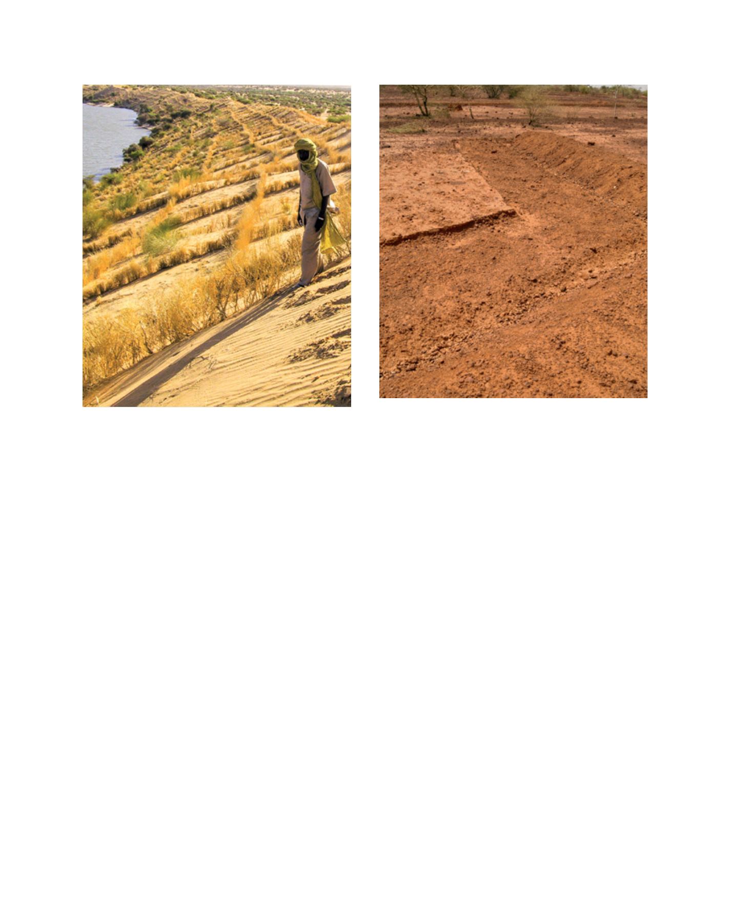
Glaze treatment methods include benches to control erosion, like these
ones at Yettoré Allah, Niger
Image: AfDB
Dune fixation in the Gao region, Mali
L
iving
L
and