


 16 / 192

[
] 16
adapted to extreme ecological conditions and provide
essential goods and ecosystem services. However, forests
and their associated ecosystems are facing serious and
multiple threats, ranging from deforestation to degrada-
tion, fragmentation and desertification. Nevertheless, if
well managed and properly valued, forests and agrofor-
estry landscapes in drylands can help alleviate poverty and
contribute to food security and sustainable livelihoods for
2 billion people worldwide. Many drylands countries are
developing and piloting approaches and technologies to
support sustainable management and restoration of dryland
forests and agroforestry systems.
Over the past several years, these technical practices were
fine-tuned and tested and a number of packages for the
best management of water and land, including reducing
land degradation, were developed. However, to achieve
better adoption by farmers and ensure positive results
from their implementation, suitable techniques/technolo-
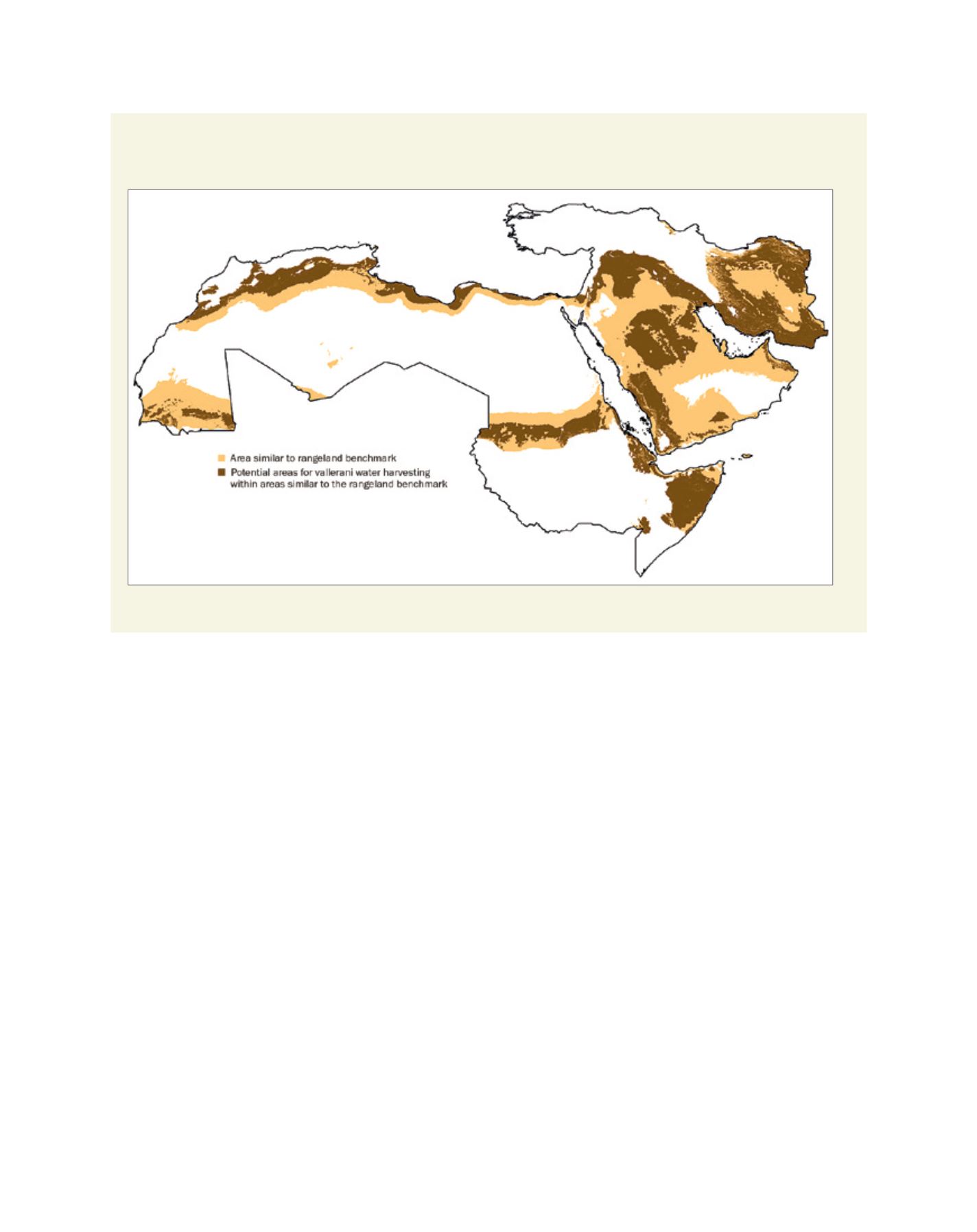
gies need to be disseminated on a large scale to similar dry
areas. Identifying areas similar to those of the benchmark
research sites where technologies are developed is a tool to
facilitate the scaling-out process.
In many countries, the dissemination of improved tech-
nologies does not usually take into consideration the
specificities of the agroecosystems. Consequently, the effi-
ciencies of the technology transfer programmes remain
low. Benchmarking has provided an approach that helps
identify areas similar to those where the improved tech-
nologies were developed. This starts with the selection and
characterization of a benchmark site in an agroecosystem;
then improved technologies are developed and evaluated
in this site and, finally, similar areas to the benchmark site
are identified and mapped to better target the out-scaling
on a large scale.
Similarity analyses are used to find areas with certain
characteristics that match those where technologies were
tested and fine-tuned. Similarity maps were generated at
the regional level using expert criteria, defined by an inter-
disciplinary team and using the available datasets. Among
the factors used to develop these criteria are the soil,
climate, land use and water resources. Suitability analyses
are used within the similar areas at the national level, to
identify areas where the water and land management pack-
ages developed can be applied with a high probability of
success. Professionals, planners and decision makers can
use the information and products generated from these
analyses to target the scaling-out of improved and adap-
tive technologies.
The purpose of these analyses was to identify geographic
locations for scaling out. A follow-up socioeconomic
analysis would be needed at the community level before
interventions can be implemented. This should be
supported by a proper enabling environment to enhance
adoption by the communities.
Areas similar to the rangeland benchmark research site in Jordan and potential areas for scaling out
mechanized water harvesting intervention
Source: Similarity and Suitability Analysis to Assist the Out-Scaling of Sustainable Water and Land Management Practices in West Asia and North Africa. ICARDA
L
iving
L
and