
Improved collaboration
When working on a project with
irrigation designers, engineers,
contractors and other consultants,
having the ability for everyone to be
working from the same survey datum
allows individuals to integrate up-to-
date information into their respective
plans. This streamlines communication
and the problem-solving process prior
to and during construction.
Field adjustments
During the construction process,
change is inevitable. Immediately
after documenting problem areas, the
surveyed ‘field solution’ can be added
to the plan and analyzed for further
development and assurances that
safety, functionality, and playability
are not compromised.
Construction documentation
Field observation services are
commonplace for golf course
architects, typically in the form of
regular site inspections while the
course is under construction, when
the designer can work with field
personnel and ensure the plans are
being implemented properly. Accurate
survey equipment provides designers
with the ability to monitor and track
areas of disturbance and construction
materials, and offer an enhanced
management service for clients to
ensure projects stay on budget.
The future will bring many more
possibilities. For example, GPS
units and drones work well together
for base mapping and producing
topography, with surveyed control
points provided from GPS units, and
drone-produced photogrammetry
which provides contour data.
Precision design—based on similar
principles to precision agriculture—
will see the introduction of remote
sensing data provided by GPS and
drone technology being used to
provide a detailed understanding of
a golf course’s agronomic processes,
so informed decisions can be made
about design changes to improve
a golf course’s overall efficiency
utilizing natural resources.
•
Consult your local ASGCA member
to find out if a GPS survey may be
beneficial to your golf project. Find a
member at
www.asgca.org/members.
19
Three tips for GPS surveys
1. Don’t be intimidated
While the vernacular of surveying
might be off-putting to some,
the back end of collecting and
processing surveys is all CAD
based. If you know CAD, you can
easily take advantage of GPS data.
2. Know your accuracy
As the phrase goes: garbage in,
garbage out. With so many different
kinds of GPS survey units out there,
it’s essential to know what makes
one more accurate than another, and
to make sure there are checks and
balances set up on your unit to ensure
the integrity of the collected data.
3. Know your limitations
Having the ability to survey base
data, stakeout design features,
as well as produce accurate
topographic information is a game
changer for golf course architects
—
but State Regulatory Statutes often
mandate elements such as property
lines and easements to be surveyed
by a Registered Land Surveyor.
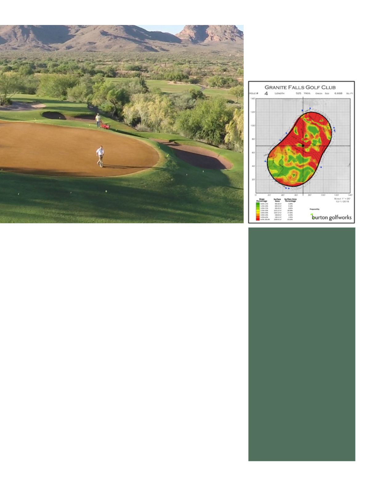
GPS survey units can help architects create
detailed green mapping with very accurate
topography and slope analysis


