


 179 / 192

[
] 179
Logging decks, where the soil is more compact, are areas
where rehabilitation is often difficult. Based on research
findings, using larger sized plants, bigger planting holes
and slow release fertilizers has enhanced the rehabilitation
of such areas.
Outside the forest reserves, open areas are also being
rehabilitated. A good example of badly degraded areas that
have been rehabilitated can be seen in the forests within
the Forest Research Institute of Malaysia (FRIM) campus.
Planting on the campus, which was originally a tin mining
and agricultural area, began in the 1920s. Today the area has
fully regenerated into a healthy and highly stocked forest
with rich biodiversity. The mean volume of timber is esti-
mated to be close to 400 m
3
/ha which is twice that of a rich
natural forest. Biomass has been estimated to be in excess
of 450 tons/ha.
Rehabilitation of degraded coastal mangroves
Mangrove forests are one of the most productive and
biodiverse wetlands on Earth. They grow in unique condi-
tions and are frequently found along sheltered coastlines
in subtropical and tropical areas. The coastal forests play
a vital role in coastal protection, especially in reducing
coastal erosion and the impacts of storm surge (tsunami).
Mangrove forests represent an important ecosystem and
have been accorded high priority in maintaining protective
and productive functions along the coastline. These forests
also play a vital role in carbon sequestration and mitigat-
ing climate change. They are an important ecosystem for
carbon reservoirs known as carbon sinks, and an integral
part of the global biological system. As such, the implemen-
tation of coastal forest conservation and rehabilitation to
reduce forest degradation and deforestation and enhance
the carbon stock is a commitment under the United Nations
Framework Convention on Climate Change.
The total mangrove area in Malaysia is currently 575,000
hectares. The area was reduced from 695,000 in the
1970s to about 575,000 in 2005 due to land conversion
or reclamation for agriculture, aquaculture, urbanization,
infrastructure development and natural causes, mainly
coastal erosion. After the 2004 Indian Ocean tsunami
caused a catastrophic disaster in the coastal areas facing
the sea, the Government of Malaysia realized the critical
need to stabilize the country’s shoreline areas that could
potentially be affected by tsunamis in the future. This could
be achieved through conserving the existing mangrove
forests and rehabilitating the degraded coastal mangroves.
To undertake this, a National Task Force Committee
on Planting Mangroves and Other Suitable Species on
Shorelines of the Country was formed on 7 February 2005
by the Ministry of Natural Resources and Environment. The
main objective of the task force was to monitor the progress
and implementation of planting programmes throughout
the country’s coastal regions. The national task force was
supported by two technical committees: Planning and
Implementation (PPTC) and Research and Development
(RDTC). These two committees are working in parallel to
ensure the success of the planting programmes. The PPTC,
which is headed by the Forestry Department of Peninsular
Malaysia, aims to conduct coastal stabilization through
planting in sheltered areas that have a low risk of coastal
erosion. The RDTC, which is headed by FRIM, was given
the task to carry out research and development related to
mangrove forest conservation and rehabilitation. One of
the activities under the RDTC was focused on ensuring
a high rate of survival of mangrove seedlings planted in
coastal mudflats which are classified as highly eroded with
strong wave actions.
The mudflats of mangroves are still unstable environ-
ments for natural succession to take place due to active
erosion and accretion occurring within the areas. To facili-
tate the stabilization of coastal mudflats prior to innovative
techniques of mangrove planting, ‘soft engineering’ tech-
niques were applied whereby partially submerged woven
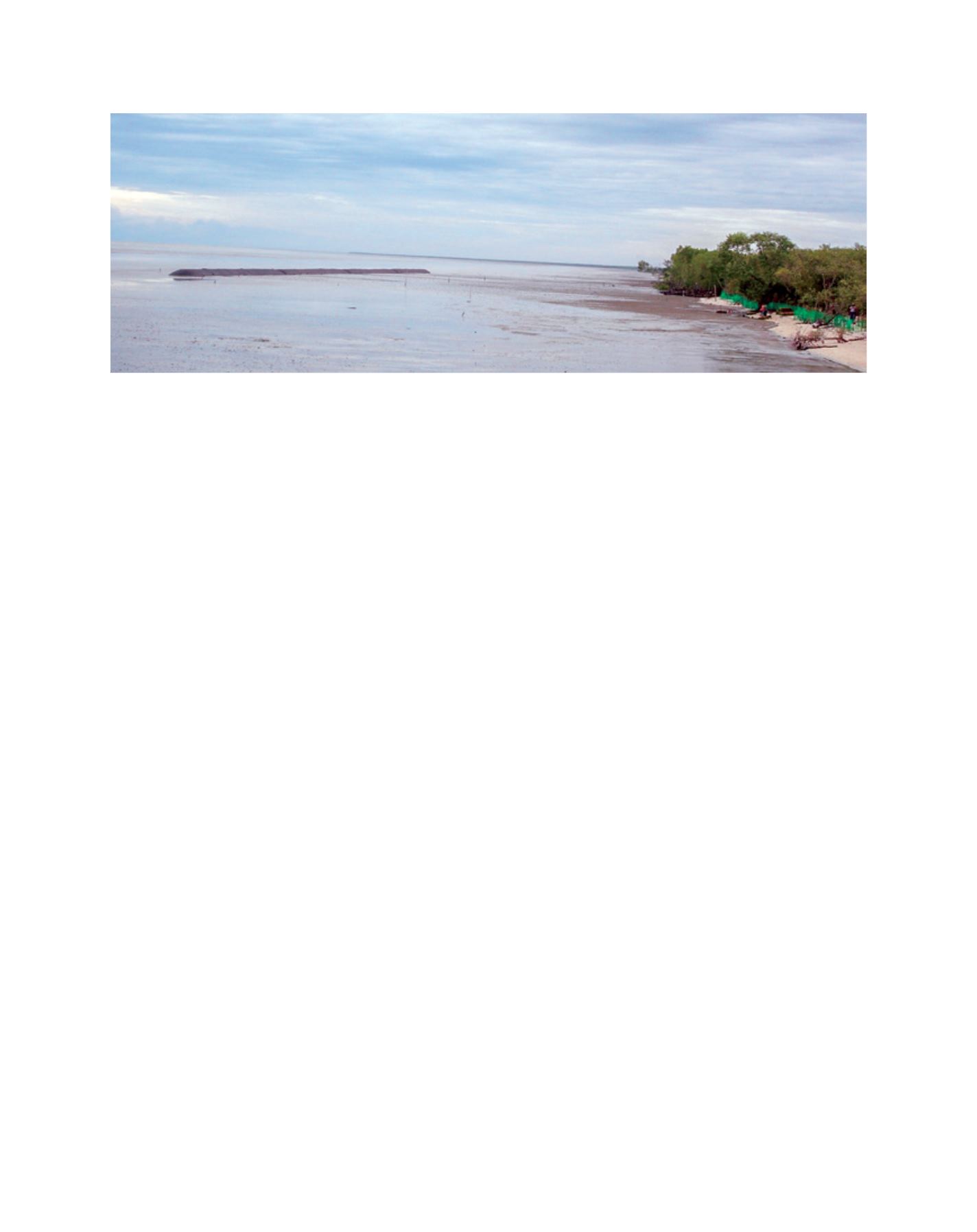
geo-textile tube (geotube) sand-filled breakwaters were
constructed. Four geotubes, each 1.8 m high, 3.7 m wide
and 50 m long were successfully constructed in July 2007
at the beach of D’ Muara Marine Park Resort in Sungai Haji
Dorani, Sungai Besar, Selangor. The design and placement
of the geotubes as breakwaters took into account the height
of the incident waves, depth, tidal range and site conditions
(soil profiles).
The geotube breakwaters constructed at the beach of D’ Muara Marine Park Resort (before planting)
Image: FRIM
L
iving
L
and