


 14 / 28

14
|
By Design
“By having a progression of
aerial photos through time, it’s
very interesting to look at how
vegetation emerges and eventually
dictates the character of a course.”
“I have made use of things like
old meeting notes and club ledgers,
as sometimes all you’re looking
for is some sort of indication
that something did or did not at
one time exist, and if so, when,”
Rogers adds. “It all really helps
put the puzzle pieces together so
that a story can be told. It helps
modern memberships gain a greater
understanding of how their club
came to be and why. If there is good
reason to consider some restorative
efforts to the course, we look to find
the rationale and support through
history to help us understand the
HISTORIC MATERIALS
Case Study - The Old White course at The Greenbrier Resort
Lester George, ASGCA, completed a
five-year restoration of The Old White
course at The Greenbrier Resort in West
Virginia, between 2001and 2006.
Originally designed by C.B.
Macdonald and Seth Raynor and
opened in 1914, the course has held
the Greenbrier Classic on the PGA
Tour since 2010.
The Old White was drastically
changed over the years, but after sitting
down with the club’s historian and
director of golf, George used a series
of aerial photographs and applied an
innovative technique to identify and
analyse the Old White’s original layout.
The project took five years to complete,
but the intensity of the work is why it has
been regarded as one of the strictest
restorations of a Raynor/McDonald
course in the U.S. Here, George
describes some features of the work:
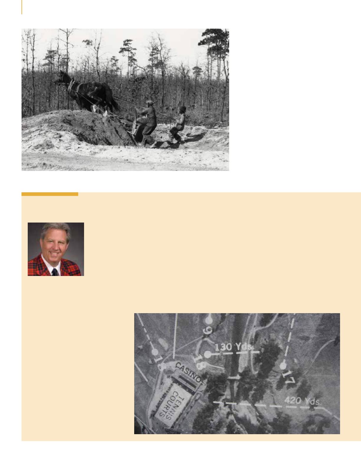
“Where it says ‘Casino’ (below), that’s
the clubhouse. There’s an awning on
that building, between the clubhouse
and the tennis courts, that is still there
at the same elevation today. Once we
had the photograph, we looked at the
shadow of the trees that are still there,
such as ones around the 18th green.
We could tell roughly what time of
day the photograph was taken. By
measuring the shadow on the awning,
which I knew was a known height, I
could transfer around the golf course,
and look at all the bunkers and
tell how deep they were. I studied
aerial photography and military
photographs when I was in the army
for many years, and so I felt like I
had a pretty good understanding of
two dimensional light and depth, and
shadow and form. I applied what I
already knew and got lucky and found
this one shadow that was consistent
from the 1920s to today.”
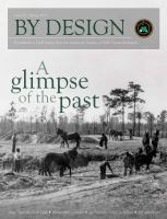
A vintage style of bunker creation in evidence at Pine Needles, North Carolina
Photo: courtesy of Tufts Arhives