


 191 / 288

[
] 192
T
ransport
and
I
nfrastructure
From vulnerability mapping to risk management
Once the vulnerability mapping is completed, it is possi-
ble to carry out a risk evaluation relating to elements
such as property, people, environment, reputation and
finances. Having analysed the most endangered areas,
railways can then act concretely by taking preventive
and reactive measures. They can have a better weather
warning system, improve technical standards, reinforce
protective structures, take measures during incidents
which aim at minimizing damage by rapid and targeted
intervention, and improve resilience with more specific
engineering recommendations.
With the right information given in time, rail-
ways have many ways to handle new hazards created
by climate change. All these good practices can be
exchanged to enable widespread information and act as
a model for those who want to adapt to climate change.
Improving reliability
Tomorrow’s Railways and Climate Change Adaptation
(TRaCCA) was a research project aimed at providing
tools and knowledge to improve the reliability of the
railway network and at finding solutions to these prob-
lems. To do so, Britain’s Network Rail collaborated with
experts at the UK Met Office Hadley Centre, enabling
the company to prioritize and scope exercises to meet
statutory reporting deadlines aligned to Control Period
5 work covering the 2020s, 2030s and 2040s. Network
Rail used detailed climate impact analyses on the
selected priorities and implemented various tools.
Improving resilience
There are many practical ways in which railways
are making their networks more resilient to extreme
weather and natural hazards.
Wind
To face strong winds and gales, JR East equipped its
tracks with windbreak fences.
Humid conditions
To manage hard rains, JR East decided to reinforce slopes
and to protect scours. Train manufacturers are develop-
ing systems to cope with hot and humid conditions by
managing air-flow, protecting the electronic control panel
and installing condensers in the machines area.
Desert conditions
It is also possible to prepare railways infrastructure
to resist desert conditions through measures such as
equipping rolling stock with cyclonic filters, resizing
the electronic equipment, cooling the power supply
system or power converter and reinforcing the air-
conditioning system.
Nordic conditions
Many railways companies need to handle Nordic
conditions. For instance, JR East now benefits from
anti-avalanche facilities and good snow removal equip-
tion. With the information, JR East can decide to restrict speed
or suspend traffic, to protect the passengers and infrastructures.
The weather information enables companies to act quickly.
For example, the Austrian company OBB launched a programme
called InfraWeather. The preparative work included the develop-
ment of a regional, meteorological model and GIS-based overlay
of railway tracks and meteorological data. Thanks to all this infor-
mation, OBB now has an online portal giving the storm, flood and
snowfall forecast.
When predefined warning levels are reached, alert message are
automatically generated by the system and sent by text messages,
email, fax and telephone to all responsible people inside the company.
This allows more efficiency, improves management, saves costs
and achieves the capacity building process.
The final piece of the jigsaw in terms of weather and natural
hazard information is future climate and weather forecasts. This is
the point at which meteorological organizations become crucial to
the planning and future condition of the railway, as only they can
provide this data. One challenge is to achieve the right level of detail
in both temporal and spatial terms: climate adaptation is primarily
a local issue, affecting very specific parts of the railway network.
However, climate models tend to provide an overview on a regional
or national scale. Also, railway infrastructure (track, signals, trains)
lasts a long time (parts of the European railway network are well
over 100 years old), and so it is important to have a reasonably long-
term approach to climate forecasting.
Moving on from the weather and natural hazard data gathering,
the vulnerability map then requires the identification of the rail-
ways’ infrastructure assets in areas prone to hazards, and assessing
the likely resilience of these assets. Overlaying the natural hazard
zones and the areas where the infrastructure assets (such as, track,
earthworks, bridges, tunnels, drainage systems, protective structures
and signalling) are in a poor condition, it is possible to identify the
priority zones.
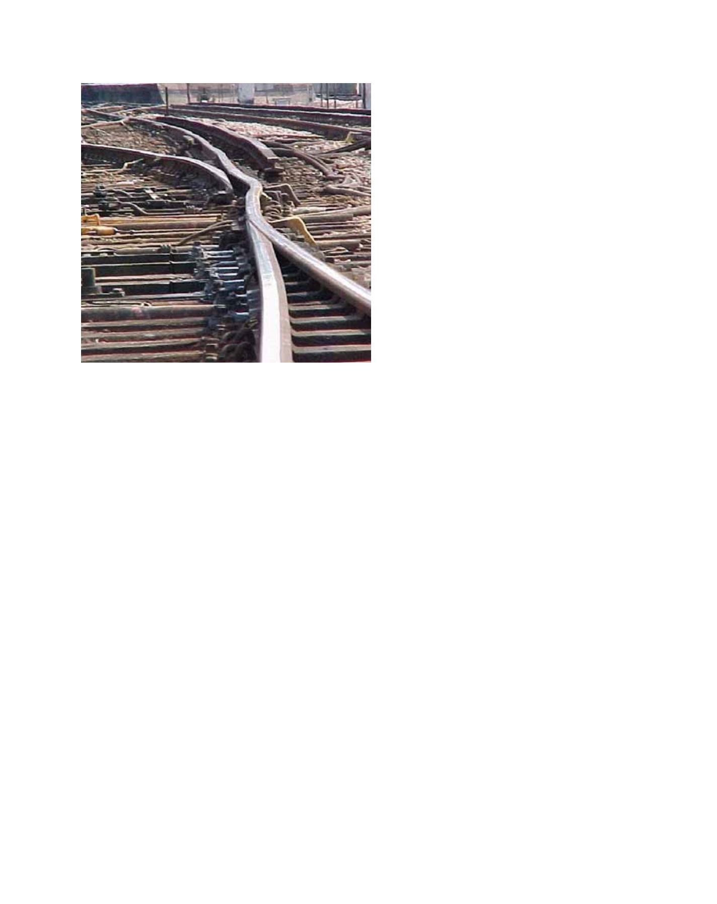
Increasing summer temperatures take their toll on existing rail infrastructure
Image: Network Rail