


 186 / 288

[
] 187
T
ransport
and
I
nfrastructure
In November 2012, Weathernews will witness the launch of
WNISAT-1 to increase the data available to the GIC at a reason-
able cost. This will be the first of several compact and inexpensive
satellites with a 5-10 year lifespan that will provide real-time moni-
toring data on ice conditions in the Arctic Ocean. Eventually, the
accumulated data will allow for the prediction of ice distribution,
thickness and movement using our simulation model, the I-SEE
Engine. Only by predicting the seasonal ice extent in the Arctic can
the shipping industry make the necessary long-term planning for
total optimization of voyage operations that will significantly reduce
carbon emissions.
Evolved weather routing for fuel efficient voyages
Traditionally, weather routing services have been used by the shipping
industry to ensure the safe arrival of a vessel and its crew and cargo.
However, as a natural by-product of sailing the safest route through fair
weather, a vessel also often benefits from increased engine efficiency
and fuel savings. Over the course of three decades at Weathernews,
this core service has evolved into a service for optimizing voyage fuel
efficiency. The primary merit of these services for the shipping industry
is reduced operating costs through safer and shorter voyages. However,
pressure from the International Maritime Organization on the shipping
industry to reduce emissions has made the industry realize that the ‘eco’
in ecology is really the same ‘eco’ as in economy. The next stage in the
evolution of optimized voyage planning is to offer the Polar Route as
an alternative to the longer traditional trade routes, in order to help the
shipping industry meet its eco-targets.
Global Ice Center: using existing resources
At Weathernews, our tradition is always to first ask what we can do
to help this issue. How can we help our partners in the shipping
industry optimize their operations and reduce carbon emissions
from ship engine exhaust? The answer was to establish the GIC in
2008 at Weathernews Global Center in Japan with help from the
Center for Environmental Remote Sensing at Chiba University. The
role of the GIC is collection, analysis and distribution of all relevant
information from related organizations on global ice conditions that
can be used not only by our customers in the shipping industry, but
also by the general public through the GIC website.
1
One of the GIC’s special contributions is a two-week
forecast of changes in ice concentration, thickness and
distribution. This forecast is produced using simula-
tion model output from the GIC’s I-SEE Engine, which
analyzes factors like sea temperature, current, and
sea-ice observations. Although a voyage through the
Arctic Ocean takes about a month, the I-SEE Engine’s
predictions are enough to assist operators in planning
and making a final go/no-go decision for polar transit
voyages. Last summer, the GIC assisted in the safe
passage of a Japanese-owned/Danish-operated bulk
carrier’s voyage from Murmansk to Jintang through
the Polar Route. Thanks to the combined efforts of the
owner, operator, a pair of Russian ice-breakers and real-
time navigation support from Weathernews, the vessel
completed the icy voyage without incident in only 22
days; half the time it would have taken through the Suez
Canal, or a third of the days at sea sailing around the
Cape of Good Hope.
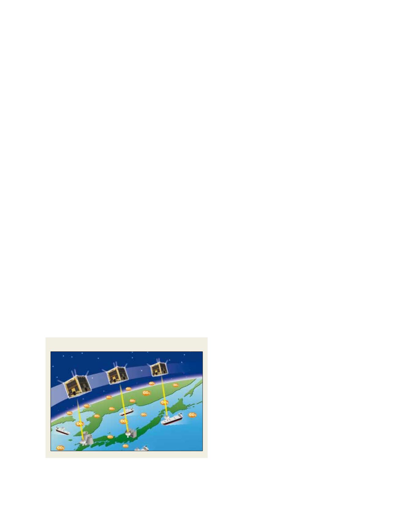
WNISAT-1: Cost effective-monitoring
Hiro Ishibashi’s shared dream for Weathernews service
will be realized in November 2012 with the launch
of a satellite designed and built by Weathernews in
conjunction with Axel Space, a small domestic start-
up founded by Tokyo University graduates. Data from
the satellite will monitor and eventually help predict
conditions in the Arctic necessary to providing Polar
routing to the shipping industry. Unlike tradition-
ally large and expensive satellites designed to fulfil a
number of roles, WNISAT-1 is a nano-satellite only
27 cm wide and weighing less than 10 kilograms.
Equipped with only a camera for observing sea-ice and
laser for measuring CO
2
levels, WNISAT-1 represents
the new generation of modern satellites developed
for highly-focused applications. These two measur-
ing instruments provide just enough functionality
to facilitate the GIC’s monitoring infrastructure for a
Polar routing service. Moreover, the goal was to add
this functionality at a reasonable development, deploy-
ment and operating cost so as to provide services
cost-effective enough to encourage widespread use in
the shipping industry, as well as being accessible to the
general public to raise awareness of the issue.
Raising awareness to reduce energy consumption
Weathernews also hopes to use the satellite to
conduct public science experiments where ordinary
people can participate in CO
2
monitoring to help raise
awareness and inspire everyone, as Weathernews has
done, to ask: “What can we do to help the issue?”
Japan is one of the world’s biggest consumers of
electricity, and the many bright lights of the Tokyo
metropolitan area can easily be spotted from Earth
orbit. It is our hope that raising awareness will allow
Japan to make an even more substantial contribu-
tion to the reduction of CO
2
emissions, not only in
the global shipping industry, but in Japan’s domestic
energy industry as well.
Source: Weathernews
The WNISAT-1 nano-satellite has a laser for measuring CO
2
levels