
[
] 214
Learning from community-based
forest management in Nepal
Resham B. Dangi, Deputy Director General, Department of Forests, Nepal
N
epal occupies less than 0.1 per cent of Earth’s land
mass in the central Himalayan region, covering a
surface area of 147,180 km
2
with an altitude range of
60 to 8,848 metres above sea level. Nine important eco-regions
are situated in Nepal out of sixty across the entire Himalayan
region, comprised of thirty-five forest types and 118 ecosys-
tems.
1
Mountain ranges divide the country into five major
physiographic regions, from the tropical lowland plateau to the
snow-covered Himalayas, representing all major climatic condi-
tions. High mountain forests are home to many endemic plants
and tropical lowland forests host rare species such as tiger,
one-horned rhinoceros and wild elephant.
Almost 80 per cent of the population of Nepal lives in the rural
areas, where land is a critical resource to maintain livelihoods, and
the agriculture and forestry sector accounts for more than one third
of total GDP. A quarter of the population lives below the absolute
poverty line and two thirds earn less than US$2 a day. Hills and
high mountains cover almost 86 per cent of the total land mass and
the remaining 14 per cent is comprised of flat Terai landscape.
2
Since one fifth of the land mass is under a farming system with low-
input cultivation, the poverty level in remote areas is estimated to
be higher than the national average.
The last National Forest Inventory, undertaken in 1999 with
technical and financial support from the Government of Finland,
estimated the area under forest land use as about 5.8 million hectares
(ha), of which around 4.2 million ha is forest and the
remaining 1.6 million ha is scrub land. Only 51 per
cent of the forest area is assumed to have attained mean
stem volume of 178 m
3
/ ha.
3
Between 1978 and 1994,
shrubland increased by 5.6 per cent per year and forest
area decreased by 1.7 per cent per year,
4
indicating that
degradation is a widespread problem in Nepal.
Since 2010, DFRS has again had support from the
Government of Finland in implementing a National Forest
Resource Assessment project. This assessment will provide
an updated picture of forest cover and biomass change
since 1994, along with additional statistics regarding
biodiversity, trees outside forests, carbon stocks and non-
timber forest products. The report will assist in developing
a national strategy for sustainable forest management, a
monitoring, supporting and verification (MRV) system
for Reducing Emissions from Deforestation and Forest
Degradation in Developing Countries (REDD+) and a new
forestry sector master plan.
Forestry institutions
Nepal was historically divided into many small states, with
the southern lowland plateau under thick forests. Those
forests which were strategically important were regulated
by royal decree, while attempts were made to increase the
tax base by converting less important forests to farm lands.
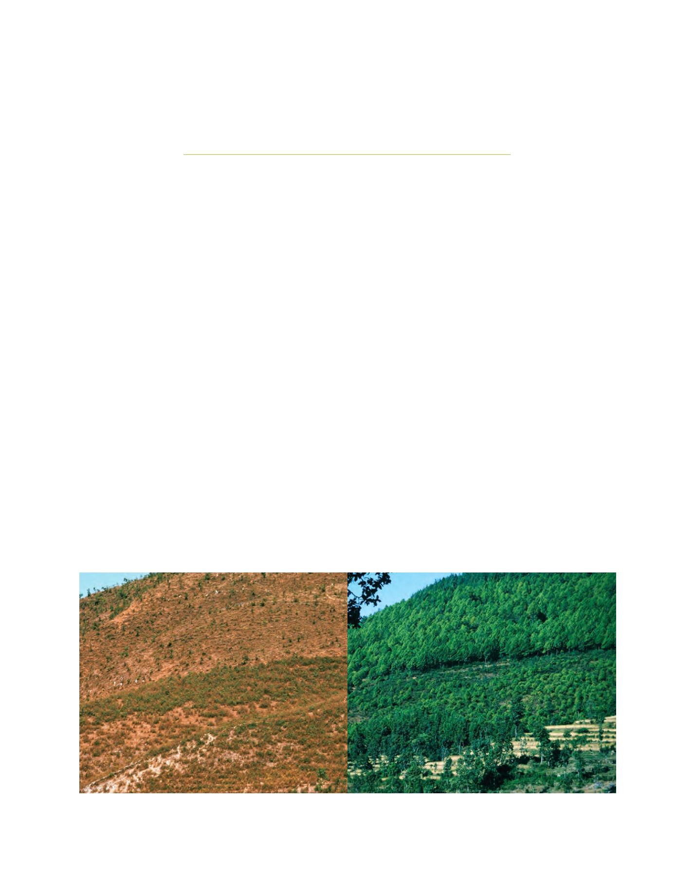
Danda pakhar, Sindhupalchok forest restoration after the community took management responsibility. Left 1975, right 2005
Image: Nepal Swiss Community Forestry Project/
Intercooperation/SDC/Fritz Berger


