


 97 / 336

[
] 97
T
ransboundary
W
ater
M
anagement
by the national experts of the countries participating in
the project, the initial georeferenced information system
was updated (Version 2 of the system). The final version
couples a Google cloud database, in which all the relative
information is stored, with Google Fusion Tables tech-
nology, in order to spatially distribute the information on
the total study area. JavaScript and the HTML5 program-
ming languages were used for the creation of the platform.
Furthermore, both these languages were used for sending
requests and exchanging data asynchronously between
browser and server to avoid full page reloads. Geographic
information systems tools were used for the homogeniza-
tion of the different vector files representing the aquifers
(namely shape files) and for their projection to a common
projection system (namely WGS 84).
The final version of the system incorporates all the
attributes and characteristics of the second version as
well as including:
• presentation of a summary of the main data on each
basin (excerpts from questionnaires)
• option to download descriptive information on the
basins in pdf format (questionnaires)
• option to download the national reports on each
aquifer in pdf format
• pop-up box with attributes for each country
participating in the project
• integration of a ‘search’ module
• selection between four different background
thematic Google maps
• visualization of the spatial extent of the basins
• demonstration of a comprehensive legend tool
• ability to leave comments, either of a general nature
or related to a specific geolocation
• automated e-mail notification to the identified
project recipients whenever comments are made.
located outside the Danube watershed were identified. The Mesta/
Nestos River, shared by Bulgaria and Greece, and the Prespa Lakes,
shared by three SEE countries, were two cases aimed at enhancing
cooperation that gave promising results.
The main difficulties arising in transboundary water resources
management and governance are a lack of:
• political willingness for cooperation from countries on one or
both sides of the border and limited or non-effective exchange
of data and information
• communication and understanding between scientists, water
professionals, decision makers, stakeholders and the general public.
The principal aim of the developed georeferenced systems and plat-
forms was to provide the appropriate tools needed to strengthen
the capacity of water management institutions in the SEE region to
implement sustainable forms of utilization, management and protec-
tion of transboundary water resources.
The structure of the information systems, and the technologies used
for their construction and design aim to:
• facilitate water users to retrieve data related to transboundary
water resources
• enable the national experts responsible for a country’s water
resources to use the system’s capabilities to update in real time
information about the water bodies available on the platform
• support public participation by allowing users to provide comments
(either general comments or those related to a specific geolocation)
on the shared water basins that appear on the base map
• automatically generate e-mails to the workgroup whenever
comments are made.
During the project implementation, an interactive map using Google
Maps and Google Earth technologies was initially developed. This
was based on existing maps indicating basic geographic informa-
tion on transboundary water basins (location, boundaries, extent)
(Version 1 of the georeferenced information system). After collecting
and working on the data and the descriptive questionnaires submitted
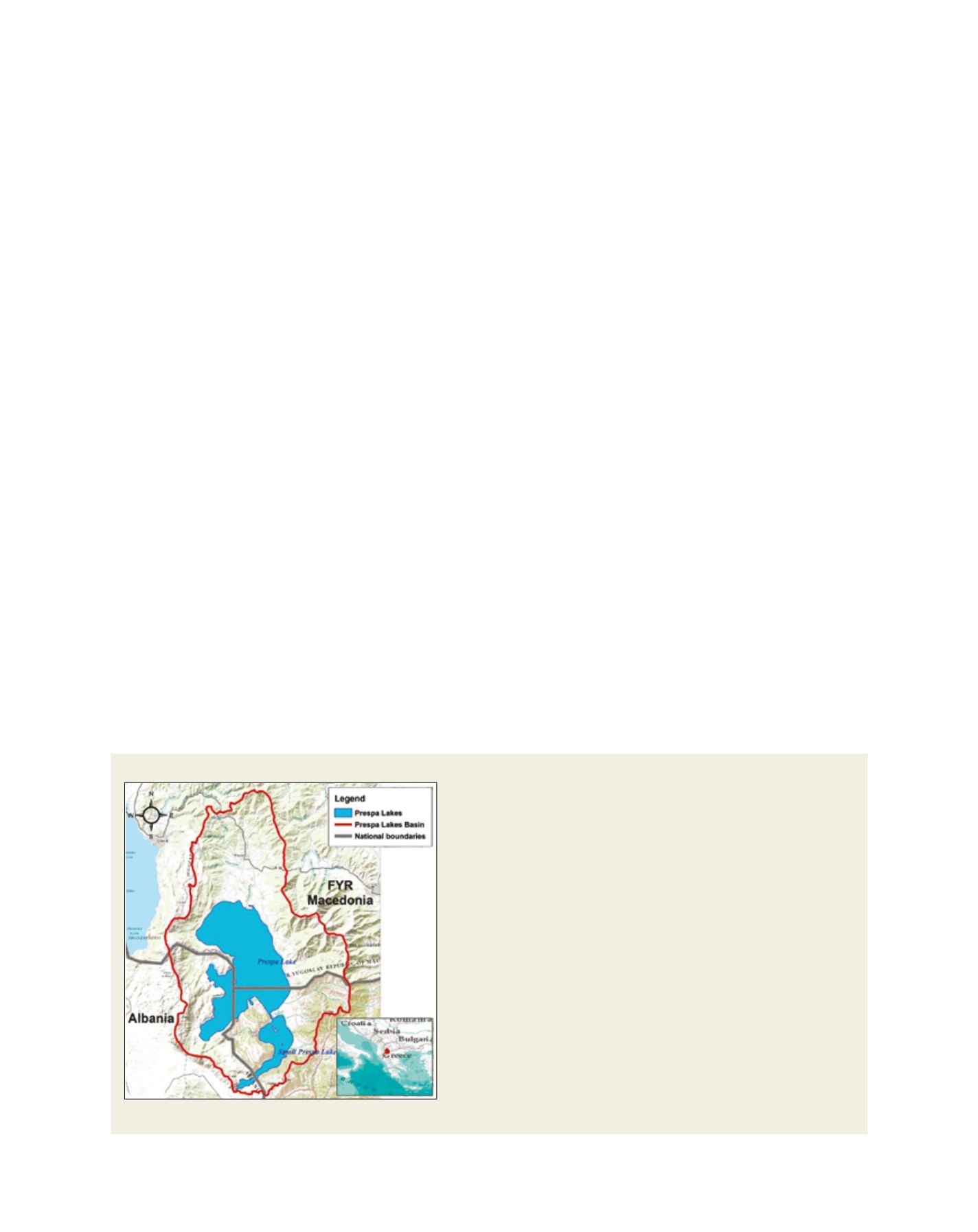
Case study: the Prespa Lakes
Prespa Park is situated on the borders of Albania, Greece and the Former Yugoslav
Republic of Macedonia (FYROM). The area of 2,519 km
2
consists of two lakes:
Micro Prespa and Macro Prespa, and the surrounding forested mountain slopes.
It has no surface outflow, but a subterraneous water flow brings water from the
Macro Prespa into the Ohrid Lake basin, and from there to the Adriatic Sea. It is
best known for its natural beauty, its great biodiversity and its populations of rare
water birds –including the largest breeding colony of the Dalmatian pelican in
the world. The area is also remarkable for its cultural sites, including Byzantine
monuments and examples of traditional architecture.
The Prespa Lakes provide an excellent example of how transboundary
environmental issues and conflict can be the way to encourage international
cooperation among neighbouring nations
2
.
On World Wetlands Day on 2 February 2000, the prime ministers of Albania,
Greece, and FYROM decided to make the Prespa Park the first transboundary
protected area in SEE and declared it a Ramsar Protected Site. The declaration
has been followed by enhanced cooperation among competent authorities in
the three countries with regard to environmental matters. In this context, joint
actions have been considered in order to:
• maintain and protect the unique ecological values of the Prespa Park
• prevent and/or reverse the causes of its habitat degradation
• explore appropriate management methods for the sustainable use
of the Prespa Lakes water
• ensure that the Prespa Park becomes and remains a model of its
kind as well as being an example of peaceful collaboration among
the three countries.
Geographical location of the Prespa Lakes
Image: UNESCO Chair/INWEB