


 98 / 336

[
] 98
T
ransboundary
W
ater
M
anagement
The main features of an open source interactive information system
are detailed below.
Data catalogue (data layers)
The data catalogue is a listing of available datasets including infor-
mation about the layers which are overlaid on the map. The specific
module enables the activation and deactivation of layers related to
the extent of the river basin and the project countries.
View window (thematic maps)
The specific module is the viewer of the mapping interface. It includes
the four different types of base maps: standard, satellite, hybrid and
terrain maps. These are supported by the Google Maps web mapping
service application and technology provided by Google. It also
includes navigation tools (zoom in, zoom out and the pan arrows)
and a scale bar both in kilometres and miles. Moreover, the mapping
interface supports the overlaying of the countries’ boundaries and
extents as well as the overlaying of the identified aquifer’s extent.
Information window
The window also integrates links with synoptic and detailed
summary information, descriptive information and country reports
on the river basins.
Search tool and feedback menu
The feedback menu, appears when users click on the button ‘Click
here to give feedback’. In order for a comment to be sent to the project
participants, the person making the comments has to provide their full
name and e-mail address. There are two types of comments: general
comments and comments referring to a specific geolocation. In the
latter case, users should click on the map, so that the coordinates of the
specific location are automatically integrated into the comments form.
Different georeferenced information systems for trans-
boundary waters are hosted on the UNESCO Chair/
INWEB portal under the ‘Databases’ menu tab. This
menu contains similar interactive databases on trans-
boundary surface and groundwater in SEE, Northern
Africa and the Middle East.
Collaboration is the key to transcending and cross-
ing boundaries between countries or between different
administrations, institutions and groups of stakehold-
ers within the same country. When rivers, lakes and
aquifer systems cross political boundaries, the issue of
having good governance for water resources manage-
ment becomes very complex and difficult to attain.
Again the key for resolving such problems is collabo-
ration between institutes, decision-making authorities,
water professionals and stakeholders.
Modern ICTs can facilitate distance dialogue
between the above parties, by providing interactively
on the Internet spatially distributed data and distance-
based collaborative tools. New tools and interactive
maps can be put together by using open source soft-
ware such as Google Maps, Google API and Google
Fusion Tables technologies.
The progress made in developing such collaborative
tools is shown in the case studies from SEE. By using
specially tailored collaborative information systems, the
data collected from different countries were communi-
cated to stakeholders at a local level in such a way as
to facilitate their involvement in the decision-making
process. Different aggregations of conflicting multiple
criteria can help in producing alternative solutions for
sustainable groundwater resources management.
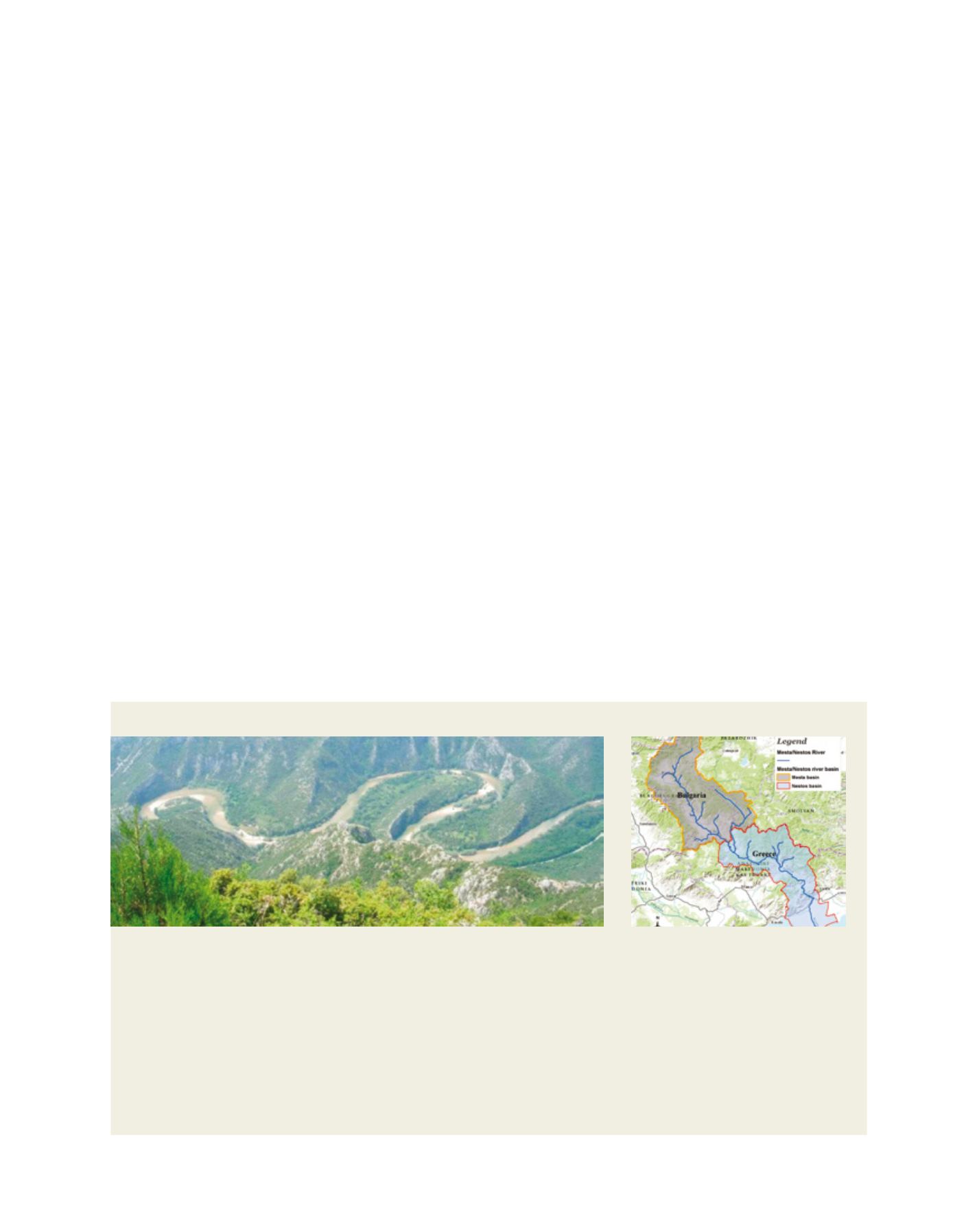
Case study: the Mesta/Nestos River
The transboundary Mesta/Nestos River watershed extends over Bulgaria
and Greece. The Mesta River springs out from the Rila and Pirin mountain
ranges and flows into a graben plain bordered by the granite formation of
the Rhodopes mountains. Changing its name into Nestos when crossing the
border between the two countries, the river cuts its gorges through the vast
marble karstic formation of the Lekani. Its course finally ends in a highly
irrigated deltaic plain before reaching the Agean Sea. The Mesta/Nestos
Basin extends over 5,751 km
2
, of which 2,314 km
2
are situated in Greece.
The Bulgarian part of the basin is primarily a mountainous agriculture
region, although there are several urban areas and the recent development
of ski resorts. Being one of the few high-quality freshwater resources in
South-West Bulgaria, the Mesta river basin is the site of storage dams and
water diversions, both in the present and planned for the future. On the
Greek side, there are several large and recently constructed hydropower
dams in the Upper Nestos River. Further extensions of this dam complex
are under study as part of an irrigation development project which could
serve the areas of Drama, Xanthi and the Nestos Delta.
In the past, Bulgaria and Greece signed a bilateral treaty regulating the
amount of water used for serving their national interests. Both Greece and
Bulgaria are obliged to apply the European Union (EU) Water Framework
Directive as they are EU member states, Bulgaria having joined in 2007.
Good cooperation exists between the two countries and several water-related
projects have been developed in the basin, which is one of the UNESCO/
Hydrology, Environment, Life and Policy programme’s demonstration basins.
3
The Mesta/Nestos downstream gorges in Greece
The Mesta/Nestos river basin
Image: UNESCO Chair/INWEB
Image: J. Ganoulis