


 100 / 192

[
] 100
Tad Fa, Thailand
Tad Fa watershed is located in Phu Pa Man district in the Khon
Kaen province of Thailand. It was developed as benchmark site
to address the issues of land degradation and poor agricultural
productivity in 2003. The Department of Agriculture, the Land
Development Department, Khon Kaen University and ICRISAT,
along with the rural community, formed the consortium for
implementing the programme. The watershed receives a good
amount of rainfall (1,300 mm) but due to uneven distribution
and lack of water harvesting structures, the village was suffering
water scarcity even during the monsoon period. Nearly 80 per
cent of the total agricultural area was rain-fed, having one crop
per year. Farmers in upland areas with high to medium slopes
were cultivating maize along the slope (up and down cultiva-
tion), triggering heavy soil erosion, as well as cash crops and
rice on the lower lands for domestic use. The watershed faced
severe soil erosion and crop productivity was declining year by
year due to land degradation.
Several soil, water, nutrient and integrated crop management
interventions were introduced in 2003. In consultation with the
farmers, the Land Development Department constructed 17 farm
ponds each of 1,260 m
3
storage capacity to facilitate supplemen-
tal irrigation to crops, fruit trees and vegetables, particularly in
the post-rainy season. Field bunds were constructed along with
vetiver grass largely in uplands. Sowing through hand dibbling
was promoted on steep slopes; and cultivation using tractor-
mounted implements was promoted in farms with moderate to
mild slopes. About 70 per cent of the area was promoted under
contour cultivation. Relay and sequential cropping systems were
promoted to use green water efficiently and improved varieties of
seeds were introduced. Fruit tree cultivation was promoted and
improved plantation methods were introduced to enhance the
land and water use efficiency.
Maize yields increased by 30-40 per cent compared to
the conventional system due to the increased availabil-
ity of green water resources. Surface run-off (60 per cent
reduction) and soil loss (40 t ha
-1
to 8 t ha
-1
) were reduced
drastically and crop productivity increased. Areas under fruit
tree cultivation increased in and around Tad Fa watershed
within three years of the project implementation. This has
helped in controlling soil erosion and provided better and
more sustainable income to farmers which significantly
contributed to enhancing rural livelihood.
The way forward
Integrated watershed management is an important strategy
for strengthening resilience to drought, especially in uplands
which are hotspots of poverty, water scarcity and land degra-
dation. Soil and water conservation practices have resulted in
higher groundwater recharge which enables supplementary
irrigation of the monsoon, bridging of dry spells and scope for
irrigation of a second dry-season crop. Moreover,
in-situ
water
harvesting has resulted in enhanced green water use efficiency
in rain-fed agriculture. Productivity enhancement, crop inten-
sification and diversification further helped farmers to utilize
available resources effectively and earn more. Watershed
interventions are also helpful in strengthening various ecosys-
tem services such as reduced nutrient and soil loss, which is
expected to have positive impacts on in-stream river ecology
and run-off generation for other downstream water uses.
Under the changing climatic scenario with reduced annual
rainfall and higher rainfall intensities, watershed development
programmes are increasingly important for securing agri-
cultural yields in upland areas to achieve food security and
improve the livelihoods of small and marginal farmers and,
most importantly, for building the resilience of systems to the
changing climate. Scaling-up of these initiatives is urgently
needed to achieve the desired level of impacts and outcomes
for food, nutrition and water security for the growing popula-
tion through sustainable development.
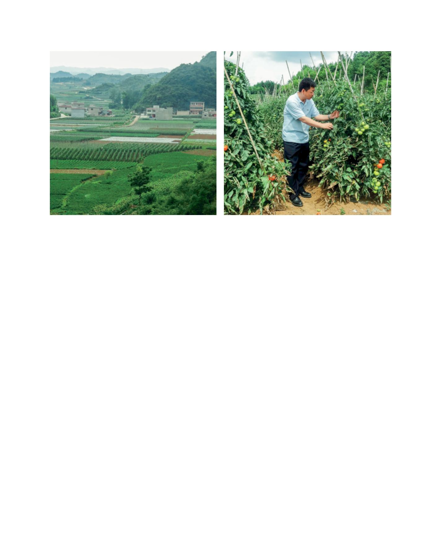
Lucheba watershed, China: (left) the landscape shows a large area under vegetable and cash crops; (right) Scientist observing staked tomato plants
Images: ICRISAT
L
iving
L
and