


 112 / 288

[
] 113
The Chilean Ultraviolet Radiation Network:
monitoring and forecasting the
UV index for health protection
Solangela Sánchez Cuevas, Jorge F. Carrasco and Humberto Fuenzalida,
Dirección Meteorológica de Chile – Dirección General de Aeronáutica Civil
T
he Dirección Meteorológica de Chile (DMC) operates
an ultraviolet radiation network (URN) consisting of 20
stations, most of them deployed in a meridional transect
from around 17º S to 56º S, including one station at Easter Island
and another on the northern tip of the Antarctic Peninsula (~62º
S). The stations measure solar ultraviolet radiation within the
wavelength range 280-320 nm (UV-B). The data are expressed
in terms of erythemic irradiance as a risk index (UVI), accord-
ing with the World Meteorological Organization (WMO) and the
World Health Organization (WHO). Daily 24-hour maxima of
UVI are predicted for cities where the stations are located.
The continental Chilean territory spreads in a north-south direction
for about 4,500 km along the western coast of South America (17°
S to 56° S) including the Andes Range with several peaks exceed-
ing 6,000 m. It hosts a large variety of climates, from north to south
and from the coast to the mountains. Apart of the annual cycle, the
near-surface air temperature decreases southward and eastward due
to altitude, while precipitation varies from north to south with a
maximum in extratropical latitudes where weather systems travel
eastward. In the northern part is the driest desert of the world, while
in the southern part (50° S) the rainy region (more than 6,000 mm per
year) is found, along with the largest continental ice caps in the world
outside the Polar regions (the Northern and Southern Patagonian Ice
H
ealth
Fields). In spring, the southern Chilean territory is also
exposed to a thinner stratospheric ozone layer that fluc-
tuates between 260 and 300 Dobson Units (DU), well
below what is considered a normal value (350 DU). This
means that incoming ultraviolet radiation (UV) reaching
the ground is a hazard, mainly during solar noon hours
with values that can exceed the limit considered a risk
for human health. During cloudless sky conditions, the
total amount of UV-B received on the surface varies with
latitude, terrain altitude and the time of year; therefore,
UV-B is higher towards the Equator than towards the
poles, increases with altitude, and presents a maximum
near the summer solstice.
The Chilean URN measures UV-B irradiance, which
is used to calculate the erythemic irradiance and finally
expressed in term of the UVI risk index to transmit a
simple warning message to the public. The UVI is a
measure of the UV-B intensity on the earth surface at
the solar noon, is given on a scale that runs from zero
to more than 11, according with WMO and WHO. The
index represents the risk level for skin damage due to
sun exposure.
At present, 20 stations are deployed at different cities
from Arica in northern Chile (~ 18°, 70°W, 23 metres
above sea level (masl)) to Eduardo Frei Montalva (~ 62°S,
53°W, 10 masl) located on the northern tip of the Antarctic
Peninsula. The distribution of the URN includes stations
in coastal and inland cities, as well as, three stations
located at higher elevations such as San Pedro de Atacama
(~ 18°S, 70°W, 2450 masl), El Tololo (~ 30°S, 70°W, 2030
masl) and Central Andes (~ 33°S, 71°W, 2746 masl).
There is also a station at Easter Island (~ 27°S, 109°W, 47
masl). All the stations are equipped with a pyranometer
instrument with a sensor that measures UV-B radiation
within the spectral band 280-320 nm. The unit used
is the miliwatt/metre
2
(mW/m
2
). The DMC also has a
standard pyranometer which is calibrated in the World
Radiation Centre of the Physikalish-Meteorologisches
Observatorium DavosInstitute, Switzerland. This instru-
ment is used as a reference for calibration, which is done
by comparing the data recorded by the standard pyranom-
eter simultaneously with those under.
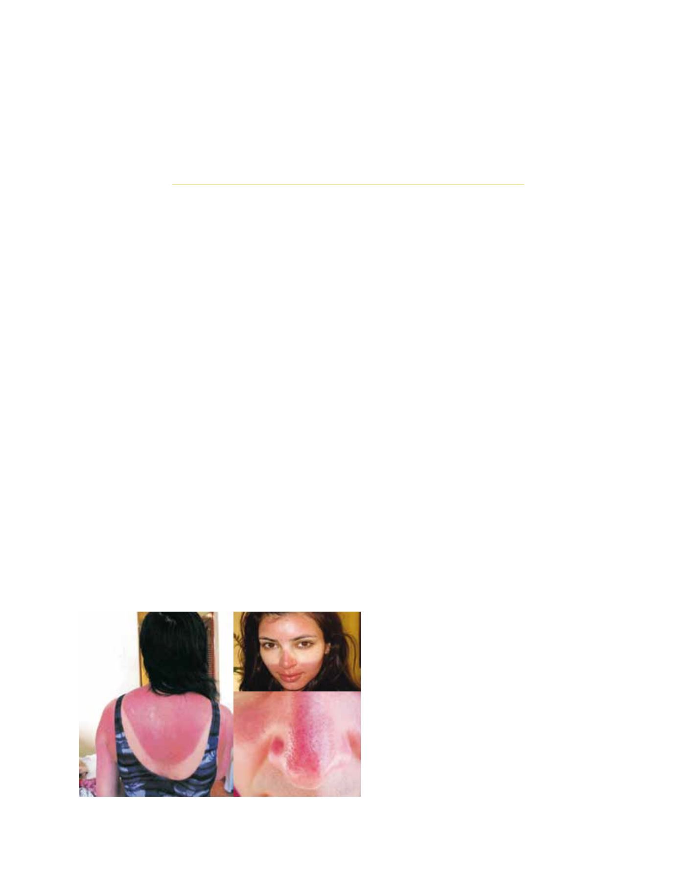
Sunburn caused by excessive exposure to UV radiation
Image: Sociedad Dermatológica de Chile