
[
] 288
The Japan Aerospace Exploration
Agency’s forest monitoring programmes
Dr Masanobu Shimada, Earth Observation Research Center, Japan Aerospace Exploration Agency
T
he Japan Aerospace Exploration Agency (JAXA) has been
conducting spaceborne L-band Synthetic Aperture Radar
(SAR) programmes since the 1990s to contribute to global
Earth monitoring and more specifically, forest monitoring. The
associated satellites are the Japanese Earth Resources Satellite-1
(JERS-1), the Advanced Land Observing Satellite (ALOS) and
ALOS-2, which will be launched in 2013. These programmes aid
in the advancement of global forest monitoring as they enable
systematic observation of global land and generation of space-
time consistent high-resolution SAR images, as well as allowing
for related time-series analysis. In particular, the tools used by
JAXA to perform these tasks assist in deforestation monitoring and
forest carbon estimation. Under this framework, we produced the
world’s first global 10 metres per pixel (10-m) resolution forest/
non-forest map in October 2010. This chapter introduces JAXA’s
activities and the typical outcomes of these satellite programmes.
JERS-1 SAR: a world first
JERS-1 was launched on 11 February 1992, carrying the world’s
first operational spaceborne L-band SAR, a visible and near-
infrared sensor with stereo viewing capability and a
20-minute data recorder. It entered a 568-kilometre
sun-synchronous orbit with a revisit cycle time of 44
days. Following its launch, JERS-1 operated for six
and a half years (1992-1998), which corresponded
to the mission request from users both inside and
outside JAXA as well as several foreign ground
stations. During this period it collected 400,000 SAR
images globally.
In 1995, two events initiated forest monitoring
using the JERS-1 SAR. During the initial mission
check of the SAR, global images were collected.
Several images from the Amazon were severely
contaminated with dark stripes, which were not
artificial patterns but were strongly related to the
land features of smooth surfaces, which showed a
strong correlation to deforestation in Rondonia. The
second initiating event was the JERS-1 verification
programme, which included an announcement of
opportunity to investigate the potential of JERS-1.
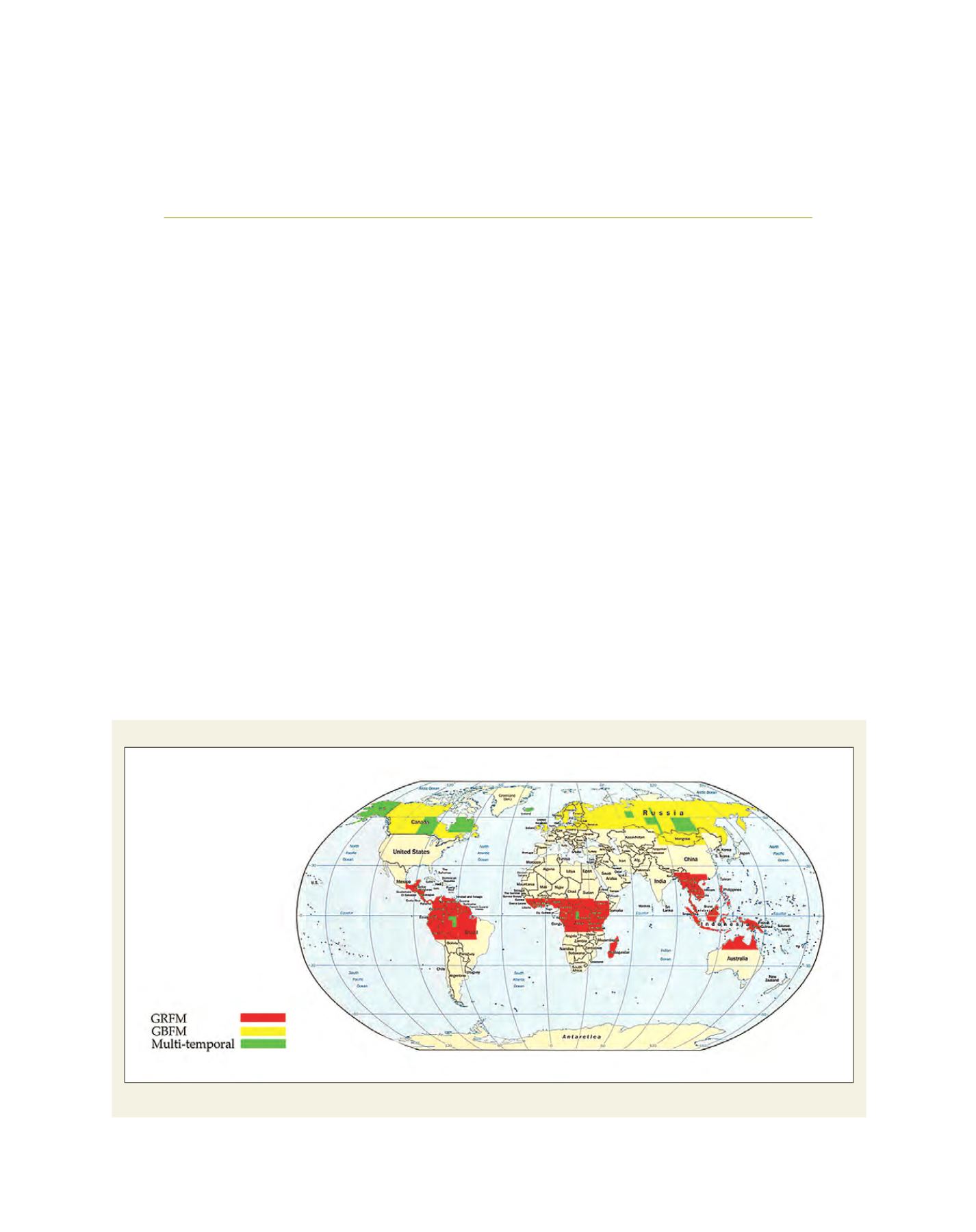
NASDA/JPL/JRC Forest Mapping Projects
Forest monitoring areas: by Global Rain Forest Mapping Project (GRMP) (red) and by Global Boreal Forest Mapping Project (GBFM) (blue)
Source: ©JAXA


