
[
] 289
Time-space consistent global PALSAR data are
acquired using Fine Beam Dual (FBD) polarization
from June to September and Fine Beam Single (FBS)
polarization from November to January. ScanSAR
is used frequently for registered areas, where the
reference observation rule is defined in the Basic
Observation Scenario. Frequent ScanSAR observa-
tion becomes especially important to the process of
monitoring seasonal and annual forest changes in
spite of lower resolution. ScanSAR observation was
directed at limited areas of the Amazon, Southeast
Asia, Central Africa and Siberia for deforestation and
wetland monitoring.
SAR is an oblique observation system and the geome-
try and radiometry are easily distorted by terrain height
and spatial distribution. Correction of these distortions
using a global digital elevation model (SRTM-DEM)
is essential to the generation of accurate high-level
products (ortho-products) and for reliable forest clas-
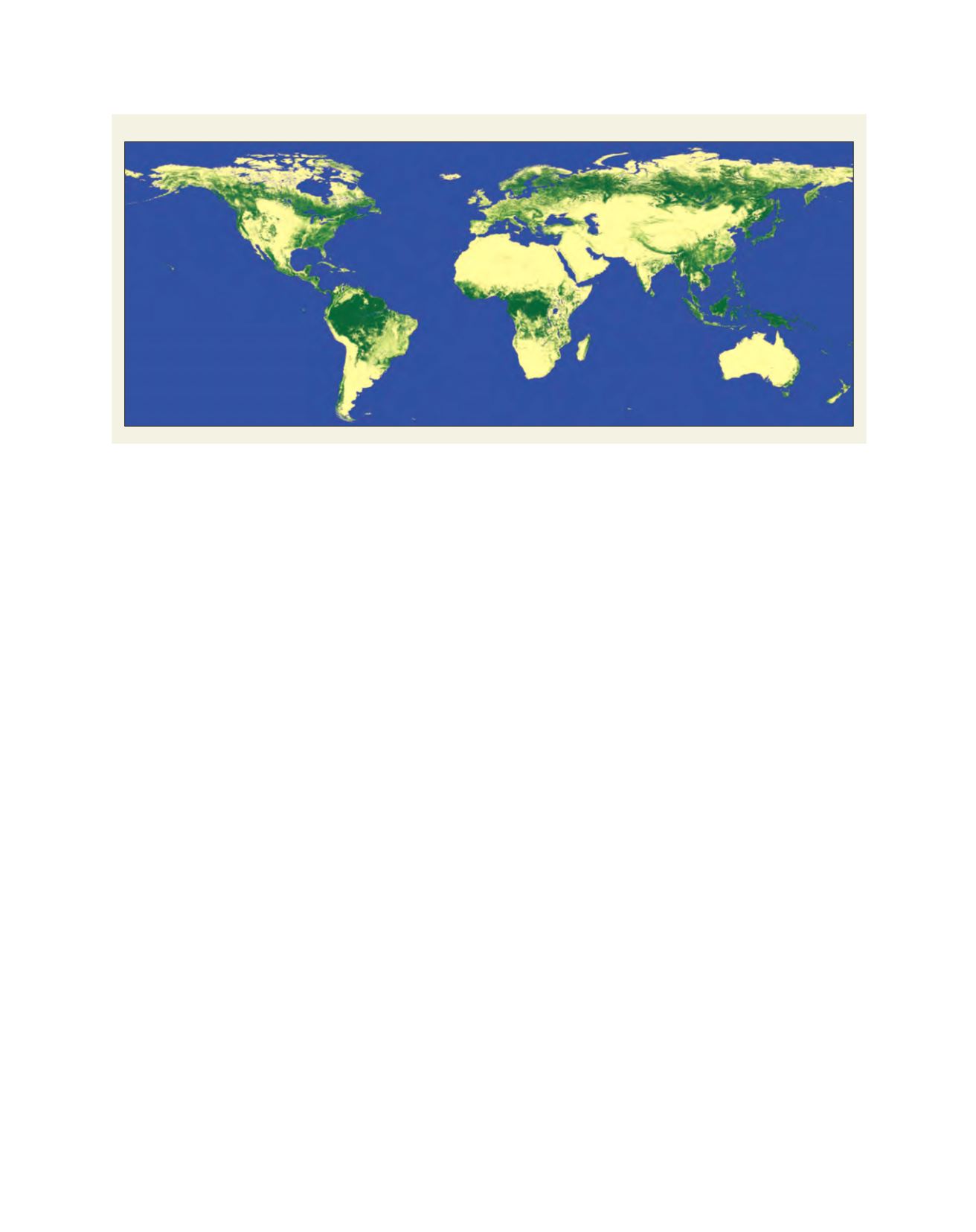
sification. Under this project, we have produced global
10-m resolution SAR mosaics and forest/non-forest
maps. The resolution of the data is 10-m and it is possi-
ble to track the decadal or annual change of the forest
status in that geospatial scale.
Frequent ScanSAR observation over Brazil is one
representative operational example using PALSAR.
Since ScanSAR has a wide swath of 350 km and
the equivalent revisit time is shortened to nine
days, frequent ScanSAR imaging of the Amazon has
contributed to decreasing its deforestation. ALOS data
acquired over the Amazon was recorded and sent to
the Earth Observation Research Center of JAXA in two
days via the Data Relay and Tracking Satellite. The
data was processed using high-level processing and
distributed to the Brazilian Institute of Environment
and Renewable Natural Resources (IBAMA) via FTP
transmission. IBAMA compared the ‘before’ and ‘after’
The final report meeting concluded that the most effective and
important applications for research using L-band SAR would be
forest monitoring and interferometry.
Based on these scientific episodes, JAXA initiated two consecu-
tive forest research projects, the Global Rainforest Mapping Project
(GRFM: 1995-1998) and the Global Boreal Forest Mapping Project
(GBFM: 1998-2002), collaborating with approximately 10 interna-
tional forestry researchers. These two projects targeted observations
of the pan-tropical region and the boreal forest regions. Although
JERS-1 carried a data recorder, limitations in data recording and
linking with ground stations limited the collection of pan-tropical
and boreal forest region coverage during its mission life. Even
with its limited processing capability and the unavailability of a
digital elevation model, however, JERS-1 succeeded in creating the
world’s first 100 metres per pixel (100-m) resolution SAR mosaics
for the Amazon, Southeast Asia, Central Africa, Central America
and Siberia. These products were freely distributed throughout
JAXA and the data were used for forest monitoring in early 2000.
As an example of the product the occurance of fish-borne defor-
estation can be clearly identified using L-band HH polarization
SAR images.
From these scientific results, the L-band SAR was recognized as
a very effective tool to monitor the forest status (deforestation and
land cover changes) and developments occurring over time.
ALOS/PALSAR: a view below the canopy
L-band SAR is more effective than higher frequency SAR for forest
monitoring because the electric signal partially penetrates the forest
canopy and reaches the forest trunks, which contain large amounts
of biomass, and because the clear-cut regions can easily be seen as
they appear darker than the natural forest regions. This is because
the surface roughness is relatively smaller than the wavelength, a
phenomenon known as the Kirchhoff condition.
Based on experience gained from JERS-1 and its science project,
we established larger scale international collaborative forest research
projects such as the Kyoto & Carbon Initiative in 2002. This inter-
national programme is supported by 19 forest institutes.
Global forest/non-forest dataset for 2009
Source: ©JAXA/METI analysed by JAXA


