
[
] 295
Tropical rainforest monitoring with
ALOS/PALSAR in Brazil and Indonesia
Masatoshi Kamei, Makoto Ono, Tsutomu Yamanokuchi, Nobuhiro Tomiyama and Takashi Ogawa,
Remote Sensing Technology Center of Japan
T
he Advanced Land Observing Satellite (ALOS) was devel-
oped and launched by the Japan Aerospace Exploration
Agency (JAXA) in January 2006. ALOS carries two optical
sensors and one radar sensor on board: the Panchromatic
Remote-sensing Instrument for Stereo Mapping (PRISM), the
Advanced Visible and Near Infrared Radiometer type 2 (AVNIR-
2) and the Phased Array type L-band Synthetic Aperture Radar
(PALSAR). While optical sensors PRISM and AVNIR-2 cannot
observe the ground surface when it is obscured by cloud, PALSAR
provides 10 m ground resolution fine radar data regardless of
weather conditions. PALSAR also has a wide observation mode
called ScanSAR. The ground resolution of ScanSAR is 100 m, but
it covers a width of 350 km. In addition, PALSAR uses L-band
frequency which is suitable for forest monitoring because L-band
radar waves can penetrate forest leaves and obtain information
on both the tree canopy and below. Therefore, PALSAR data is
attractive to countries which have a large forest area in their terri-
tory – in particular tropical rainforest countries (such as Brazil
and Indonesia) and which have been struggling with cloud cover
when observing forest areas from satellites.
The Remote Sensing Technology Center of Japan
(RESTEC) has supported JAXA with the reception, cali-
bration, validation, analysis and dissemination of ALOS
data since its launch in 2006. RESTEC also supported
JAXA when it developed various data products for
users, particularly in a forest field, such as global mosaic
products. In addition to the collaboration with JAXA,
RESTEC has conducted other forest-related research
and projects by using PALSAR data with domestic and
foreign partners. This article introduces two typical
forest projects by RESTEC in Brazil and Indonesia.
Detecting illegal logging in Brazil
Brazil has a long history of using satellite data for forest
conservation since the 1970s and developed the near
real-time forest monitoring system DETER. This system
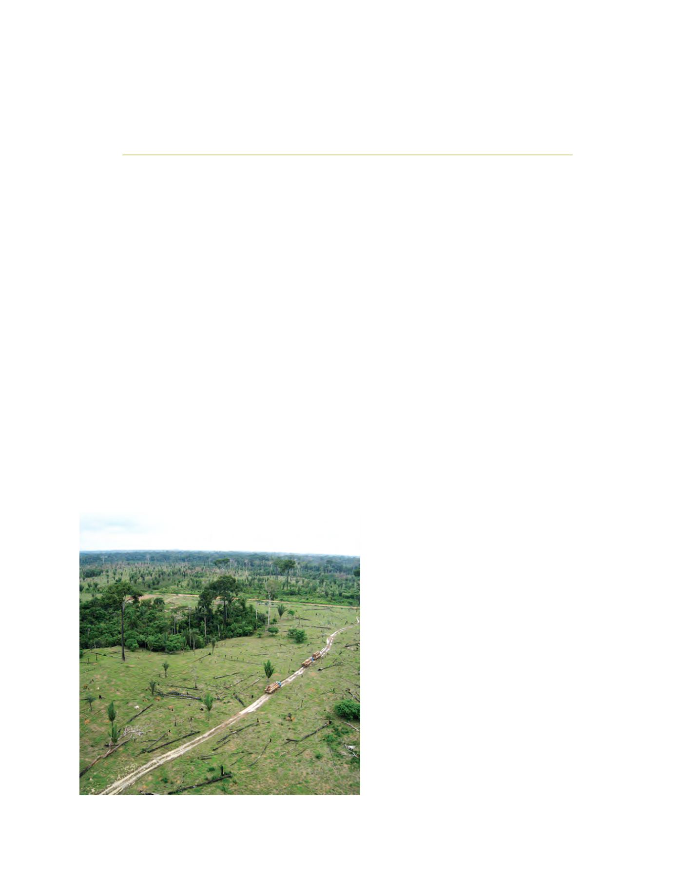
contributed to preventing illegal logging, a very serious
threat to forests in Brazil. However, one problem is that
the system uses optical satellite data and cannot observe
the ground surface during almost five months of the
year because of thick cloud. The Brazilian Institute
of Environment and Renewable Natural Resources
(IBAMA) and the Federal Police Department (DPF)
obtained PALSAR data from JAXA, but they did not
have mature analysis techniques.
Thus, based on a request from Brazil, the Japan
International Cooperation Agency (JICA) agreed to
transfer the required techniques to IBAMA and DPF
in 2008. In February 2009, JICA launched a three-year
project called ‘Utilization of ALOS images to support
protection of the Brazilian Amazon forest and combat
against illegal deforestation’ in order to detect and
prevent illegal logging in the Amazon using PALSAR
data. JICA selected RESTEC as an implementing organi-
zation of this project.
During this project, IBAMA and DPF receive PALSAR
ScanSAR strip data approximately every five days from
JAXA. The strip data covers a region 350 km wide and
over 3,000 km long, which means that one single strip
data covers more than 1 million square kilometres.
IBAMA and DPF overlay the strip data on the previous
data observed from about five days before, and then
make a colour composite image using the original soft-
ware developed by RESTEC. The original strip data is
black and white, but the colour composite image helps
users identify land classification and obtain valuable
Illegal logging is a very serious issue in Brazil, with large areas of trees being cut down
Image: ©RESTEC


