
[
] 290
images and through manual operation detected any possible
deforestation. This quick progress from data observation to infor-
mation dispatch was demonstrated in a successful collaboration
between JAXA, IBAMA, the Brazilian Federal Police and the Japan
International Cooperation Agency.
Unlike JERS-1, ALOS was able to achieve systematic acquisition
and high-level image processing over several years. Additionally,
ALOS became the workhorse for monitoring the global forest and
the related reductions of emissions from deforestation along with
the forest degradation REDD+ projects.
ALOS-2/PALSAR-2: addressing deforestation with a new satellite
ALOS operation was terminated on 12 May 2011, due to a power
failure. ALOS-2 is the successor of ALOS and will be launched in
August 2013. ALOS-2 is a SAR satellite and carries PALSAR-2, an
enhanced version of PALSAR. Its mission objectives involve both
forest and disaster monitoring. To suppress global warming, we will
conduct biomass measurements, deforestation watches and wetland
monitoring on a global scale. Decreasing forest carbon is an important
target and quantitative measurements and reducing deforestation are
the main goals. ALOS-2 houses the SAR antenna underneath the satel-
lite body, enabling both right- and left-side observations.
The main objectives using ALOS-2 are to observe the
global forest using FBD and to carry out quick deforesta-
tion monitoring using the dual-polarization ScanSAR in
Brazil, Indonesia and other locations.
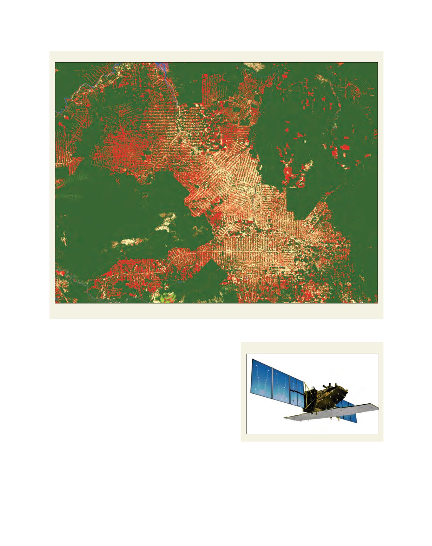
A 14-year change map of the forest at Rondonia, Brazil
An artist’s view of ALOS-2
Source: ©JAXA/METI analysed by JAXA
Source: ©JAXA
Red is used to show deforestation during the period (PALSAR-JERS-1 SAR), green the forested area as of 2010


