
[
] 78
Development study of the forest carbon
monitoring system using remote sensing
Yoshiki Yamagata, Hasi Bagan, Akihiko Ito and Minaco Adachi,
National Institute for Environmental Studies, Center for Global Environmental Research, Japan
R
educing emissions from deforestation and forest degrada-
tion (REDD) is considered to be one of the most important
carbon emission reduction efforts. The post-Kyoto regime
under the United Nations Framework Convention on Climate
Change requires forest carbon monitoring systems of signa-
tory nations. Deforestation and land-use changes are human
activities with a major impact on regional carbon budgets. For
instance, carbon emission from land-use change accounts for
between 12 per cent
1
and 20 per cent
2
of the total anthropo-
genic emissions worldwide. Forest carbon biomass in Southeast
Asia is the largest in the region; however, the area of primary
forest has continuously decreased due to land-use conversion.
The Food and Agriculture Organization (FAO) reported in 2010
that the forest area in South and Southeast Asia decreased by
0.68 million ha (23 per cent of the forest area) between 2000
and 2010.
In an effort to develop a larger-scale system for monitor-
ing forest carbon, we used time-series satellite (optical
and radar) remote-sensing data to track the history of
forest disturbance, and estimated the resulting forest
carbon budget using a terrestrial ecosystem model. We
found that the active radar sensor Phased-Array L-Band
Synthetic Aperture Radar (PALSAR) is especially advanta-
geous for monitoring tropical forest cover under clouds,
and that the time series of forest changes could be detected
using Moderate Resolution Imaging Spectroradiometer
(MODIS) data. We used a process-based model,
Vegetation Integrative Simulator for Trace Gases (VISIT),
to estimate the resulting forest carbon budget during the
last 25 years. Borneo Island is one of the main sites of
forest carbon tracking by the Global Earth Observation
System of Systems (GEOSS), because forest disturbances
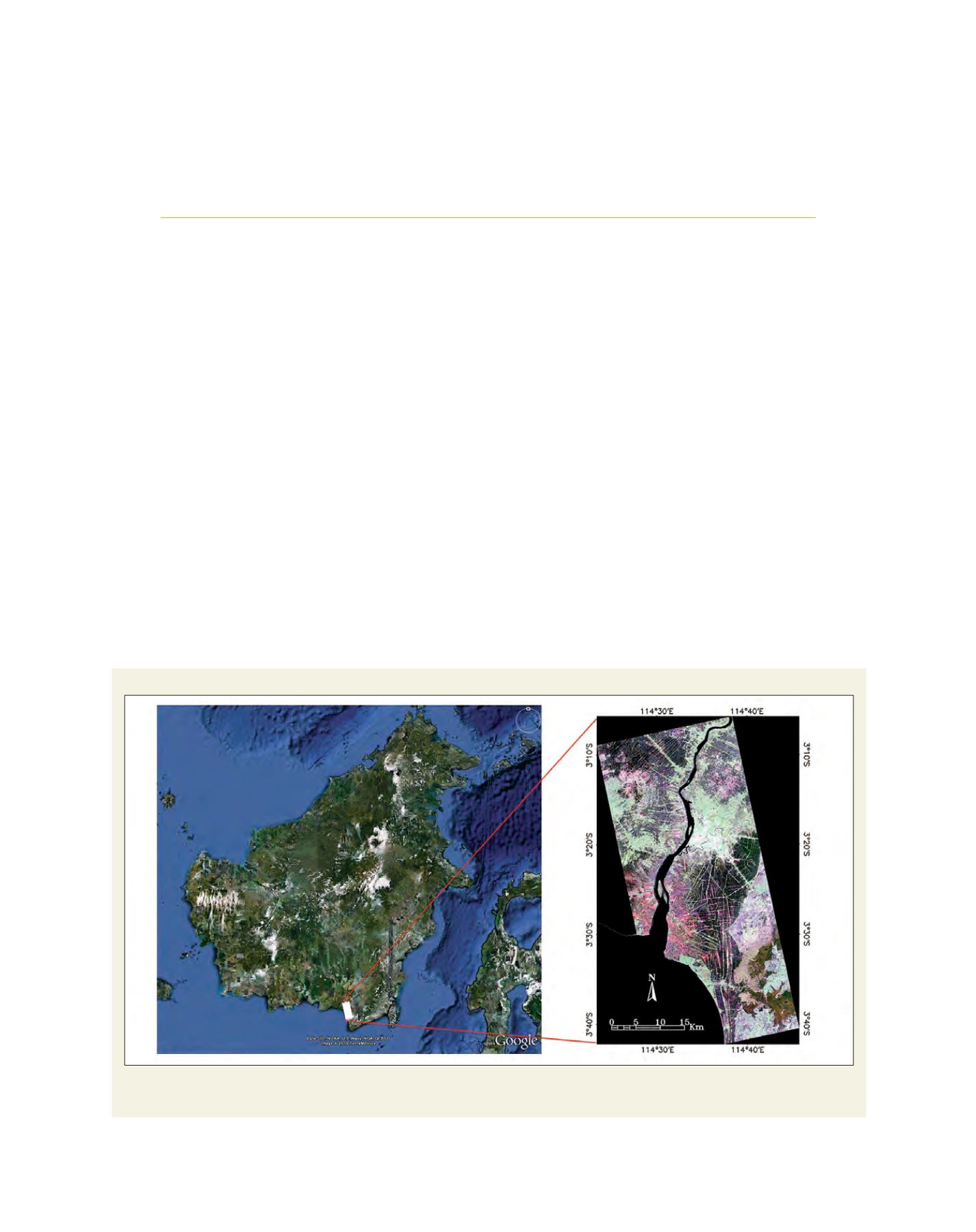
Location of the study area
The left-hand image shows the location of the study area on Borneo Island. The right-hand image is the full-scene PALSAR image acquired on 25 March 2010
(RGB = HH, HV, and VV)
Source: Extracted from ©Google Earth


