


 284 / 336

[
] 284
E
conomic
D
evelopment
and
W
ater
west side to 20
o
C in the south of the island. Precipitation
patterns are highly varied, with mean precipitation
ranging from 327 mm in coastal areas to 2,161 mm in the
headwaters of the White mountains.
6
The highest precip-
itation is observed in the mountains, with much less on
the north coast of the Chania prefecture and south part
of Irakleion. During recent decades a decreasing trend in
annual precipitation has been observed, with the largest
reductions in higher elevations.
7
The combination of the Cretan mountainous relief,
complex geology, long coastline and the remoteness
of some biotopes has led to great diversity and the
existence of many endemic and rare animal and plant
species. The national Woodland of Samaria (4,850 ha)
has been categorized as a Biosphere Reserve by the
United Nations Educational, Scientific and Cultural
Organization, and was awarded a European Diploma of
Protected Areas (Category A) by the Council of Europe.
In 1994, a survey by the Greek Biotope/Wetland Centre
recorded 37 biotopes including 14 river estuaries, one
spring, one lake, six wetlands, nine rivers, three arti-
ficial lakes and three sealakes. Many sites in Crete
have been included in the Natura 2000 network and
many national and European projects have targeted the
protection, restoration and sustainable management of
these areas. A key issue of Cretan ecological protection
is the safeguarding of its water resources.
Water management in the past
In ancient times, water supply was covered by spring
and river water and shallow groundwater. Water storage
was achieved by a dense system of drainage networks
and cisterns. The complicated water supply and sewage
system of the Palace of Knossos was greatly admired
in prehistoric Crete, even though most of its features
were destroyed and little is known about its main opera-
tion. Some hypotheses assume that this system is the
complicated labyrinth mentioned in the Greek myths of
later periods. Aqueducts of gravity-flow and pressure-
piped systems were designed in the palace, revealing
a deep knowledge of water management techniques.
In the palace of Phaistos, terracotta pipes were in use,
comprising one of the earliest applications of hydro-
static law in communication vessels.
8
Today’s water resources balance
A mean annual precipitation of 934 mm corresponds to
a water volume of 7,700 hm
3
. Due to high temperatures
it is estimated that almost 72 per cent (5,544 hm
3
) of
the rainwater is subject to evapotranspiration, with only
12.5 per cent generating surface flow (962 hm
3
) and
15.5 per cent (1,194 hm
3
) filtering into the soil.
9
An
estimated 593 hm
3
of groundwater enters the surface
flow as spring water. The major springs are found in
the north-west part of Crete (maximum recorded flow
6,000 m
3
/hr) in contrast to the south-east part, where
springs flow at 15-70 m
3
/hr.
Annual freshwater needs in the Cretan region reach
515 hm
3
. Of this, human water supply demands around
Crete faces limited natural water supply and increased seasonal
demand, especially in the summer for agricultural and touristic
use. A key issue of concern is the allocation of water resources
to ensure sufficient water for all demands. During recent decades
several hydraulic projects such as reservoirs and water pipe systems
have been constructed to serve water needs, drastically altering the
natural regime of rivers and aquifers. There is a conflict between
users’ demand and the rational use and protection of the island’s
existing water resources.
The island of Crete
Greece covers an area of 130,000 km
2
in the Mediterranean region
in the south of Europe. The island of Crete occupies the southern
part of Greece with an area of 8,265 km
2
and is divided into four
prefectures: Lassithi (1,810 km
2
), Heraklion (2,626 km
2
), Rethymno
(1,487 km
2
) and Chania (2,342 km
2
). Agricultural areas cover 37.9
per cent of the island (3,134 km
2
). Permanent trees (mostly olive
and orange trees) occupy 1,901 km
2
, arable land 300 km
2
, vegeta-
bles and other horticultural crops 86 km
2
, grapes and raisins 255
km
2
, and 592 km
2
is fallow land. The permanent population of
the island is 601,131.
4
In 2006, the livestock population on the
island was counted as 2,000 heads of cattle, 65,000 pigs, around 1.3
million sheep, 635,000 goats, 6,000 horses, over 1 million heads of
poultry, 544,000 rabbits and 158,000 beehives.
Four mountain ranges run west to east: the White mountains in
the west (2453 m), Idis mountain (2,456 m) in the centre, Asterousia
(1,280 m) in south Irakleion and Dikti (2,148 m) in the east. The
geology of Crete is comprised of limestone, which allows water to
penetrate, creating major karstic formations.
5
Crete stands on the
verge of the tectonic trough of the Mediterranean and the Aegean
volcanic bow, giving the island high seismic activity.
Crete has a typical Mediterranean climate with cool winters and hot
summers. The mean annual temperature ranges from 18.5
o
C in the
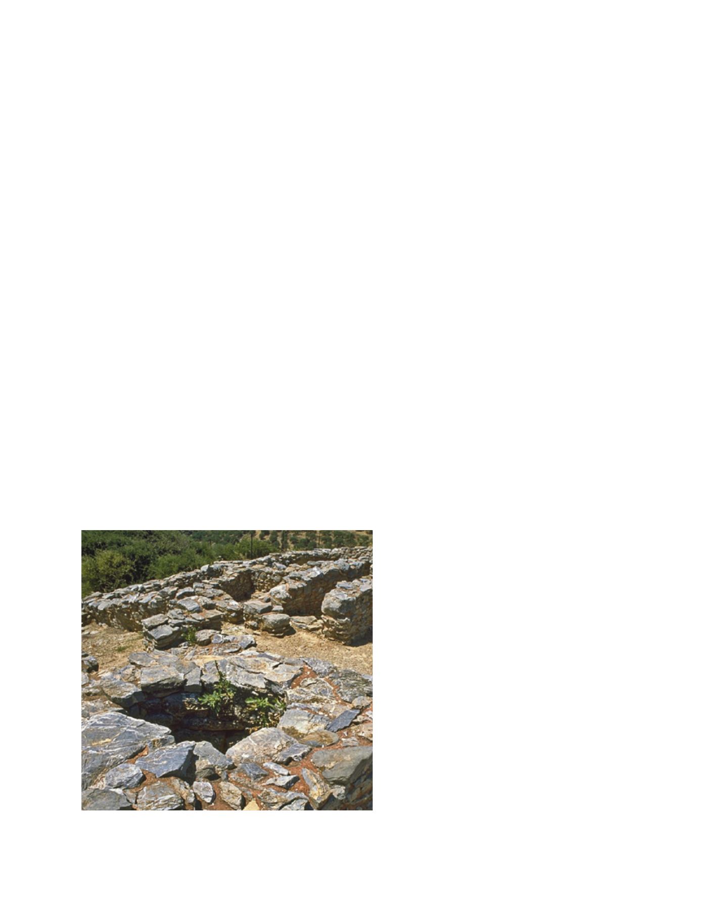
Water storage in ancient Greece: an ancient courtyard with a
cistern in the foreground
Image: www.minoancrete.com/chamaizi.htm