


 117 / 192

[
] 117
Landslide and debris flow in Hiroshima
Hiroshima city was damaged by two landslide and debris
flow events in 1999 and 2014. On 29 June 1999, a severe
storm event (50-200 mm during five days before the event)
caused a landslide and debris flow disaster that killed 32
people and destroyed 101 houses mainly in Hiroshima
Prefecture. At that time we investigated how landslide and
debris flow events took place in terms of rainfall character-
istics and estimated the critical line for the Hiroshima area,
Figure 4: A conceptual explanation of disaster risk,
hazard, exposure and vulnerability (interpretation
for a huge tsunami in Sendai)
Source: Kaoru Takara
Safer place
E
x
p
o
s
u
r
e
(
p
e
o
p
l
e
,
p
r
o
p
e
r
t
y
)
V
u
l
n
e
r
a
b
l
e
p
l
a
c
e
Huge tsunami (Hazard)
(a)
(d)
(c)
(b)
Figure 5: Landslide occurrence around
Hiroshima city in June 1999
Source: Ushiyama, Ohido and Takara, 2001
0 50
0
20
40
60
80
100
100
Effective cumulative rainfall (mm)
150 200 250
Hourly rainfall (mm)
The critical line
No landslide
Landslide occurred
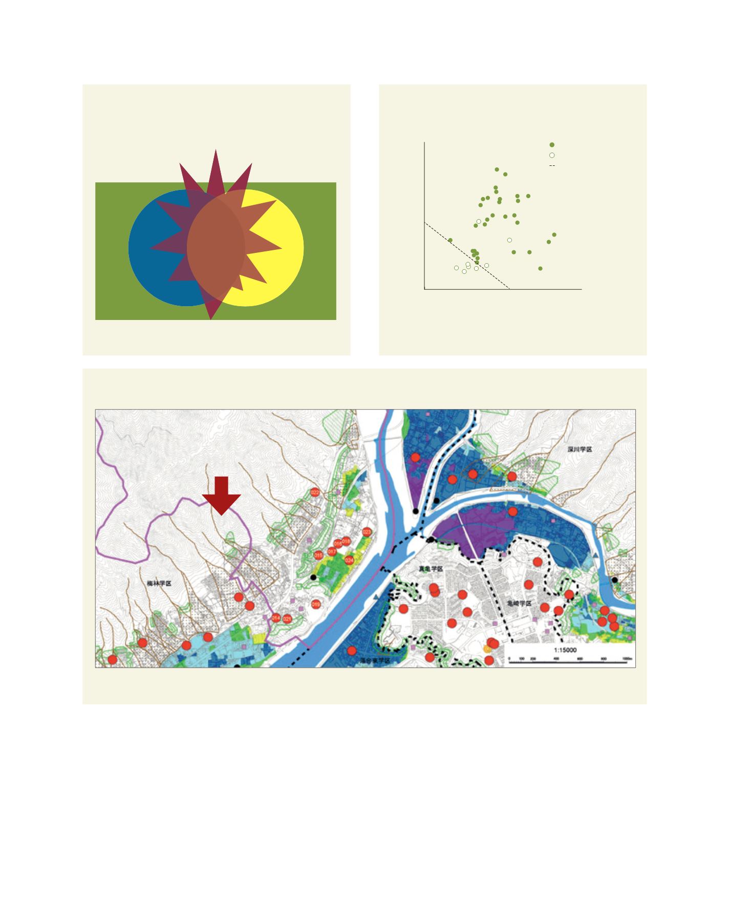
Figure 6: Part of the flood hazard map of the Yagi District in Hiroshima
Source: Hiroshima City home page. Note: The red arrow indicates the location of the second photo overleaf
L
iving
L
and
using effective cumulative rainfall and hourly rainfall that
triggered landslides (Figure 5).
Immediately after this event, the Japanese central
Government established the Act on Promotion of Sediment
Disaster Countermeasures for Sediment Disaster Prone Areas,
which encouraged local governments to disseminate infor-
mation about possible sediment disasters caused by heavy
rainfall-induced landslides and debris flows. Figure 6 is a part
of the flood hazard map of the Yagi District in Hiroshima.