


 199 / 280

[
] 199
the average long-term radiation available. If a site is
found, time series are needed for the power plant tech-
nical design phase. For larger project developments,
hourly resolved time series of up to ten years are neces-
sary, for smaller projects monthly mean values are
sufficient. GEOSS satellites provide such long-term time
series over a large geographical area.
Services for plant management
– A service line for plant
management is needed once a solar energy system is
built. Automatic fault detection and performance control
allow reliable alarm issuing and assure the validity of the
investment, while a performance check for smaller plants
gives first estimates of performance and failures. Through
comparison between the effective energy production and
the corresponding solar energy at the array plane, the
proper functioning of the solar power plant can be moni-
tored in defined time intervals. Hourly values are used
for error analysis, comparing typical patterns of energy
loss and the profile of the actual failure.
Services for utilities
– Both energy supply and demand
require information on the solar resource. The schedul-
ing of large power plants and overall grid management
necessitates precise knowledge of the expected load.
Beside temperature, irradiance has a major environ-
mental influence of up to ten per cent on electricity
demand. For this reason solar irradiance needs to be
forecasted as well load. On the supply side, electric
power transmission systems collect power from conven-
ments. Basic information for solar energy users includes the amount
of incoming solar radiation measured at ground level. Global, diffuse
and direct irradiance are needed for the different technical systems.
Spectral distribution of irradiance will be required in the future, for
example, in the use of spectrally more sensitive thin film photo-
voltaic (PV) technologies.
Earth observation allows the provision of surface solar irradiance
services specifically adapted to users’ needs in the solar energy sector.
In particular, the temporal and spatial resolution of geostationary
satellites in the GOES and the METEOSAT series are essential for
this application.
An important function of meteorological geostationary satellites
is detecting cloud fields and monitoring their evolution in time over
extended regions of the world. Clouds are the main modulator of
daily and hourly solar irradiance, thus radiance measurements from
space represent a unique data source for geographically continuous
assessments of the solar resource at the earth’s surface.
In addition to cloud information, detailed knowledge about atmos-
pheric substances like aerosol particles, water vapour, trace gases
and air molecules involved in the scattering and absorption of
sunlight is a further necessity. Such information is taken from clima-
tologies, atmospheric modelling and atmospheric satellite
measurements.
Space-based services
Services for investment decision
– Site assessment allows the investor
to find the best site for a planned power plant and to optimise the
financial yield. Site analysis and optimisation is based on maps of
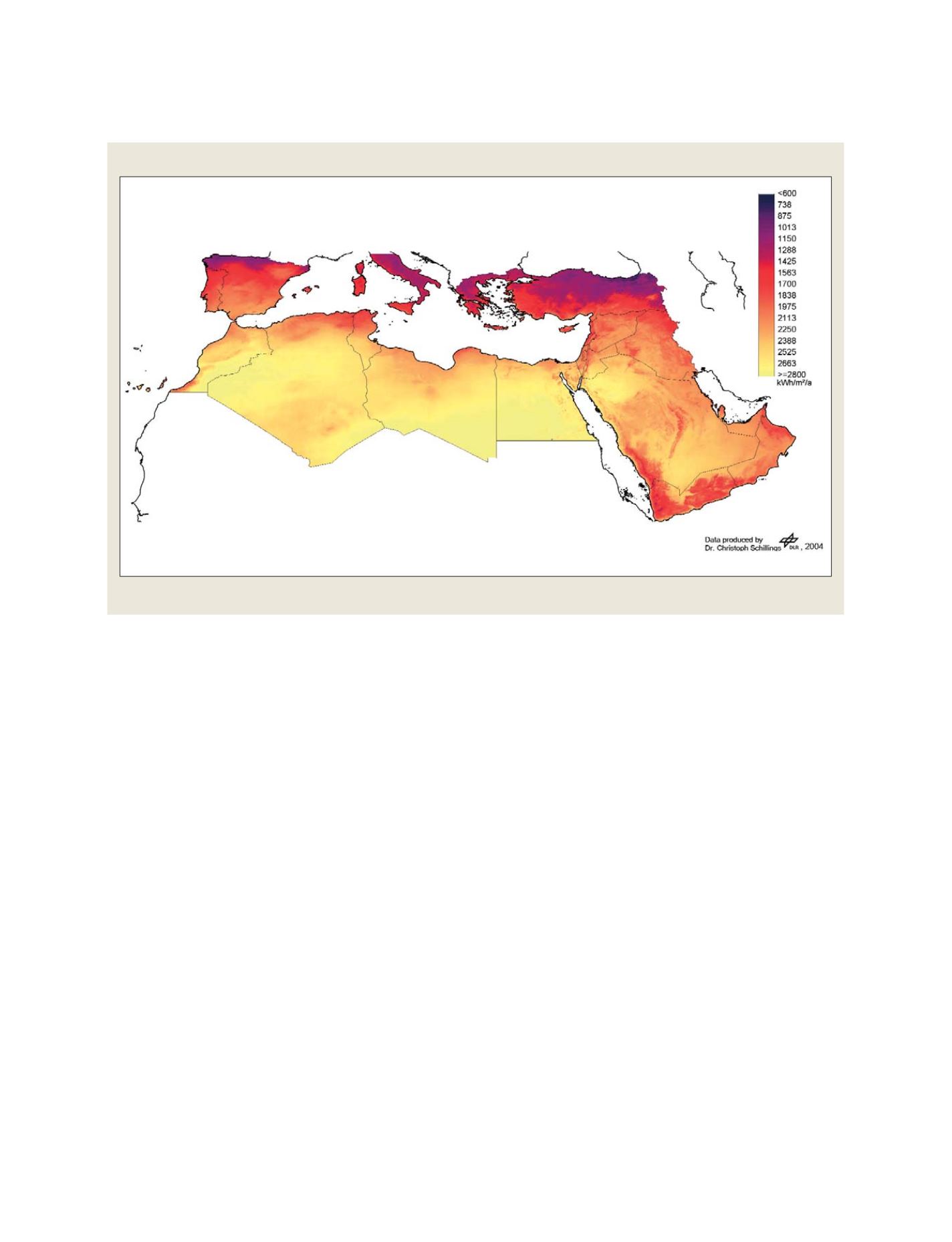
Irradiance image
Image showing annual sum of direct normal irradiance for 2004
Source: DLR
S
OCIETAL
B
ENEFIT
A
REAS
– E
NERGY