


 210 / 280

[
] 210
we think, provides an ideal approach, strongly reliant
on high-quality earth observation data and robust,
repeatable and auditable modelling and data processing
methods. The ability to adapt and continuously improve
estimates of national carbon stocks and emissions is an
integral component of the NCA framework.
NCAS was set up by the Australian Government in
1998, to monitor all greenhouse gas emissions at all
scales, with coverage of all gases (CO
2
and non-CO
2
), all
lands and activities. This very methodical approach is
bottom-up, spatially and temporally explicit, and inclu-
sive of all lands and causes of emissions and removals,
including climate variability. The ‘Land Cover Change
Project’ remote sensing programme in NCAS, underpins
Australia’s continental mapping and monitoring of the
extent and change in perennial woody vegetation. It is
based on Landsat satellite imagery, assembled as a
publicly available time-series of 15 national mosaicked
coverages (at 25-metre resolution).
3
The database
includes some 5,000 original Landsat scenes (185km x
185km), which have been analysed to specific land-
cover products, and then used to calculate annual
greenhouse gas emissions. Each time-slice of a national
coverage includes derived products to provide the infor-
mation needed for estimating greenhouse gas emissions
for various accounting frameworks:
1. Forest extent and change
2. Planted forest type
3. Sparse (non-forest) woody vegetation.
neously through the application of models of atmospheric fluxes,
driven in part by earth observation data. This is the approach adopted
for Australia. The NCAS approach provides increased understanding
of the seasonal and spatially dynamic variations in atmospheric
exchanges of all greenhouse gases, rather than only providing terres-
trial carbon stock assessment. Australia’s NCAS uses a spatially
explicit hybrid-model approach (at 25 metres grid scale) of a carbon-
to-nitrogen ratio, and a mass balance ecosystem model. This results
in estimates of all emissions from all lands (managed and unman-
aged), yet still allows for simple extraction of reportable
anthropogenic parts, as currently required by the UNFCCC. This,
Simultaneous reporting
Simultaneous reporting on all and anthropogenic-only emissions can be
done by applying models of atmospheric fluxes
Source: Australian Greenhouse Office
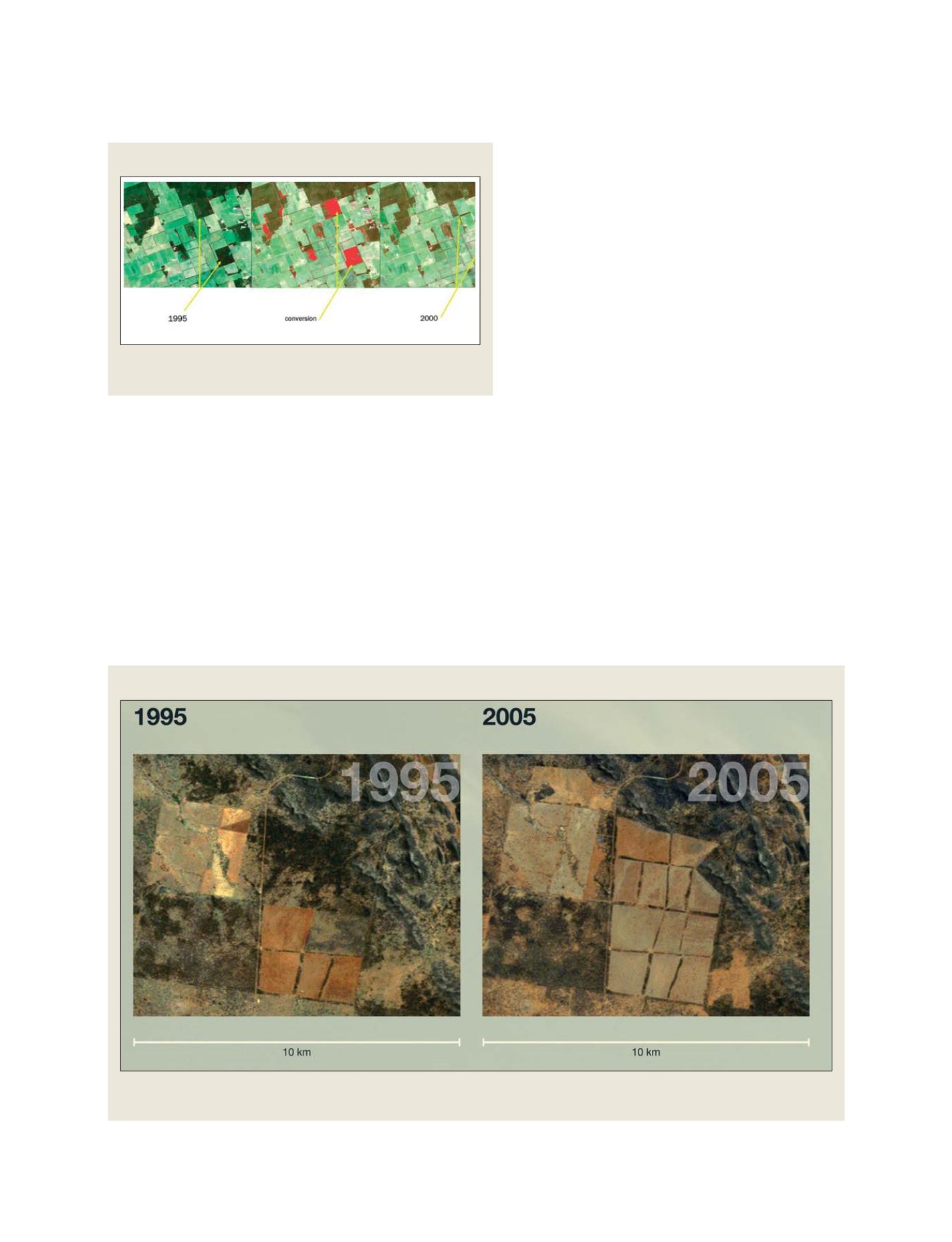
The NCAS Land Cover Change Project remote sensing programme underpins Australia’s continental mapping and monitoring of the extent and change in
perennial vegetation. It is based on Landsat satellite imagery, assembled as a publicly available time-series
Source: Australian Greenhouse Office
Land cover change
S
OCIETAL
B
ENEFIT
A
REAS
– C
LIMATE