
[
] 48
Thailand, as a member of GEO, recognizes these impor-
tant issues and the necessity of pursuing the following
goals:
• Further strengthening national coordination
mechanisms in meeting national development
needs by collective efforts across various govern-
ment agencies
• Establishing a regional/sub-regional cooperative
mechanism for the implementation of space appli-
cation projects of common interest, and minimizing
duplication of efforts
• Supporting and coordinating an operational Earth
space information database and its network with a
more advanced spatial data infrastructure on a
regional/global scale.
In order to achieve these goals, a high-level forum of
ministerial conference is a necessary step towards inten-
sifying regional and global cooperation, mobilizing
stronger political will and collectively addressing a range
of issues. The third Ministerial Conference will be
convened on 30 November 2007 in Cape Town, South
Africa to address these issues towards the
10-Year
Implementation Plan
for GEOSS. On this occasion
GISTDA commits itself to participate actively in support-
ing GEOSS activities.
avails itself to working towards an integrated Earth observations system
that can meet user needs at global and regional levels. GISTDA has
continuously supported GEOSS in several activities.
GISTDA’s role has evolved from that of a satellite data user to a data
provider. This will be particularly enhanced with the launch of THEOS,
by the end of 2007. GISTDA is in a position to continuously contribute
and share its data in case of emergency, particularly to neighbouring
countries in Southeast Asia.
Thailand has developed a spatial database under the framework of the
National Spatial Data Infrastructure (NSDI) to facilitate the recording
and storage of data in clearly defined formats for easy access by end
users. ‘Digital Thailand’ is an example of a product being developed to
achieve data accessibility to and interoperability among the various
government agencies as well as national end users through the Internet
map server system.
NSDI is designed to ensure that spatial data are available frommulti-
ple sources and can be easily integrated. Specific requirements are put
on relevant agencies that collect, use or disseminate geographic infor-
mation to ensure that the resulting data, information or products can
be readily shared and integrated among user agencies. The NSDI should
be developed so that all participants interface with each other through
interoperability specifications based on open, international standards
to facilitate users at all levels, from national to regional and global. The
adherence of NSDI to advanced Spatial Data Infrastructure (SDI)
regional/global standards will bring about synergy among regional and
global decision support systems through this data-sharing concept.
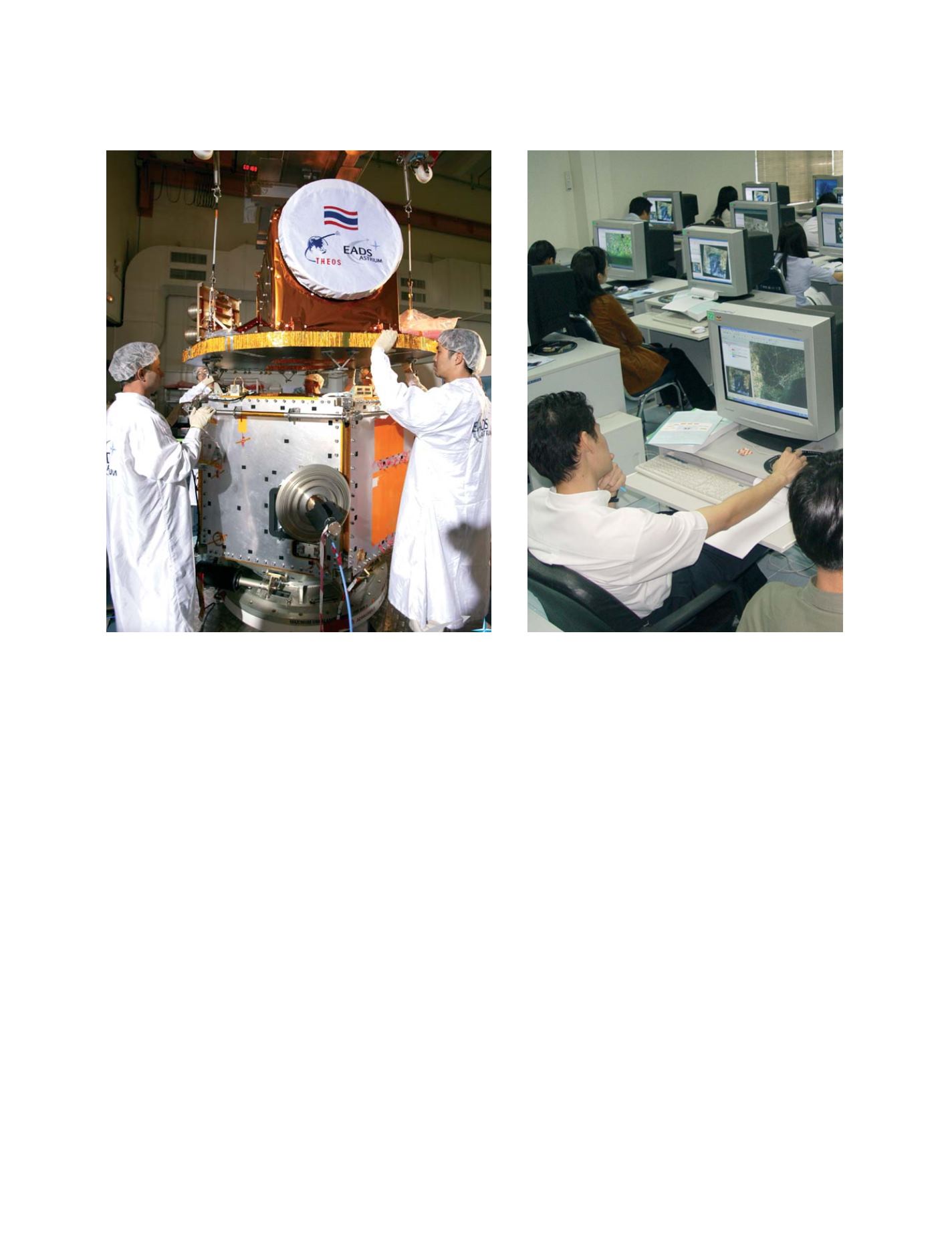
GISTDA has a leading role in educating the public and provides
more than 12 training courses a year in Thailand
The Thailand Earth Observation System (THEOS) will provide
high-resolution data accessibility to the country
Photo: GISTDA
Photo: GISTDA
N
ATIONAL
& R
EGIONAL
R
EPORTS


