


 151 / 288

[
] 152
D
isaster
R
isk
R
eduction
weather, climate, physical environment and socioeconomic data to
provide critical information on hazard, vulnerability, exposure and
risk to decision makers. The platform address several aspects of the
GFCS: (i) it provides an online environment in which producers of
weather and climate information can interact in real time with users
of the information and (ii) because the platform contains information
which scales from regional to local as well as across multiple timescales
it readily supports the delivery of a range scalable products and services.
Because of its online nature, the platform has provided an effective and
efficient approach for the sharing of human resources to support deci-
sion-making between countries and institutions. For example, during
the 2011 and 2012 Atlantic Hurricane Seasons, the platform was used
to support online discussions or possible impact scenarios between
National Disaster Management Offices, National Meteorological and
Hydrological Services, CIMH, the CIMA Foundation in Italy and the
Caribbean Disaster Emergency Management Agency among others. The
project has also provided extensive training for participants in areas
such as GIS and remote sensing. The project is also in the process of
developing cheap low cost rain gauge loggers with the software and
hardware schematics being made publicly available.
An important requirement of the GFCS is the ingestion of global data
by regional centres to produce products and services for national services
and entities. The GFCS also requires that regional centres acquire data
from national entities and make it available to global product produc-
ing and archiving centres. Component 1 of the ERC project supports
this objective in that 14 automatic weather stations were installed in the
ten participating eastern Caribbean states. While all of these stations
have not been installed at this time, those that are transmit weather and
hydro-meteorological data in near real time to the platform as part of
the sub-regional early warning monitoring programme. Plans are under-
way to archive this data into the recently upgraded climate
database at CIMH prior to making it available to national,
regional and international users. In this way, the project is
filling important national and regional climate data gaps.
From 2008 to 2012, JICA implemented the CADM
Phase 2 project in Belize, Saint Lucia, Grenada, Guyana
and Dominica. The project included (i) the establish-
ment of early warning real-time monitoring networks
consisting of rainfall measurement stations and stream
level gauges in critical watershed on participating coun-
tries and (ii) the development of flood hazard maps for
selected watersheds in participating countries. The
early warning network was established with message
passing occurring via either cellular networks or other
wireless methods. As part of the sustainable plan for
the project, real-time data from the observing network
along with flood hazards maps are being integrated into
the Dewetra platform. The data collected will be made
available to the global production and archiving centres.
The GFCS represents an important achievement of the
WMOand its global partners that has the ability to transform
the generation and application of climate services to reduce
losses fromweather and climate disasters in the Caribbean.
Recognizing the full benefits will require a concerted effort
by the range of stakeholders in the region to integrate
resources to develop common platforms that support the
sharing of data, information and human resources in near
real time. Efforts are underway to demonstrate the value of
such an approach, however, it is recognized that while this
transformation will be slow, it is essential.
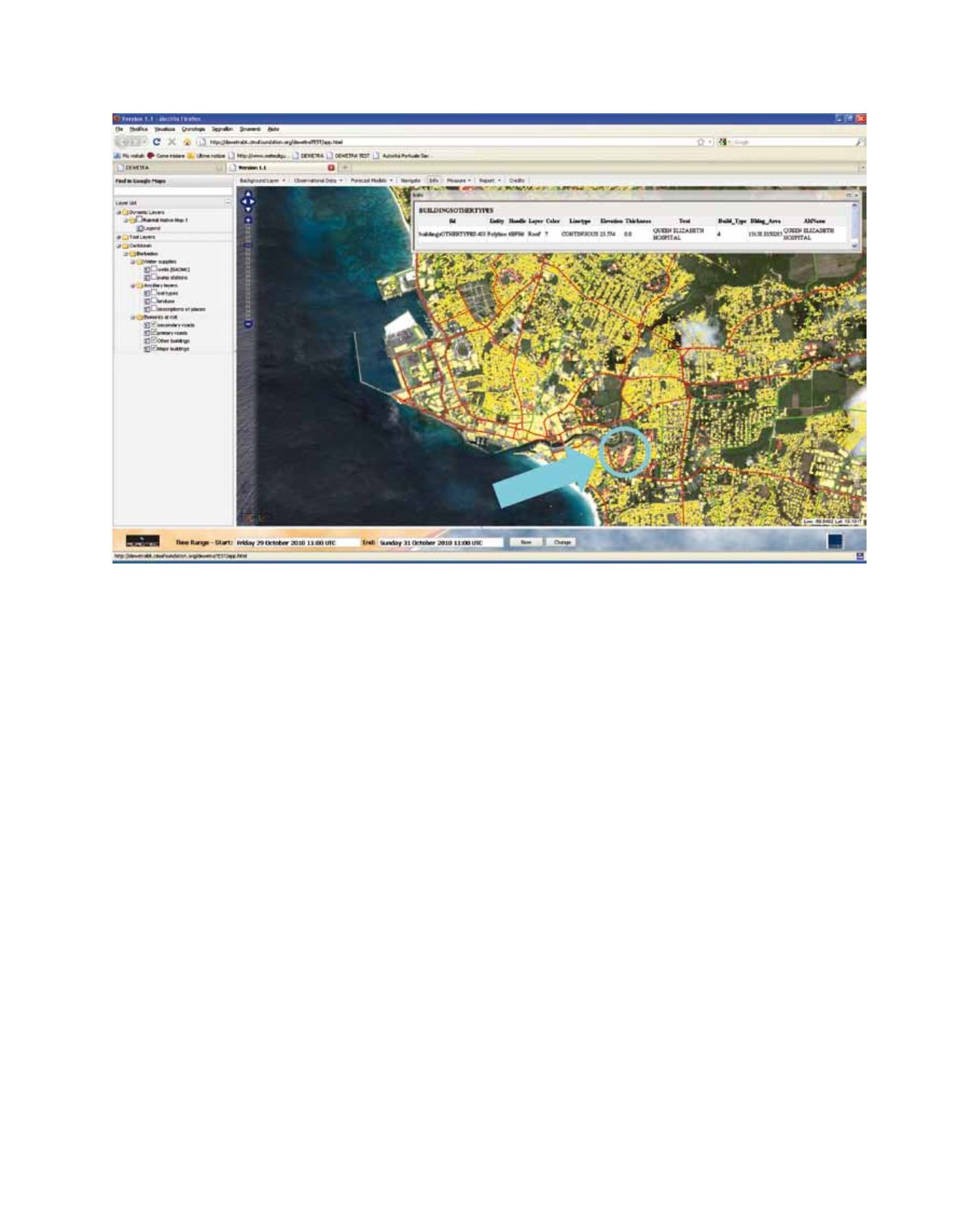
Elements of exposure on Barbados as visualized through the Dewetra platform
Image: CIMH