


 147 / 288

[
] 148
D
isaster
R
isk
R
eduction
to enhance tribal drought monitoring capabilities by developing addi-
tional weather monitoring stations, along with a more detailed historical
climatology for determining appropriate drought triggers. The governance
approach undertaken by NIDIS focuses on building longer-term collabo-
rative partnerships and is also responsible for maintaining the structure
for supporting ongoing indicators development and public engagement.
NIDIS engages water resources and community level groups in:
• Setting goals and priorities, and involving partners in problem
definitions
• Using professionals from relevant agencies to build and secure a
common basis for action
• Producing collectively authored knowledge and information
gaps assessments and agreement on the way forward
• Integrating different types of knowledge in EWS, particularly in
terms of linking scientific and local knowledge
• Revisiting major or landmark drought events to show the
benefits of new information and coordination processes.
Thus the DEWS in this organizational model involves more than
simply disseminating a forecast. In each prototype location, the
design is polycentric. It allows for major innovations from the
research community, such as new information, technologies and
applications for detecting and communicating risks and warnings,
to be prototyped and introduced.
The centralized component of NIDIS (Program Office
and Implementation Team) has oversight and fiscal
responsibility, and provides political authority and
policy coherence across sectors. As noted in several
contexts, emergency management organizations can
rarely play that role.
7
The decentralized components
of problem definition, capacity-building and informa-
tion resources are based on the location of prototype
EWS development, taking advantage of local practices
and innovations. This is key to cost-effectiveness and
sustainability, at each level of governance.
8
While the
local social process is critical and shows important prac-
tical pathways for action, these are rarely sustained over
the long term. There are a growing number of positive
examples of such partnerships that cross spatial scales.
For other locations or countries, the NIDIS approach
might likely entail a change in the culture of public
administration. NIDIS is creating similar RDEWSs in
others watersheds, including the US Southeast and
the State of California. The lessons and tools from
these systems are being transferred to other states and
regions, including the Columbia Basin, the lower Great
Plains and the Chesapeake Bay tributaries, to create a
fully ‘national’ drought early warning presence.
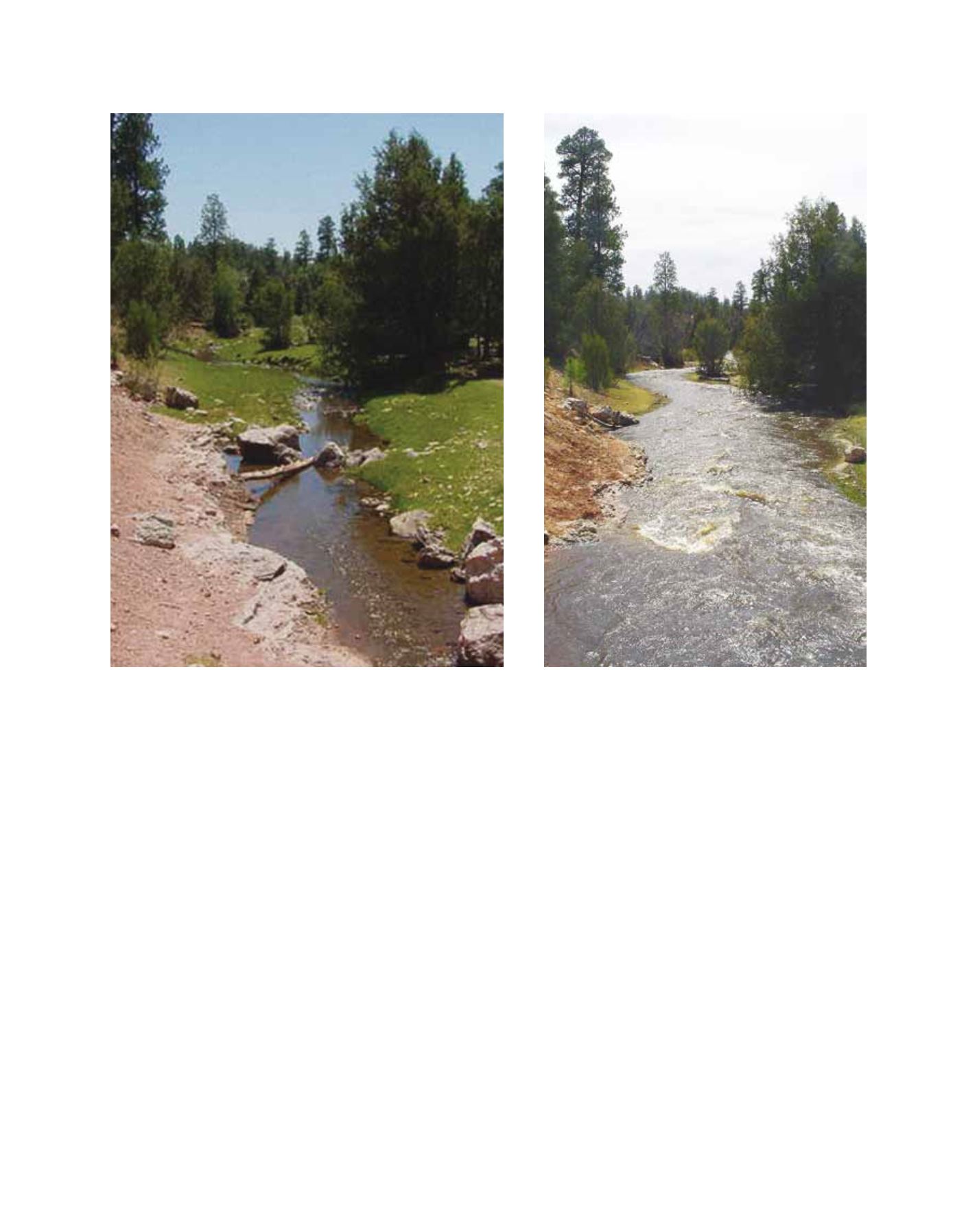
Stream flow in Wheatfields Creek, upstream of Wheatfields Lake, in April 2006 (left) and April 2005 (right)
Image: Jolene Tallsalt Robertson, Navajo Nation Dept. of Water Resources
Image: Jolene Tallsalt Robertson, Navajo Nation Dept. of Water Resources