


 245 / 336

[
] 245
Examples of cooperation in the Czech Republic
flood forecasting and information service
Jan Danhelka, Eva Soukalova and Lucie Brezkova, Czech Hydrometeorological Institute;
and Jan Cernik, Czech Development Agency
F
lood protection is a major part of practical water manage-
ment and a way of reducing the damage caused by the
most prominent type of natural disaster in Central
Europe. In the Czech Republic flood protection, especially
forecasting and information services, involves cooperation at
various levels from local to international.
In the aftermath of the disastrous 1997 floods, hydrological forecast-
ing models have been developed. The 2002 floods triggered, among
other things, a change in data measurement and data transmission
from meteorological and hydrological stations. In response to the
2009 flash floods, many local warning systems have been installed.
Providing information to municipalities
The national network of water gauging sites, which is operated
by the Czech Hydrometeorological Institute (CHMI), consists of
almost 400 stations equipped with automatic monitoring systems
featuring online data transmission to the central database over a
mobile telephone network (using GPRS protocol). The stations’
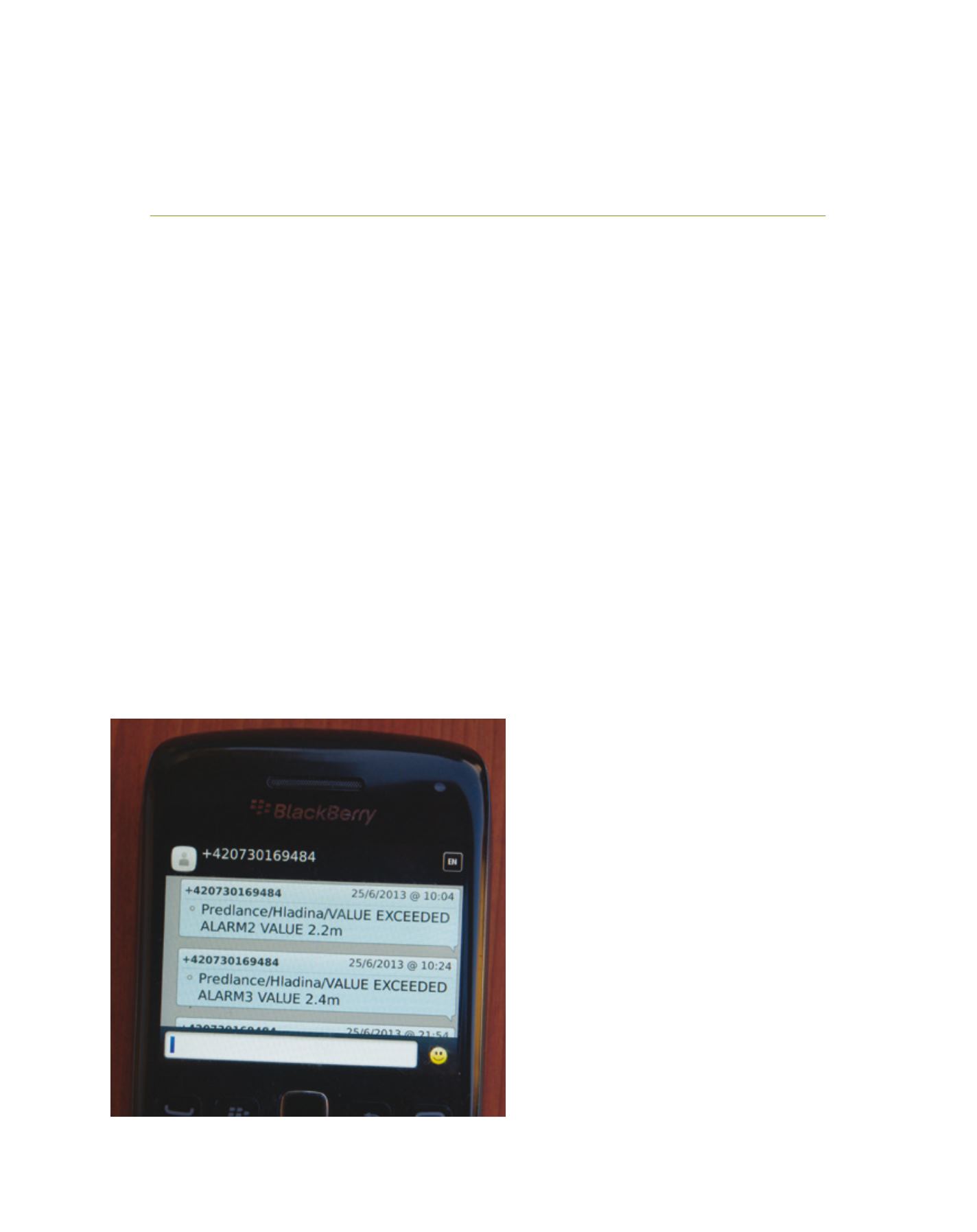
other function is to transmit short text messages
(SMS) notifying of major events registered at the
station. For the needs of CHMI, as the operator of
the stations, such notifications also include informa-
tion about the technical condition of the station (for
example, the back-up battery voltage), which helps
to support the operation of the measuring network.
However, the key pieces of information are those that
indicate that the threshold water stages, correspond-
ing to the flood levels at each particular site, have
been exceeded.
CHMI approached regional and local flood control
authorities (in the Czech Republic, these are regional
authorities and municipal authorities administer-
ing regions and municipalities). The institute offered
them inclusion in its distribution list of specified text
messages. A number of users subscribe to this free
service as the quickest method of notification that does
not suffer from delays in the delivery of information
during central data processing.
CHMI publishes observed water stages, discharges
and precipitation on its web page for the general
public with an update frequency of 10 minutes.
1
In addition, CHMI provides two special non-public
websites with the water stage data to ensure its avail-
ability even in case of overload of the public website.
However, recent flash floods affected many small
streams that are not covered by the national moni-
toring network. A programme of developing local
warning systems, targeted at small watercourses at
risk of flash floods but not monitored in the national
monitoring system, was established. This has been
successful thanks to experience with the above system
of data transmission. Since 2009, a total of 341 projects
have been supported through this programme under
the Operational Programme Environment, which is
managed by the Ministry of the Environment as the
national flood protection authority.
International cooperation in the forecasting service
A total of 19 countries share the Danube basin,
making it the basin shared by the largest number
of countries. One of these is the Czech Republic,
through which the Danube does not actually flow;
however, the Czech Republic contains approximately
W
ater
C
ooperation
, S
ustainability
and
P
overty
E
radication
An example of a warning SMS from station Predlance at Smeda River (northern Bohemia)
Image: CHMI