


 246 / 336

[
] 246
W
ater
C
ooperation
, S
ustainability
and
P
overty
E
radication
initially, the upper stretches of the Thaya basin and, after
2006, the area of the Morava and Thaya confluence. In
2007, a Memorandum of Understanding (MoU) was
signed with Lower Austria’s hydrology department. The
MoU contains approval of cooperation in the forecasting
of discharges in the upper Thaya basin between CHMI
and Lower Austria’s hydrology department. Every day,
CHMI transmits discharge forecasts for two sites in the
upper part of the Thaya basin, at Schwarzenau on the
Austrian Thaya and at Raabs on the Thaya.
Under ‘European Territorial Cooperation Austria-Czech
Republic 2007-2013’, the M00090 Morava-Thaya Flood
Forecasting System project was put in place. The project
has resulted in an extension of the existing HYDROG
forecasting system to include the Hohenau (Austria)/
Moravský Svätý Ján (Slovak Republic) site on the Morava,
downstream of the Morava-Thaya confluence.
A study from 2007
2
contains a decision that the
current HYDROG forecasting model,
3
applied to the
Czech part of the basins, would be expanded to cover
the Hohenau/Moravský Svätý Ján site on the Morava
and the current monitoring network would be extended
to include nine sites in the confluence area to monitor
the effect of polders and inundation. The model also
covers a part of the Thaya basin in Austria and the
Myjava basin in Slovakia, and considers handling opera-
tions on water reservoirs in the Thaya basin.
The Slovak Hydrometeorological Institute (SHMI)
has been using the HYDROG model to forecast
discharges in the Myjava basin since 2010, while fore-
casts for the Hohenau/Moravský Svätý Ján site started
to be computed in February 2010. The management
of handling operations on polders and on diversion
84 per cent of the Morava basin, in terms of its area (26,580 km
2
),
and this is the seventh largest tributary to the Danube with an
average discharge of 120 m
3
per second.
In the aftermath of the disastrous 2002 and 2006 floods that also hit
the Thaya basin, the Lower Austria Government requested an exten-
sion of the discharge forecasts, computed at CHMI’s Brno Regional
Office and employing the HYDROG model. This was to include,
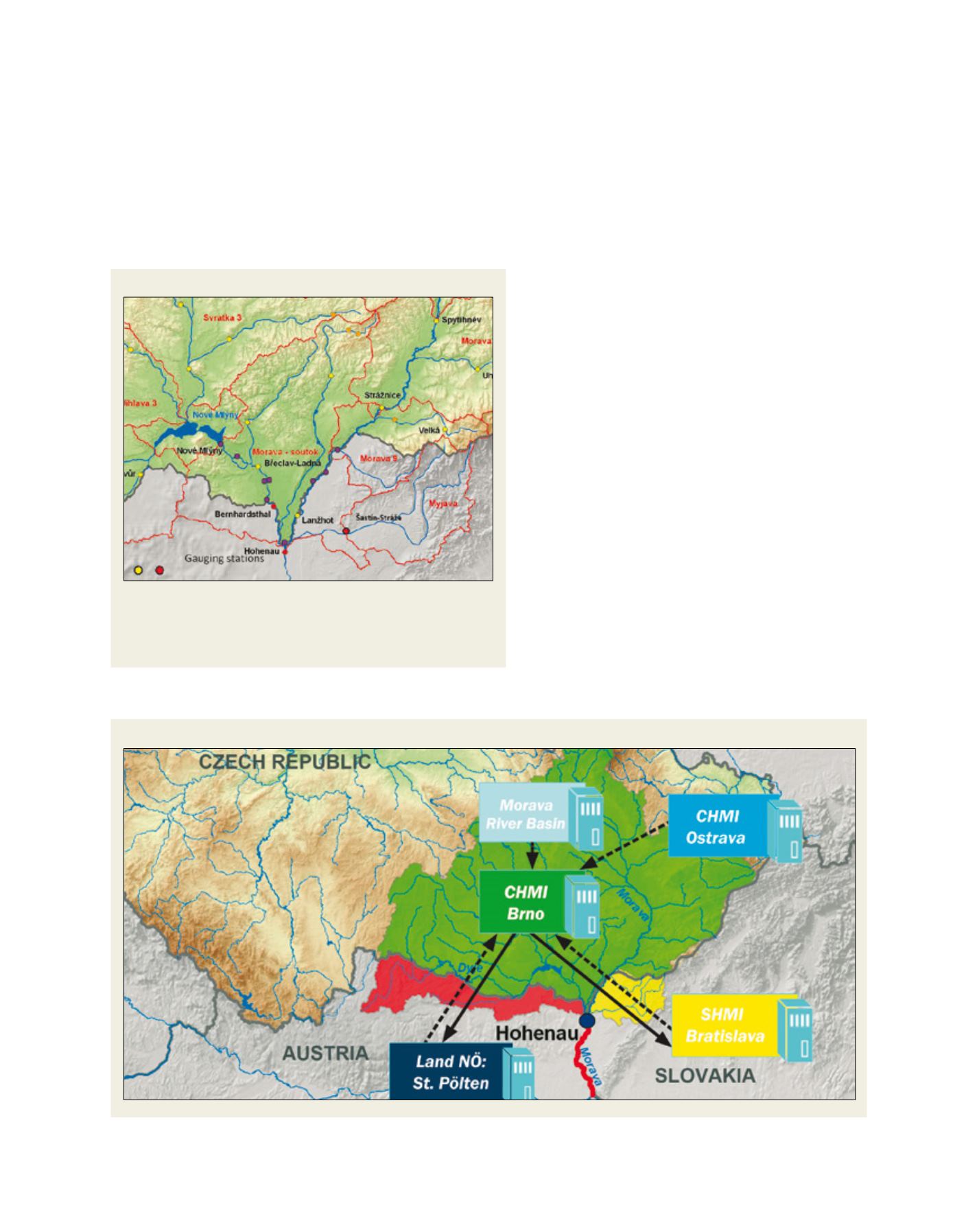
Scheme of the consecutive calculation of flow predictions in the Morava River basin
Source: CHMI
The Morava-Dyje confluence
Source: CHMI
The above detail shows: sub-basin borders (red lines); water gauges
operated by CHMI (yellow), Povodí Moravy (orange), SHMI and Lower Austria
hydrology department (red); and new monitoring sites operated by Morava
River Authority (purple)