


 251 / 336

[
] 251
W
ater
C
ooperation
, S
ustainability
and
P
overty
E
radication
makes improvements difficult. Ramsar partners have therefore
focused on improving the situation by gathering substantive experi-
ence, working across administrative and political borders, in Europe.
Many wetland ecosystems are shared between several countries, yet
out of the more than 2,100 Ramsar Sites at global level, only 13 are
formally declared as Transboundary Ramsar Sites so far. With the
exception of a stretch of the Senegal river, shared between Senegal
and Gambia, all Transboundary Ramsar Sites are situated in Europe,
covering shared rivers and their floodplains, shared karst areas, exten-
sive bogs, often spreading across the watershed divide, such as in
the Giant mountains, that divide the Polish and Czech catchments
of major rivers such as the Elbe and Odra which take their source
in this area. Transboundary wetland and water cooperation is more
advanced in heavily used and densely settled floodplain areas of the
Rhine and Danube. Between Germany and France along the Upper
Rhine between Basel and Karlsruhe, and between Austria, Slovakia
and the Czech Republic in the floodplains along the Danube-Morava-
Dyje confluence, between the cities of Vienna, Bratislava and Brno.
In 2002, a tri-national non-governmental initiative for the
Morava-Dyje floodplains, jointly launched at the end of the twen-
tieth century by the expert organizations of Daphne (Slovakia),
Distelverein (Austria), Veronica (Czech Republic) and WWF’s
Danube-Carpathian programme, won the prestigious Ramsar
Wetland Conservation Award. The award recognized the incentive
work of the private organizations for cooperation towards sustaina-
ble development and biodiversity conservation in a formerly isolated
political border area. An area that was until recently cut in two
by the ‘Iron Curtain’ with trip-wires and mine fields that separated
western market economies from the eastern communist
planning zone during a large period of the twentieth
century. The scientific inventories and the ecosystem
restoration work undertaken by the award winning not-
for-profit organizations paid off and convinced the local
and national authorities in the three countries to come
together, and to formally sign a declaration of coop-
eration at a ceremony in the prestigious Zidlochovice
castle, a former hunting estate of the Austro-Hungarian
empire, located in the midst of the periodically flooded
river meadows and ancient oak forests. Over the last
ten years, the ministerial declaration was translated
into a common, trilateral management plan for a river
floodplain, centrally located in Europe. Regular coor-
dination meetings make sure that the natural assets
and ecosystem functions of the area are maintained
and restored wherever possible. The floodplains are
now at a crossroads, due to the prospect of develop-
ment infrastructure projects for continent-wide river
transport, renewable electricity production (water and
wind), and main road and railway arteries for continen-
tal trade routes. This will present a serious challenge
for maintaining and restoring sufficient natural wetland
ecosystem and floodplain areas, in order that the
human-managed ecosystems can continue to provide
effective and low-cost services, such as flood retention,
water purification, drinking water supply, timber, food,
biodiversity production and others.
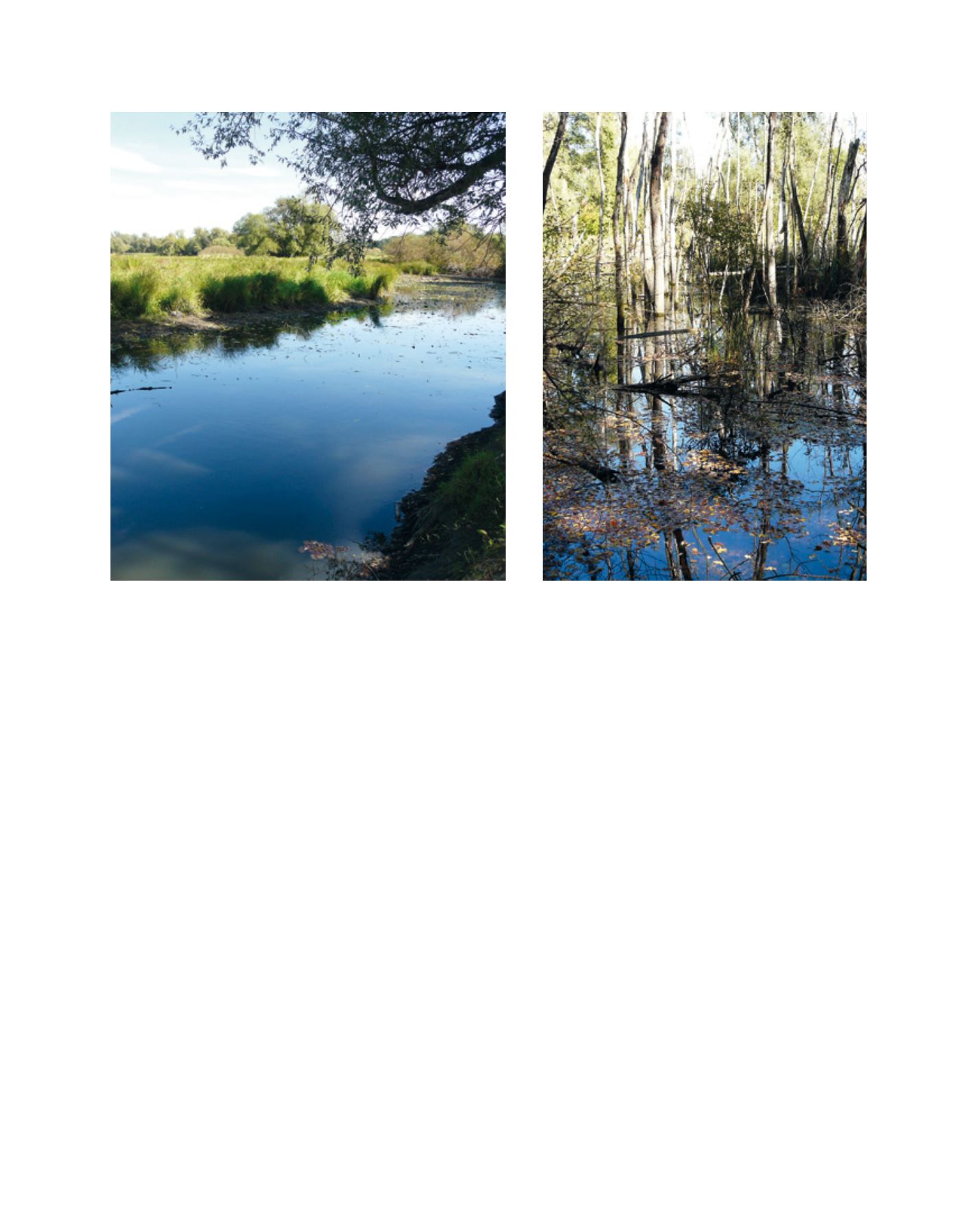
An oxbow of the Rhine in France’s Petite Camargue Alsacienne, part
of the Transboundary Ramsar Site ‘Rhin supérieur’
Drainage canal in the Slovak floodplain of the Morava, part of the Transboundary
Ramsar Site ‘Floodplains of the Morava-Dyje-Danube confluence’
Image: T.Salathé/Ramsar
Image: T.Salathé/Ramsar