


 77 / 336

[
] 77
The Murray–Darling Basin Plan: cooperation
in transboundary water management
Kerryn Molloy, Senior Science Writer, Murray–Darling Basin Authority
L
ate last year, Australia brought into law its first whole-of-
basin plan (the Basin Plan, 2012) for our most important
water resource: the Murray–Darling Basin. This plan
sets limits on the quantities of water extraction for human
(consumptive) use.
Reaching this agreed limit for sustainable use of the basin’s water
resource is a world first for transboundary water management. The
basin extends across borders and has important social and cultural
values in addition to its national economic importance. Achieving wide-
scale reform depended on agreed goals, overall stakeholder acceptance
and extensive cooperation between all levels of government.
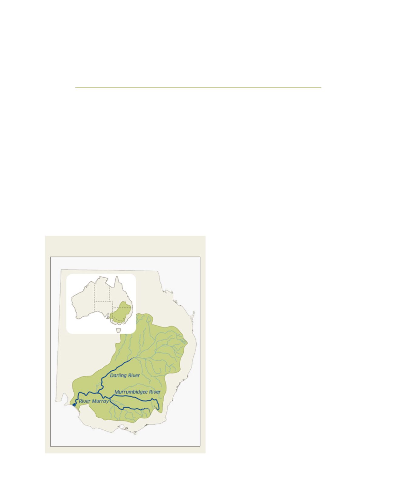
About the Murray–Darling Basin
Spanning parts of four states and all of the Australian
Capital Territory, the basin contains Australia’s largest
river system, comprising the Murray and Darling rivers
and their tributaries. Ranked fifteenth in the world in
terms of length (3,780 km) and twentieth for area, the
basin extends across 14 per cent of Australia’s land mass
(approximately equal to the area of France and Spain
combined). However, in the driest inhabited continent
on Earth and with very low topography, these long, slow-
flowing rivers have high evaporation rates (around 94
per cent of rainfall). The Murray–Darling system there-
fore carries one of the world’s smallest volumes of water
for its size. It is home to 2 million people (including 42
Aboriginal nations) and directly supports another million.
The basin’s approximately 60,000 agricultural busi-
nesses produce around 40 per cent of Australia’s food
and fibre (estimated to be worth $A13 billion annu-
ally). Around a third of this is irrigation-assisted; and
irrigation is the largest consumer of water in the basin.
Important for tourism and recreation, about 30 per
cent of the basin’s land cover is native forest; and it
contains about 60,000 km
2
of floodplain and 30,000
wetlands. Many of these are of national importance,
and 16 are listed under the Ramsar Convention on
Wetlands of International Importance. There are at least
95 threatened species dependent on basin ecosystems.
Water resource development and management
Since the mid 1800s, water resource development has
grown from initial pumping stations along the River
Murray to support settlers and livestock, to the present
where we have more than 3,000 water regulation struc-
tures. The combined capacity of the major storages is about
34,500 Gigalitres (GL). As a long-term average, 42 per cent
of the total surface water run-off to the Murray–Darling
Basin is diverted for consumption. In the connected river
systems, water is traded across and between catchments.
In Australia’s climate, supporting the economic
base without overly compromising water-depend-
ant ecosystems is challenging. The Murray–Darling
Basin receives little direct rainfall and suffers peri-
odic drought - and droughts can last a decade. In
the southern system, most rain falls across the upper
reaches of the rivers in New South Wales and Victoria,
and extraction by these states (particularly during
T
ransboundary
W
ater
M
anagement
Map of the Murray–Darling Basin, showing context
within state boundaries
Source: MDBA