


 107 / 280

[
] 107
global, and employ observing techniques from in situ
to remote sensing. Most significant from an architect’s
perspective is that GEOSS component systems do not
have common management.
The wide diversity and essential independence of
GEOSS component systems calls for a particular style
of systems architecture: a style that emphasizes inter-
operability. Systems are interoperable when their
differences are not a barrier to accomplishing a task
that spans those systems. In the wildland fire scenario,
real-time fire warnings must be interoperable with
routine monitoring and background maps, and alert-
ing systems must be interoperable across a range of
communications media.
Interoperability among diverse systems is base on
separate systems interoperating through standard inter-
faces and other interoperability arrangements. Support
for standardized arrangements is the basis for interop-
erability among credit card systems, for example.
At the system of systems level in GEOSS, interop-
erability allows each system to operate within its own
mandate, while also contributing synergistically to
serve global goals. At the inter-system scale, interop-
erability allows systems to interoperate even though
they are developed and operated independently. At the
scale of a single system, interoperability means that a
system is constructed from modular components.
Such a modular system is more robust, more easily
changed, and better able to use off-the-shelf, less
expensive components.
Given the expansive objectives of GEOSS, it is
necessary that the GEOSS Architecture be embraced
broadly. This means that the GEOSS Architecture must
be mainstream and minimally prescriptive. Ideally, it
should specify just those ‘few things that must be the
same so that everything else can be different’.
1
The
focus of GEOSS is on how systems work together, and
GEOSS will not constrain how any component system
operates within itself.
Implementing a service oriented architecture
The GEOSS Plan asserts that component systems regis-
tered to GEOSS must share observations and products
with GEOSS as a whole. To enable resource sharing, the
GEOSS Architecture uses a style of systems interoper-
ability known as service oriented architecture (SOA).
A ‘service’ is the basic unit of an SOA. The concept
of a service is straightforward. By analogy to a restau-
rant, a service in operation is like a waiter handling a
dinner order from a customer. Just as a customer is
not expected to give step-by-step instructions to the
kitchen, a service allows clients to precisely specify
their requests, but it does not allow them to specify
the exact procedure for satisfying those requests. This
is very important feature for broad interoperability.
Clients have no more control than necessary, and need
not be concerned with the details of execution.
The GEOSS Architecture is most evident at the points
of interoperability among the various systems
pushpins and grease pencils. However, use of digital mapping is
becoming more widespread. Mapping systems from different
vendors are now highly interoperable, and telecommunications
components are also becoming more interoperable.
A major challenge for GEOSS is to tackle interoperability barri-
ers specific to Earth observations: arranging for open and rapid
data sharing; combing observations from different sources; turning
data into information through models and other analysis tools;
arranging for rapid acquisition of observations as events unfold,
and so on. GEOSS Architecture principles, the GEOSS
Clearinghouse and the adoption of international standards can all
enhance interoperability.
Interoperability enabled by the GEOSS Architecture
Systems architects, like architects in other fields, are concerned
with designing ways to fit components together to attain a larger
objective. Just as a buildings architect may design a city with
diverse components such as housing, factories and offices, the
architects of GEOSS must accommodate diverse components.
GEOSS component systems encompass many scientific disci-
plines. The components range from primary data collection
systems to systems for the creation or distribution of information
products. The component systems span scales from national to
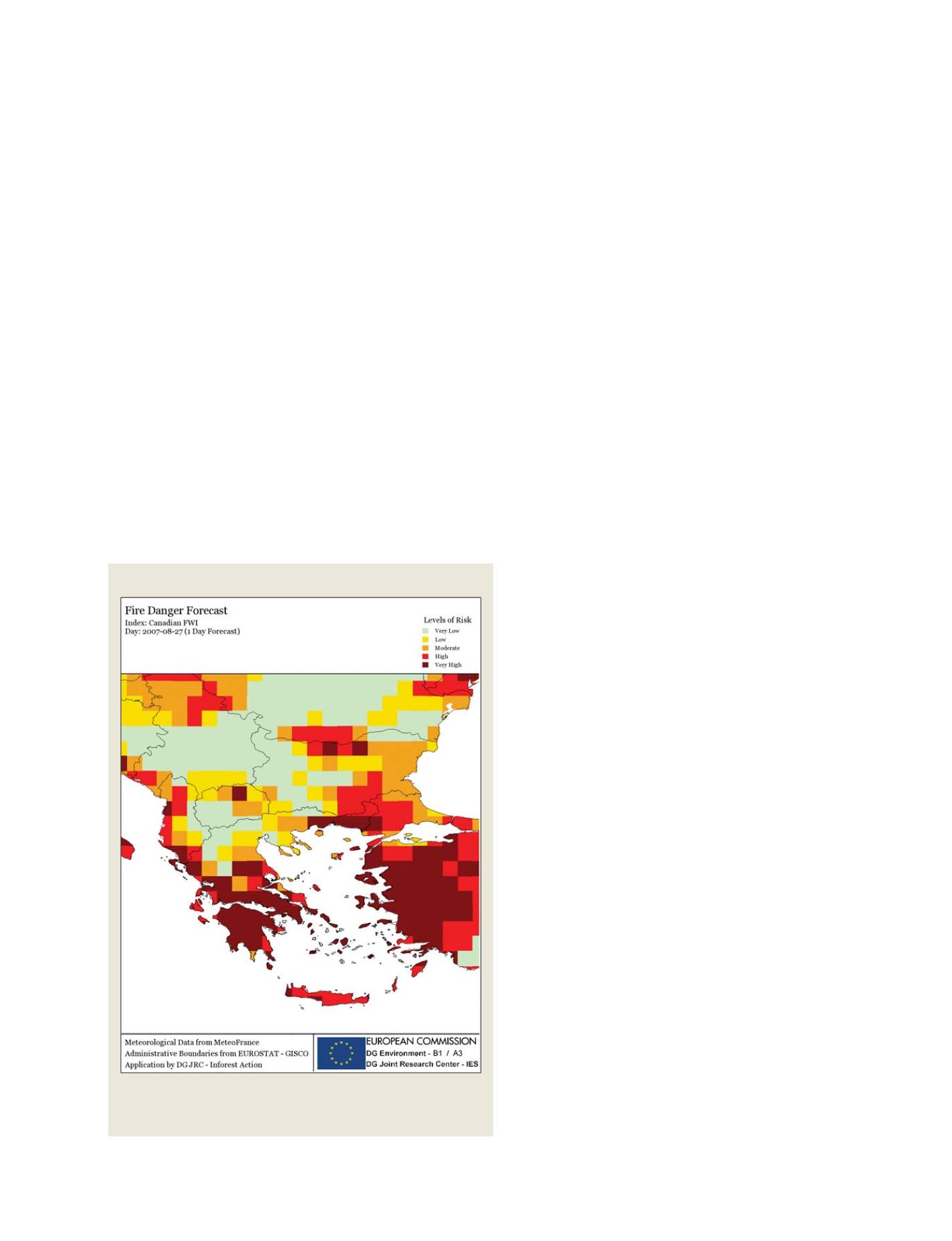
European forest fire information system
A standardized map showing the critical area of a wildland fire.
Maps like these enable tactical planning for warning, evacuation and fire
management
GEOSS C
OMPONENTS
– O
BSERVING
S
YSTEMS