


 102 / 280

[
] 102
TerraSAR-X – a new system
in the system of systems
Dr Stefan Knabe, Infoterra GmbH; Dr Jörn Hoffmann and Achim Roth, German Aerospace Center
T
erraSAR-X is a new German radar satellite that was
launched on 15 June 2007. It carries a high frequency
X-band SAR sensor operating in different modes of
polarization, coverage and spatial resolution of down to 1 m.
Using the microwave part of the electromagnetic spectrum,
TerraSAR-X is able to monitor the Earth’s surface indepen-
dently of day or night time and weather conditions.
In addition to its ability to characterize the physical properties of
the illuminated objects on the basis of the backscatter intensity
(e.g. soil moisture, vegetation cover, etc.) TerraSAR-
X can also be used for generating digital elevation
models (DEM) and for measuring surface motion
processes like subsidence or the flow velocity of river
and ocean currents through interferometric analysis
of the radar data (phase information).
TerraSAR-X partners
The mission has a scheduled lifetime of five years and
is realized through a public-private partnership (PPP)
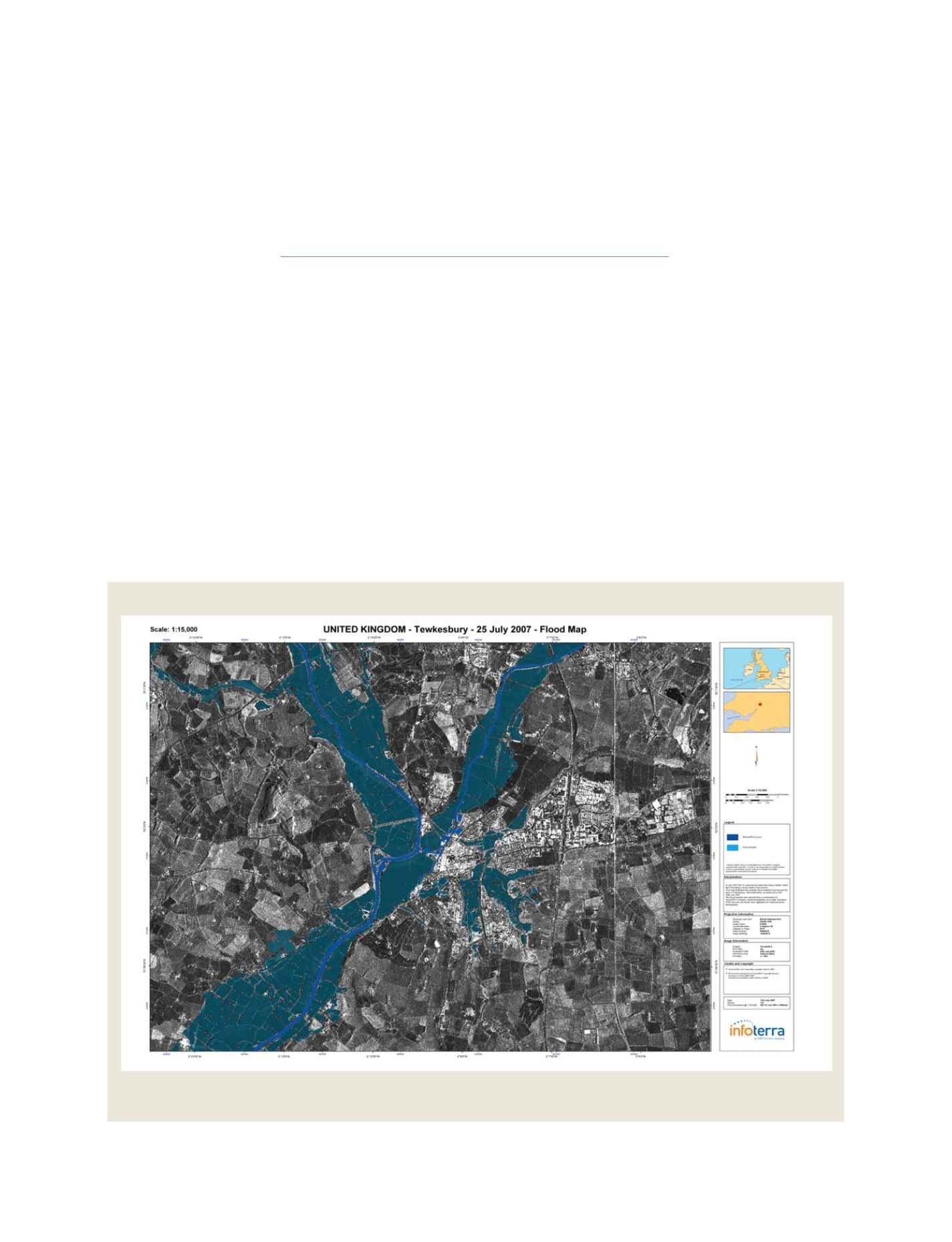
Source: Infoterra Ltd
This map shows the extent of flooding in the area of Tewkesbury, UK on
25 July 2007, derived from TerraSAR-X data (spatial resolution: 3 m)
TerraSAR-X flood map
GEOSS C
OMPONENTS
– O
BSERVING
S
YSTEMS