


 100 / 280

[
] 100
Canada’s sustained Arctic monitoring programme
Doug Bancroft, Director, Canadian Ice Service, Environment Canada; Andrew Eddy, President,
Athena Global; Guy Séguin, Director, Spacecraft Payloads, Canadian Space Agency
T
he recent recognition of accelerated long-term climate
change has brought a sense of urgency to Arctic monitor-
ing. Disappearing sea ice, melting permafrost and much
warmer temperatures are causing dramatic changes to fauna
and flora, as well as infrastructure local populations rely on.
Leveraging contributions other nations will make to the Group on
Earth Observations (GEO) and the exceptional data collection that
will take place under the International Polar Year (IPY), Canada is
working to establish a sustained Arctic monitoring program that will
identify key parameters to track these changes and monitor them
over time.
The program will run in four phases: the inventory of existing
Earth Observations (EO) and scope definition; a need and gap analy-
sis; a demonstration; and the establishment of a comprehensive EO
program. This program is undertaken in close cooperation with
departments involved in Canada’s north, particularly
Environment Canada, Natural Resources Canada,
Fisheries and Oceans Canada, Indian and Northern
Affairs Canada, territorial governments and the IPY
secretariat.
Ultimately, this program will offer governments and
other northern stakeholders a vital source of informa-
tion to support enhanced security, economic
development and environmental stewardship, stronger
territorial government, healthy and vibrant Arctic
communities and the development of Arctic science.
Canada, an Arctic nation
Canada is one of the world’s largest Arctic nations, exert-
ing sovereignty over countless islands and one of the
world’s longest coastlines across the Arctic archipelago
to the northernmost tip of Ellesmere Island. Canada’s
Inuit populations have roamed the Arctic for thousands
of years.
In the 17th century, English explorers searching for
the Northwest Passage sailed the icy northern waters
and charted out channels, straits, bays and inlets, leaving
clear traces of their passage on the land, in records and
through Arctic legends and lore.
Today, the three territories of Canada’s north account
for roughly 40 per cent of Canada’s landmass and fresh-
water reserves, with a population of 100,000 people,
representing only 1/3 of 1 per cent of the Canadian
population. In this context of sparsely populated wilder-
ness and extreme temperatures, remote sensing is a
critical tool to support economic and social develop-
ment.
In recent years, international interest in the Arctic has
grown dramatically. Global warming has led to rapid
melting of Arctic ice. In summer 2007, the Northwest
Passage was virtually ice free for the second year in a
row, a first in modern history. This is a sign of things to
come, and could herald a new age of Arctic exploration
and development.
Canada’s government has recognized this with the
decision to increase investment in Arctic infrastructure.
One of the most significant new investments announced
is the decision to build a deepwater port for Canada’s
northern fleet in Nanisivik, to support policing the
Northwest Passage and provide support to ships in
trouble. Increased northern traffic will come from new
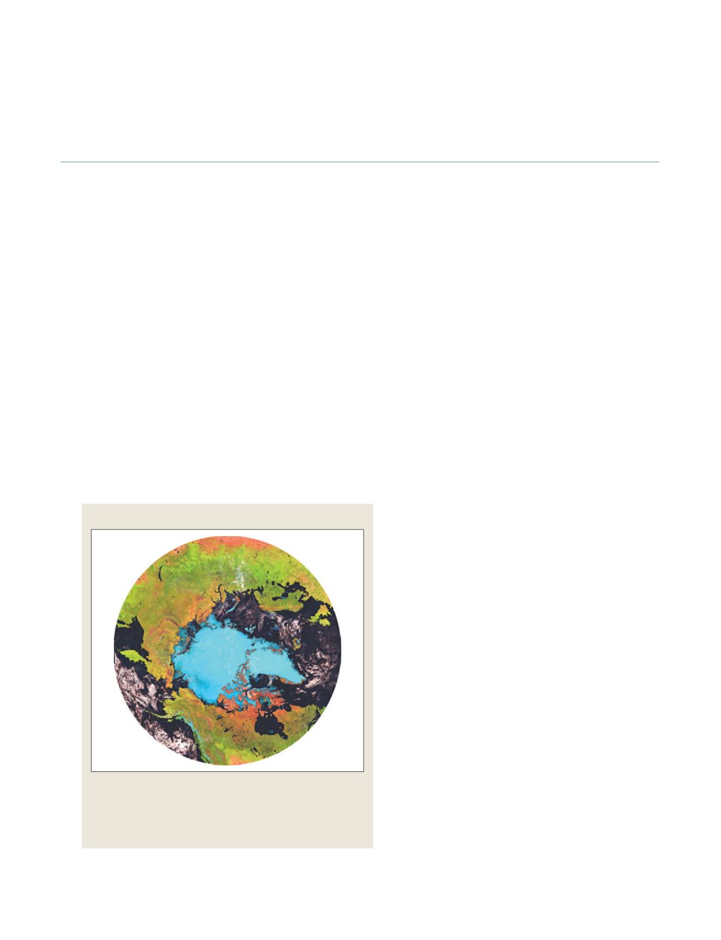
Source: Trishchenko, A.P., Y. Luo, K. V. Khlopenkov, W.M.Park, SPIE, 2007. Courtesy of NRCan
The MODIS-based Circumpolar Map was developed by the Canada Centre for
Remote Sensing, Earth Sciences Sector, Natural Resources Canada as a
contribution to Canada’s Arctic monitoring program. It provides a fusion of
MODIS land channels to produce a regional time series of multispectral
surface albedo at 250m and 10-day intervals for climate change and
terrestrial monitoring applications
MODIS-based circumpolar map
GEOSS C
OMPONENTS
– O
BSERVING
S
YSTEMS