


 98 / 280

[
] 98
Canada’s National Land and Water
Information Service
Ian Jarvis, Manager; Heather McNairn, Research Scientist; Allan Howard, Manager;
Catherine Champagne, Scientist; Ryan Ogston, Scientist, Agriculture and Agri-Food Canada
A
sustainable agricultural sector for Canada will be one that
is innovative, competitive, proactive in managing risks
and able to seize new opportunities while meeting the
needs of increasingly health conscious and environmentally
aware Canadians. A key component of promoting a sustainable
sector is providing information to strengthen the ability of
government and individuals to make sound decisions that will
preserve the land, air, water and genetic resources for current
and future generations.
Agriculture and Agri-Food Canada (AAFC) has established the
National Land and Water Information Service (NLWIS) to provide
on-line free and open access to agri-environmental data, informa-
tion, tools and expertise to support land-use decision making. NLWIS
is successfully bringing information from government and non-
government organizations together, and developing partnerships
with multiple agencies to permit sharing and access to data and prod-
ucts for the benefit of the broad Canadian user community.
NLWIS is also working to generate new information to fill critical
gaps identified by the user community using the methods and inno-
vations developed by AAFC research. NLWIS and AAFC’s research
community are working together in developing the next generation
of Earth observation products to meet ongoing and
emerging user needs.
Earth observation initiatives are critical in providing
the information needed on land and water resources.
Land cover monitoring supports a range of agri-envi-
ronmental information and application needs, including:
decision-making and monitoring for land use and
management; production insurance; development of
agri-environmental performance indicators; climate
change monitoring plus carbon and greenhouse gas
accounting and verification; biodiversity monitoring;
environmental farm planning; and incentive programs
for the adoption of beneficial management practices.
NLWIS is developing medium-resolution land cover
monitoring information for agricultural regions of
Canada to identify areas of agriculture production in
Canada, and set a baseline for tracking environmental
change. The work currently includes a circa 2000 base-
line inventory. Annual crop inventories are of value to a
diverse user community. Annual information on crops
will support programs to understand, assess, predict,
mitigate and adapt to climate variability and its associ-
ated risks, contribute to sustainable agriculture and
improve land management decisions. Earth observation
technology provides an efficient approach to large area
mapping of crop information. AAFC researchers have
developed a methodology that integrates data from radar
and optical satellite sensors to classify crops across
Canada’s agricultural landscape.
In addition to information on Canada’s land-base,
NLWIS is bringing together information to help monitor
the state and impacts of a variable climate on the agri-
cultural sector. Crop condition monitoring tracks the
seasonal health of agricultural land and is useful in
supporting water resources management, reducing
vulnerability to risk, and supporting production risk
programs. It is a particularly important contributor to
several agri-environmental information and application
needs, especially monitoring of drought and other risks
to sustainability.
Data on Canadian crop conditions are required regu-
larly and in near real time for crop condition assessment
purposes. AAFC currently uses Advanced Very High
Resolution Radiometer (AVHRR from NOAA)-derived
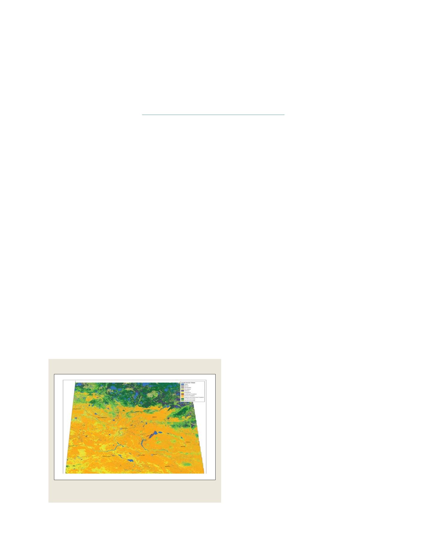
Source: Agriculture and Agri-Food Canada, 2007
Baseline Medium-resolution land cover maps will make it possible to monitor
changes in the agricultural land base of Canada
Province of Saskatchewan, Canada, circa 2000
GEOSS C
OMPONENTS
– O
BSERVING
S
YSTEMS