


 101 / 280

[
] 101
mission of Canada’s RADARSAT-1 which has collected a
unique archive of imagery over this area for future
studies focused on changes over time. Until recently, the
efforts deployed for the International Polar Year focused
solely on observations during this time period to support
science. Canada’s Arctic monitoring program will ensure
a legacy from the Polar Year observations by rooting
them in on-going monitoring and providing a mecha-
nism for information to be transmitted to decision
makers.
Comprehensive EO to support northern development
The major federal government departments active in
Canada’s north are currently developing a federal Earth
observation strategy that will include a major northern
component. This observation plan will provide for
sustained in-situ and remote observations of the Arctic,
coordinated with international partners. It will also
generate information products used to support decision
making, whether in relation to resource development,
infrastructure construction, pollution monitoring or
other areas of decision support.
Canada’s north is undergoing rapid change, and
Canada’s decision makers need new tools to track and
understand this change. As wildlife such as Canada’s
polar bears struggle to adapt, mitigation strategies
depend on comprehensive information and under-
standing. The unique but fragile environment of the
north offers exceptional development opportunities but
these must be pursued in a context of heightened stew-
ardship and environmental awareness to ensure Canada’s
Arctic remains a beautiful and pristine legacy for future
generations of Canadians.
development of the north, as well as cruise ships, the development
of local fisheries, and transit cargo.
While eventually the Northwest Passage could offer a significantly
shorter maritime route from Asia to eastern North America and
Western Europe, it is unlikely to become a major shipping lane until
environmental conditions are better understood and logistical issues
are dealt with. Nevertheless, destination shipping seasons in the
north are lengthening, bringing increasing traffic to the Port of
Churchill and other locations. Important new port infrastructure is
being built. Canada intends to ensure that maritime traffic in the
north is safe and respects Canadian environmental legislation; satel-
lite sensing is a key component of this strategy.
Building on existing observations
Canada already maintains a vast network of environmental moni-
toring stations across the Canadian north. In the future, more stations
are expected to add to Canada’s observations to support compre-
hensive weather and climate monitoring. The integration of this
information with satellite-based observations is critical. Satellites
already provide ad hoc coverage of the north to support specific operations.
During the International Polar Year, unprecedented volumes of
satellite data will be collected to support scientific research over the
Canadian Arctic. These data complement the 12-year background
Source: Annual Arctic Ice Atlas (Winter 2007), Canadian Ice Service
Canada’s Arctic areas are undergoing vast changes due to the acceleration
in long-term climate change, including disappearing sea ice and melting
permafrost
Eastern Arctic regional mosaic derived from RADARSAT data
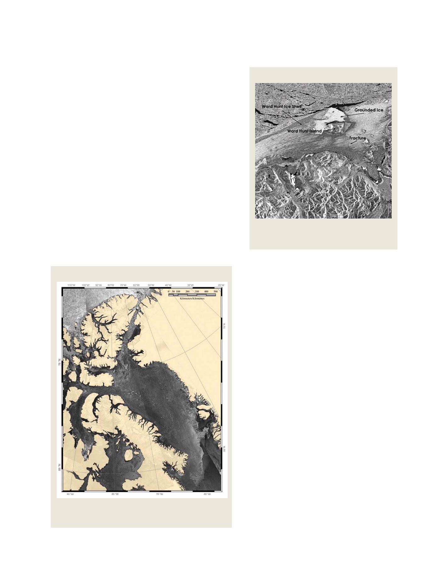
Ward-Hunt ice shelf imaged by Canada’s RADARSAT-1
Source: RADARSAT International
During a 12 year project RADARSAT collected a unique archive
of imagery over Canada’s Arctic area, for use in future studies
focused on changes over time
GEOSS C
OMPONENTS
– O
BSERVING
S
YSTEMS