


 108 / 280

[
] 108
contributed as GEOSS Components. “Interfaces” are the primary
touch points between component systems--a way to plug one system
into other systems. GEOSS interoperability emphasizes interfaces,
defining precisely how system components can interface with each
other. This minimizes impact on component systems other than
where each system interfaces to the shared GEOSS architecture.
In the wildland fire scenario, there are various interfaces among the
different systems in use. Many of these interfaces are implemented
as services in the GEOSS Architecture sense. For instance, back-
ground maps of terrain, vegetation, roads, etc. are typically available
through the standardized service for map display. These maps can
be overlain with real-time fire warnings from a standard Internet
news feed service. Finally, warnings for any hazard can be commu-
nicated across all available media using the standard format for alerts.
Standards and other interoperability arrangements
Overall, GEOSS is made up of contributed systems operating
within their own mandates. GEOSS adds value to these compo-
nent systems to the extent that they leverage each other’s resources
through standard interfaces and other interoperability arrange-
ments. That synergy among diverse and independent systems is
how GEOSS makes Earth observation data and information more
accessible, comparable, and understandable.
The GEOSS Plan states: “The success of GEOSS will depend on
data and information providers accepting and implementing a set
of interoperability arrangements, including technical specifica-
tions for collecting, processing, storing and disseminating shared
data, metadata and products.” Any newly contributed GEOSS
component must implement GEOSS interoperability arrangements
as registered at the time when it is contributed.
Potentailly, thousands of existing standards could be relevant to
one or another aspect of GEOSS, so how does GEOSS help the
designers of contributed systems to choose between available stan-
dards and arrangements, in order to maximize interoperability with
other GEOSS components? A few interoperability standards are refer-
enced in the GEOSS Plan itself, but the GEOSS Plan sets only the
most basic of requirements: “GEOSS interoperability will be based on
non-proprietary standards, with preference to formal international
standards.” A consensus process is needed to consider additional
standards and interoperability arrangements.
To support consensus seeking in matters of GEOSS
interoperability, the GEO Architecture and Data
Committee will call upon its Standards and
Interoperability Forum, which was set up to address
situations where GEOSS components cannot interop-
erate using one of the registered standards or other
arrangements. Drawing on expert advice, the objective
of the forum is to exploit existing standards to the
maximum extent possible. The forum is not itself a
standards body, but its participants will forward sugges-
tions to standards organizations from time to time.
Standardizing services, syntax and semantics
As mentioned above, there are a few interoperability
standards given in the GEOSS Plan itself. Because the
GEOSS Architecture is an instance of an SOA, the
GEOSS Plan addresses how service interfaces are
defined. If a service interface is like a power connector,
a service interface definition is like the specification for
making plugs and outlets.
Software engineers have several ways to define a
service interface at present. Because these languages
are not equivalent, GEOSS has not specified a stan-
dard for service interface definitions. The GEOSS Plan
states: “Systems interoperating in GEOSS should use
any one of four open standard ways to describe service
interfaces.” In the wildland fire example, the standard
for displaying maps is defined using one of these inter-
face languages.
Today, building adaptors to achieve interoperability
between systems can be frustrating. Even though most
systems have network service interfaces, often such
services are poorly documented. It is crucially impor-
tant to have service definitions; it is less important that
all service definitions are expressed the same way. Still,
it is inconvenient that software designers must some-
times translate between service definitions. When the
field of software design converges on a single standard,
GEOSS service interoperability should be updated
accordingly.
Source: Eliot Christian
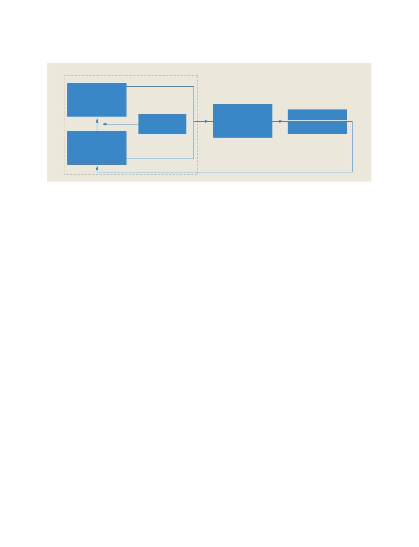
Earth System Models
• Oceans • Cryosphere
• Land • Atmosphere
• Solid Earth • Biosphere
Decision Support
Assessments
Decision Support Systems
Policy Decisions
Management Decisions
Predictions and Analysis
Observations
High Perfomance Computing;
Communication & Visualization
Standards & Interoperability
Assimilation
Ongoing feedback to optimize value, reduce gaps, and account for human activity
Earth Observation
System
• In situ
• Airborne
• Space-based
Other Data Sources
Socio-economic data
GEOSS
GEOSS architecture implemented by component systems
GEOSS C
OMPONENTS
– O
BSERVING
S
YSTEMS