


 59 / 280

[
] 59
Better coordination is also the driving force behind
CEOS’ ‘Virtual Constellations’ initiative, a proposal to coor-
dinate satellite missions across borders, allowing valuable
contributions from a wide range of parties to build and
sustain truly global observing systems for maximum soci-
etal benefit. The virtual constellations concept is of
multiple satellites working in harmony as part of the
GEOSS, to augment coverage, enhance system compati-
bility and increase data availability. Such an arrangement
encourages international cooperation among space agen-
cies while stimulating them to develop a coordinated
response to space-based observation needs. It also fosters
improved data management and dissemination worldwide.
A series of four prototype virtual constellations is
currently under review by CEOS members and partici-
pating organizations, in consultation with their respective
user communities. The focus of these virtual constella-
tions is on land surface imaging, precipitation, ocean
surface topography and atmospheric composition. They
are designed to make key GEOSS observations, maintain
continuity of observations, and identify and address poten-
tial gaps in data. They should also enable more effective
and efficient resource allocation by CEOS members to a
variety of observing systems.
The Virtual Constellations initiative capitalizes on the
idea that many ‘eyes’ focused on the same problem are
considerably better than just one. Coordinated operations
of multiple missions would also provide more accurate,
detailed and complete information on a variety of envi-
ronmental phenomena. The better the information
gathered about the Earth system, the better the chances
of understanding its workings and its impact on life and
society.
For example, a virtual constellation of land-imaging
satellites would continually monitor the Earth’s land
surfaces, tracking changes to farmlands, coastlines, deserts
and forests over time, and illuminating relatively long-
term alterations to land cover, ecosystems and biodiversity.
The same set of satellites could also track short-term
In 2006, CEOS provided a coordinated response on behalf of its
member space agencies to the proposed requirements for the space-
based component of the Global Climate Observing System (GCOS).
The CEOS response was a comprehensive collection of actions
aimed at fulfilling climate-observing needs in the atmosphere,
ocean and terrestrial domains, as well as a number of crosscutting
areas. CEOS provided the opportunity for space agencies to review
the way in which multi-agency climate observations are prioritised,
agreed, funded, implemented and monitored. CEOS also identified
what can be achieved by better coordination of existing and future
capabilities as well as specific improvements that require additional
resources or mandates beyond the present capacity of member
space agencies.
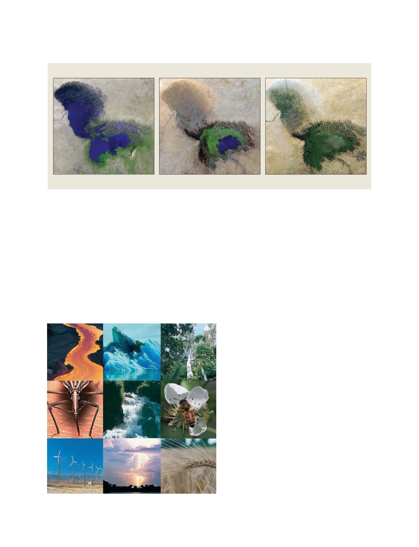
30 years of land surface change characterized by satellites
Satellite imagery reveals the progressive drying up of Africa’s Lake Chad – bordered by Cameroon, Chad and Nigeria – between 1972 and 2001
Source: Department of the Interior/US Geological Survey
GEO focuses on nine Societal Benefit Areas
GEOSS C
OMPONENTS
– O
BSERVING
S
YSTEMS