


 60 / 280

[
] 60
threats linked to climate change, such as wildfires and floods, which can
adversely affect human health, property and infrastructure, and natural
ecosystems.
A virtual constellation of satellites monitoring atmospheric compo-
sition and behaviour would measure concentrations of various gases
and aerosols above the Earth’s surface; such measurements are critical
to understanding global change. These satellites could also be used to
monitor severe environmental phenomena worldwide. In 2006, for
example, widespread fires and their smoke plumes in Africa were
mapped by European and American satellites, while the height of the
plumes was measured by a joint US-French satellite mission. Data gath-
ered by these different satellites were combined and used to predict
how the particulates in the smoke would disperse across land masses
and oceans. This information was then used by authorities to prepare
public warnings, increase the effectiveness of emergency responders
and assess environmental impacts.
A virtual constellation of satellites monitoring precipitation would
enable national authorities to track the seasonal progression of rainfall
patterns, better understand the development, movement and impact
of severe storms such as typhoons and hurricanes, and identify areas
likely to experience intense, rapid flooding. Such a virtual constella-
tion could improve forecast and warning services provided by national
weather agencies to better protect lives and property.
Oceans cover more than three-quarters of the Earth’s surface and play
an integral part in its climate system. A virtual constellation of satellites
focused on ocean dynamics would gather data critical to
monitoring sea level rise and the threat it poses to coastal
communities worldwide. Such a constellation would
gather information about ocean temperature and chem-
istry, and possible changes in ocean currents. It would also
be vital for use in tracking and predicting the behaviour of
tropical storms that form over ocean waters with the
potential to threaten coastal communities and ecosystems.
And it would provide information essential to under-
standing the scope and pace of climate change.
The Earth system is complex and changing rapidly.
Virtual constellations of satellites, unified in their focus
through international coordination, have the potential to
provide policy makers with vital, integrated and readily
available information about natural hazards, climate
change, and societies’ impact on that system. Information
that efficiently coordinated and effectively deployed satel-
lites gather can also help to protect lives and property and
assist decision makers in better managing and protecting
the Earth’s precious resources.
The concept of coordinated teams of satellites working
together will hopefully lead to the implementation of real,
physical constellations of satellites, flying in coordinated
orbits to monitor, assess and forecast changes in the atmos-
phere, oceans and terrestrial environment. It is clear that
a new period of integrative and collaborative effort has
begun in the area of Earth-observing satellites and climate
change research. With the continued support of CEOS to
develop and deploy space assets as part of the GEOSS, the
global Earth-observation community is effectively refo-
cusing its efforts. The member agencies of CEOS are
committed to this unprecedented effort to better coordi-
nate observing systems and human expertise to provide
government decision makers with a better understanding
of the Earth system.
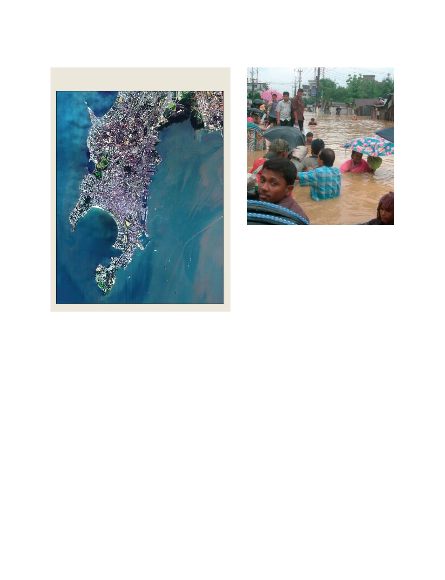
Rising sea levels worldwide will impact islands
and coastal regions such as Mumbai, India
Source: European Space Agency
Torrential rains and flooding affected millions in Bangladesh in
June 2007
Photo: AP
GEOSS C
OMPONENTS
– O
BSERVING
S
YSTEMS