


 240 / 287

[
] 241
A
dAptAtion
And
M
itigAtion
S
trAtegieS
to be conducted, particularly as the models used in AR4
weren’t precise enough to calculate climate change in
smaller islands, and as the parameters weren’t necessarily
adjusted for tropical climates.
Downscaling to improve climate predictions
According to IPCC’s AR4, there have been improve-
ments in the simulation of regional climates. This
has resulted in improvements in established regional
climate models (RCMs) and in empirical downscaling
techniques. The report also states that both dynamic
and empirical downscaling methodologies are improv-
ing to the point where they can simulate local features
in present-day climates using observations provided by
current global climate models (GCMs).
In some cases, such as when sub-grid scale variations
are minimal or when assessments are global in scale,
regional information provided by GCMs may be suffi-
cient. Theoretically, the main advantage of obtaining
regional climate information directly from GCMs is the
knowledge that the internal physics are consistent from
one scale to the next. GCMs cannot, however, provide
accurate climate information at scales smaller than their
resolution, neither can they capture the detailed effects
of sub-grid scale forcings unless they are parameterized.
The benefits of downscaling, therefore, depend on the
spatial and temporal scales of interest, as well as the vari-
ables of interest and the climate information required.
The scale of a study relates to whether or not high
resolution information is needed. At a regional/small
nation level, for example, there would be a need for
high-resolution information given that some nations
are not even represented in GCMs or they only occupy
a few GCM grid boxes. The Caribbean islands are a
prime example of a region that requires high resolu-
tion information. Here, statistical downscaling would
to be seriously compromised, especially if water supplies are limited
in the first place. Add to this predictions from the Special Report on
Emissions Scenarios (SRES), which show reduced summer rainfall for
this region, and the likelihood of meeting water demand during low
rainfall periods is slim.
The outlook for fisheries, whichmake an important contribution to the
gross domestic product (GDP) of many island states, is also foreboding.
AR4 confidently claims that climate change, particularly changes in the
occurrence and intensity of El Niño-SouthernOscillation (ENSO) events,
is likely to severely impact coral reefs, fisheries and other marine-based
resources. In addition to this, an increase in sea surface temperatures, sea
levels, turbidity, nutrient loading and chemical pollution, damage from
tropical cyclones, as well as a decrease in growth rates due to the effects
of higher carbon dioxide concentrations in ocean chemistry, is very likely
to lead to coral bleaching and mortality.
It is very likely that subsistence and commercial agriculture, and
tourism – which is a significant contributor to GDP and employ-
ment on many small islands – will be adversely affected by climate
change both directly and indirectly. There is also a growing concern
that global climate change is likely to have a negative impact on
human health. Many small islands lie in tropical or sub-tropical
zones with weather that is favourable to the transmission of diseases
such as malaria, dengue, and food and waterborne diseases. If climate
change causes an increase in temperatures alongside a decrease in
water availability, the burden of infectious diseases in some small
island states is likely to increase. A study of the relationships between
dengue fever, temperature, and the projected effect of climate
change on the transmission of dengue fever was undertaken in the
English speaking areas of the Caribbean.
1
Carried out because of the
recent increases in dengue fever outbreaks and predicted tempera-
ture increases, the study revealed that occurrences of dengue fever
are sensitive to factors such as temperature and rainfall. This, and
IPCC’s projected long-term changes in climate, should be a source
of concern for public health officials in the Caribbean.
Given these predictions it is clear that focused region-specific climate
model parameterizations need to be developed and assessments need
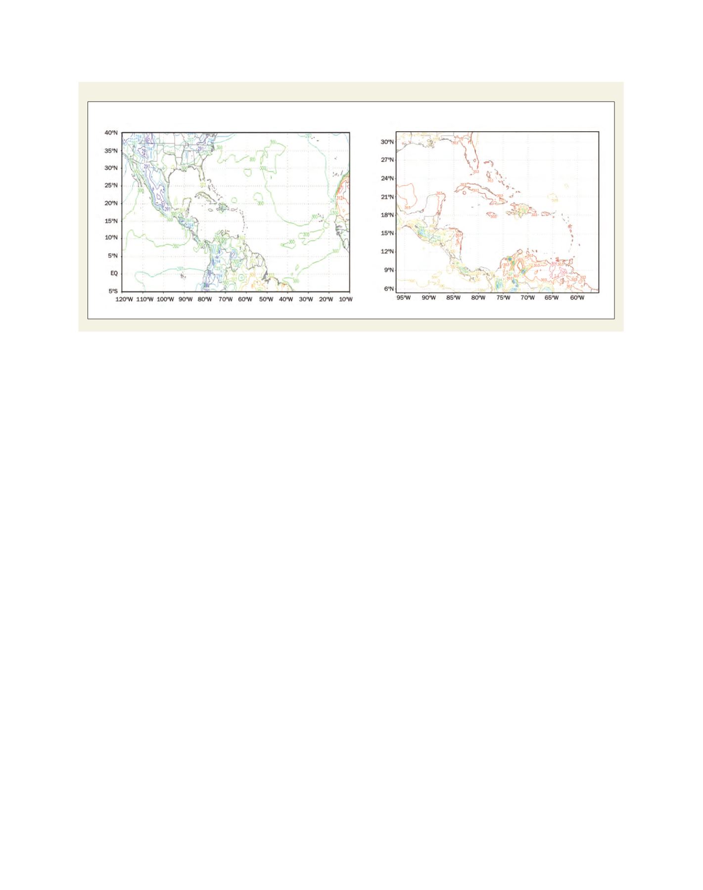
Example of temperature output from GFS (left) and WRF (right) at 100 km and 18 km resolution respectively
Source: Caribbean Institute for Meteorology and Hydrology (CIMH)
Surface temperature (degrees K)
Surface temperature (degrees K)