


 36 / 336

[
] 36
W
ater
D
iplomacy
for clean hydropower development and power trade; for
expanding agricultural production and increasing water
use efficiency; for the preservation and ecotourism use
of biospheres and designated hotspots of unique biologi-
cal diversity; for utilizing the Nile as an entry point for
broader economic-regional integration, promotion of
regional peace and security; and not least for jointly
ensuring the continued existence of the Nile through
prudent and judicious utilization.
The Nile Basin Initiative
Growing recognition of the above challenges, and the real-
ization of the potential inter-riparian conflict that would
ensue from poorly managed, increasingly shrinking and
scarce Nile water resources, spurred the member coun-
tries to formulate a shared vision1 and establish NBI in
February 1999, with significant support from the inter-
national community. NBI is headquartered in Entebbe,
Uganda with two subsidiary action programme offices in
Addis Ababa, Ethiopia and Kigali, Rwanda. NBI has three
core functions, namely facilitating cooperation, water
resources development and water resources management.
NBI fills an important gap that has been a barrier to the
joint and sustainable management of the common Nile
Basin resources. It is a transitional mechanism that will
phase out when the Nile River Commission is established.
NBI has had several key achievements in its three core
functions, along with various challenges and lessons in
transboundary cooperation.
Facilitating cooperation
NBI has provided the first and only inclusive platform
for dialogue among all riparian states. Given the earlier
history of non-cooperation characteristic of the Nile
Basin, creating an enabling environment was made a
priority. This included building transboundary insti-
tutions and raising awareness; building inter-riparian
for example, 157-207 million tons of topsoil is washed away annu-
ally, resulting in economic loss upstream and downstream. In the
midstream, important wetlands – critical in regulating the hydro-
logical balance and river flow, hosting endangered flora and fauna,
and providing environmental services to local communities – are
shrinking. In the most downstream reaches in the delta, salt water
intrusion into the Nile is posing growing challenges.
Across the entire Nile Basin, biodiversity hotspots and unique habi-
tats are increasingly disappearing.Both due to sheer demographic
pressure and demand driven by economic growth, the stress on
the finite and fragile water resources of the Nile is likely to grow to
unmanageable proportions. The problem is compounded by the fact
that each riparian country plans and implements its national water
resources development plan on the Nile in unilateral fashion. Limited
understanding of the science of the river; institutional insufficiency at
national and transboundary levels; and inadequate understanding of
the impact of climate change on the Nile – all these add complexity
to the management of the common resources of the Nile.
The Nile Basin has been characterized by a preponderance of intra
and inter-country conflicts and political instabilities. Conflicts and
civil strife related to electoral politics have been common features.
The intensity and costliness of the conflicts has been aggravated by
direct or proxy support of combatants across borders.
Alongside these challenges, the Nile Basin offers significant poten-
tial for a win-win outcome from cooperative management and
development. Among others, the basin harbours noteworthy potential
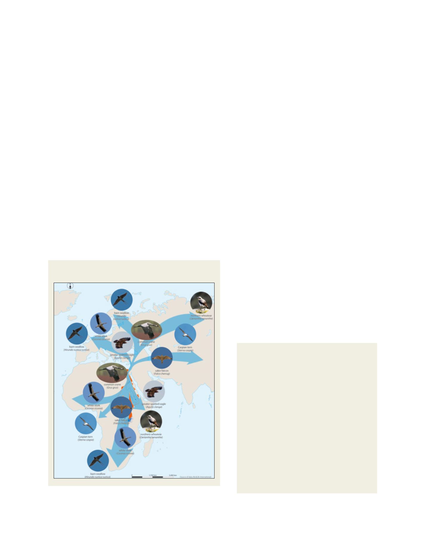
Flyways of selected birds dependent on the Nile Basin for a
stop-over or over-wintering
Source: NBI State of the Basin report, 2012
Community watershed management
project – Sudan
The Dinder and Lower Atbara watersheds are the focus
areas of this fast-track watershed management project.
The former, in the Blue Nile, is also home to the Dinder
National Park – a designated biosphere. Pastoralists
often encroach into the park on their way to find grazing
land and watering points, which creates conflicts.
This project has scored remarkable achievements in
a short period. Over 27,000 ha of degraded agricultural
land has been rehabilitated; farm yield for dominant
crops has shown significant improvement, with sorghum
yield increasing from a baseline 519 kg/ha to 1,249
kg/ha in Dinder and from 1,249 kg/ha to 3,391kg/ha
in Atbara. Similarly, sesame yield has increased from
202 kg/ha to 336 kg/ha in Dinder and white bean
yield has increased from 887 kg/ha to 2,480 kg/ha in
Lower Atbara. Over 300 km of livestock routes have
been mapped, demarcated and opened for pastoralists,
which will relieve en route conflicts. Over 5,010 ha of
rangeland has been reseeded with nutritious and soil
rehabilitating varieties of fodder. Fodder production has
been initiated in 24 villages.