


 110 / 168

[
] 110
Risk assessment
There are numerous examples of hazard, vulnerability and capacity
assessments
35
undertaken by INGOs and mass organizations
36
in
partnership with local people in disaster prone communities. These
assessments have produced comprehensive risk assessment maps
for high-risk areas, in some cases including sophisticated GIS data
and providing information on population density, major facilities,
flooding possibilities and evacuation routes.
There is a need to improve disaster risk and vulnerability indicators
and the collation and interpretation of data to allow risk reduction to be
integrated into development planning and decisionmaking.
37
AMARD/
UNDP CBDRM programme
38
will enable decision makers to improve
assessment of the impact of disasters on socio-economic conditions
and the dissemination of information to the public and people at risk.
Knowledge and education
Over the past decade, the VNRC
39
has implemented an extensive disaster
preparedness programme for school children. In 2000, a comprehensive,
child-friendly text,
An introduction to disaster preparedness for primary
school children
,
40
was first published. Subsequently, in partnership with
the Ministry of Education and Training (MoET) and the provincial
Departments of Education and Training, the VNRC has undertaken
activities in schools in many of the most disaster-prone provinces. More
than 18,000 primary school teachers have undertaken training, going
on to teach approximately 627,000 primary school children. Over this
period, Save the Children, SEEDS,
41
UNICEF and UNESCO have initi-
ated work withMoET in endeavours to include DRR on the primary and
secondary school curricula.
Risk management and vulnerability reduction
Traditionally, the Government has focused on prepared-
ness and response with a strong emphasis on structural
measures, such as dykes and seawalls. The country has
over 10,600km of 6-9m high river dykes
42
and 2,600km
of 3.5-5m high sea dykes that need further expansion
and reinforcement. The Government has invested
considerably in the dyke system and has ambitious
plans for the next decade to expand upon this.
43
Much of the 3,200km coastline is, or could be,
protected by mangrove forest,
44
which mitigates
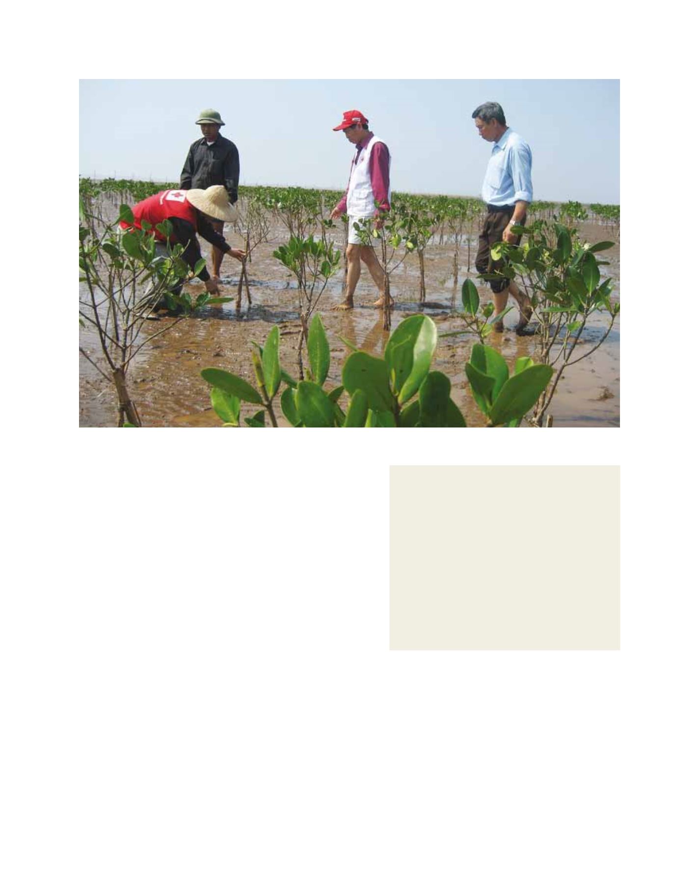
Red Cross staff monitoring newly planted mangroves in Ninh Binh province
Image: Vietnam Red Cross, 2009
Mangroves for protection and resilience
Mangrove afforestation has been undertaken in eight
of the most disaster prone northern and central coastal
provinces.
49
Funded by the Japanese and Danish Red
Cross Societies with funds from local counterparts, the
programme has planted a mix of mangrove, Australian pine
and bamboo, providing over 100km of protection on sea
and river dykes.
A recent independent cost-benefit analysis reported that,
on average, 1ha of planted trees costs US$843/km.
50
To
effectively protect a dyke through mangrove afforestation
costs US$84,300, while upgrading a dyke by raising the
height by one metre and concretizing it costs between
US$800,000 to US$1.5 million/km.
51
The programme
has facilitated the development of a broad range of social
projects and mangrove-related livelihood activities.
52