


 40 / 196

[
] 38
Since the recurrence interval of large earthquakes is
very long (a few to several hundred years for a subduc-
tion-zone event), geological surveys are important to
examine the earthquake history. The 2004 Sumatra-
Andaman earthquake and the accompanying tsunami
left geological traces that would be permanently
preserved. Uplifted corals appeared above the sea
surface on islands off Sumatra or North Andaman
Island. Sand brought by the tsunami was traced inland
along the Sumatran, Thai and Indian coasts. Geological
studies found evidence showing that a giant earthquake
similar to the 2004 event occurred in the same region
several hundred years ago. If such paleoseismological
studies were made before the 2004 earthquake, scien-
tists would have anticipated a giant earthquake in this
region.
Development of human resources for enforcing human
power against natural disasters
– It is essential to
develop human resources for enforcing human power
against earthquakes and tsunamis. Education and train-
ing residents as well as other practical countermeasures
in local communities are important for this purpose.
A questionnaire survey in Banda Aceh found that the
local people’s knowledge of tsunamis was very low
before 2004. To the question, ‘Did you know that
tsunamis would come after a big earthquake?’, only
three per cent answered ‘yes’. A further finding is that,
even if people had started evacuation immediately after
the earthquake, not everybody would have been able
to survive. The practical implication is that education,
socialization, escape routes, evacuation structures,
warning systems and wave resisting structures are
participated and 28 researchers cooperated in the project. An advi-
sory committee was established for monitoring the project.
Outline of results
Mechanism of the giant earthquake and its prediction
– Seismological
investigations indicated that the Sumatra-Andaman earthquake was
a typical subduction-zone type event. The Indian plate is subduct-
ing beneath Sumatra and the Andaman Islands, causing the upper
plate to be dragged and deformed up to a certain limit. When the
stress reaches its maximum strength, the continental plate rebounds
and generates an earthquake. The 2004 earthquake, with a magni-
tude of 9.1 and a source about 1,200 kilometres long, was the largest
in the world over the last 40 years.
The most popular but controversial question is whether such a
large earthquake is predictable. Stress concentration might occur
before the event and an accelerating stage of stress relaxation might
exist, being visible as precursors. We investigated seismicity and
stress change and found that there might have been a significant
change in seismic activity before the 2004 earthquake. Though it
has to be evaluated more carefully, the accumulation of such possi-
ble evidence of a precursor to a large earthquake is important.
On the other hand, after-effects of a large earthquake are readily
visible as post-seismic crustal deformations, and such research has
become increasingly important for earthquake studies. Several teams
deployed GPS stations in Indonesia, the Andaman Islands and
Myanmar. A GPS site established in Aceh, Indonesia, has registered
more than 50 centimetres of land displacement in less than two
years after the earthquake, and this is still continuing. Preliminary
investigation of data from new and existing GPS stations suggests
post-seismic slow slip around the co-seismically slipped area, though
decades of monitoring are necessary for clarifying the stress
readjustment process.
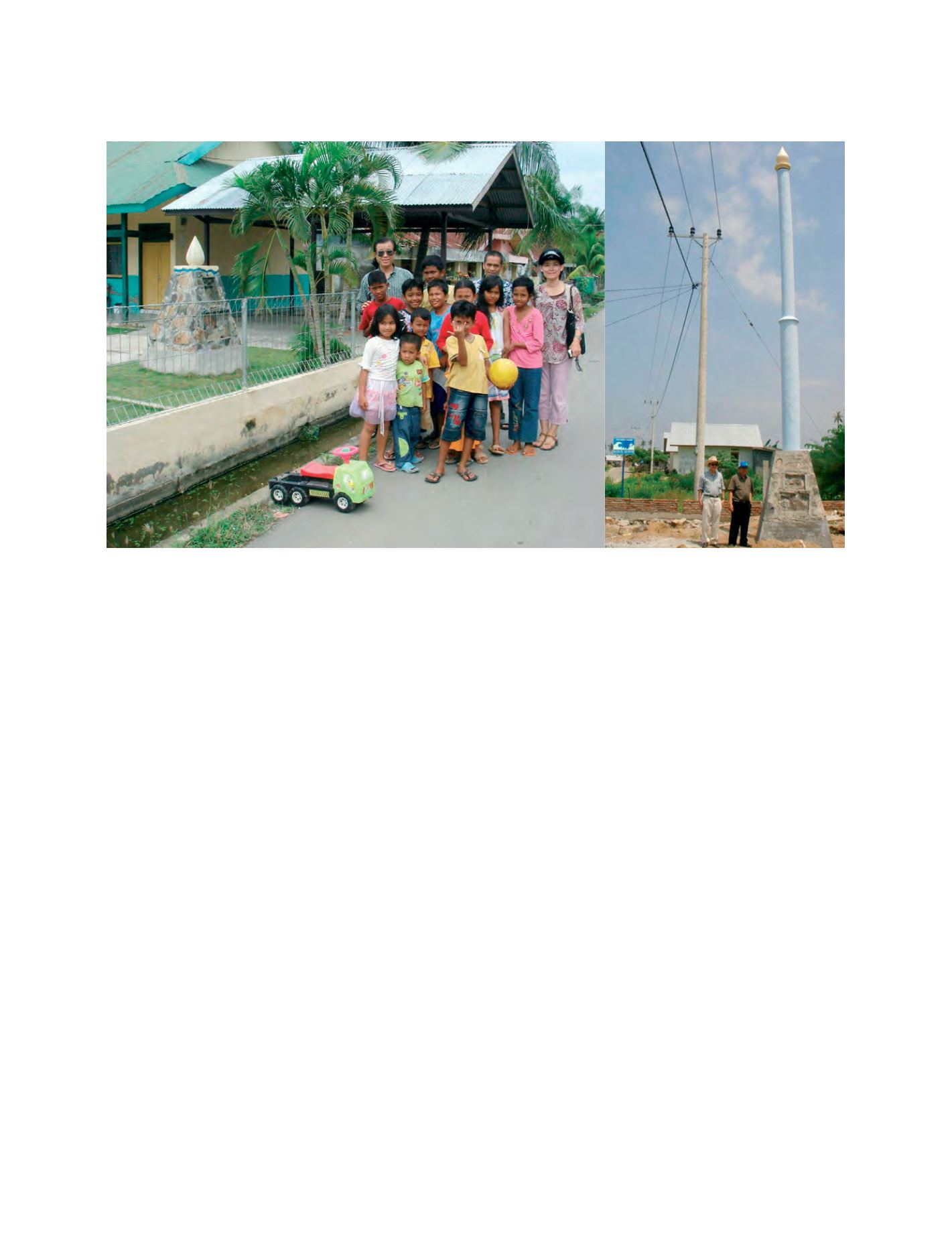
Tsunami memorial poles are built along evacuation routes, and also serve as education tools to convey the memory of the disaster to future generations
Image: Hirokazu Iemura