


 116 / 280

[
] 116
CBERS – the Chinese-Brazilian
Earth Resources Satellite programme
José Carlos Neves Epiphânio, João Vianei Soares, Hilcéa Ferreira and Gilberto Câmara Neto,
Instituto Nacional de Pesquisas Espaciais, Brazil
T
he world has been facing new challenges on its sustain-
ability. Many fields of research including biology,
meteorology, environmental and land use must provide
their contribution so humankind can envisage a safer future to
the planet. In order to take the right actions and work towards
better practices on this changing planet, we need a deep under-
standing of nature, modeling its processes and dealing with each
variable involved.
Satellites are fundamental tools to help understanding many of these
variables and processes. Since the launch of the first civilian remote
sensing satellite – Landsat-1-, back in 1972, many new satellites with
different capacities have been launched, especially in the past 15
years. The benefits brought by satellites for studying and surveying
the planet are enormous; and everyone agrees that it would be impos-
sible to reach the understanding of the planet we have today without
the data produced by them.
In general, each satellite belongs to only one country. However, in
1988, Brazil and China signed an agreement to build, launch and run
jointly a remote sensing satellite. The CBERS Program -
the acronym for China-Brazil Earth Resources Satellite -
was developed under this agreement. The main objec-
tive for both countries was to develop the capacity to
build and run a civilian satellite series that could provide
remote sensing data to survey their huge territories
autonomously. The agreement was a cost sharing
arrangement for building and launching the satellites,
and their operation performed by Brazilian and Chinese
control centers, with a schedule to the handover of
control to one another.
Satellites
The first phase of the Brazilian-Chinese agreement
comprised building two remote sensing satellites with
the same characteristics. The first satellite – CBERS-1 –
was launched from the Taiyuan launching base, in
China, in October 1999. It worked for almost four years,
until August 2003. CBERS-2 was integrated and tested
in Brazil, and was successfully launched from the same
launching base in October 2003. The satellite is still
working (August 2007), beyond its expected lifetime.
Both satellites were put into orbit aboard the Long
March 4 rocket.
Two new agreements were signed to build CBERS-2B,
and CBERS-3 and 4. CBERS-2B payload is similar to
CBERS-1 and 2 carries a new high-resolution Camera.
CBERS-2B was successfully launched in September, 20,
2007. CBERS-3 and 4 make up a new family, with new
sensors and capabilities. They are scheduled for launch-
ing in 2009 and 2011, respectively.
The CBERS satellites have near-polar, sun-synchro-
nous orbit at 778 km altitude, and cross the equator
around 10:30 a.m., descending node. CBERS cycle is
phased in 26 days, with around 14 orbits a day. The duty
cycle is close to 20 minutes each orbit making for a global
monitoring capacity. Up to now there are four ground
receiving stations for CBERS: three in China and one in
Brazil (32 years-old Cuiabá Ground Station). There are
arrangements in progress to set up direct receiving capac-
ities in other ground stations, especially to supply
Caribbean and African countries needs. Besides the direct
downlink, CBERS satellites are able to record data
onboard from everywhere and downlink these images to
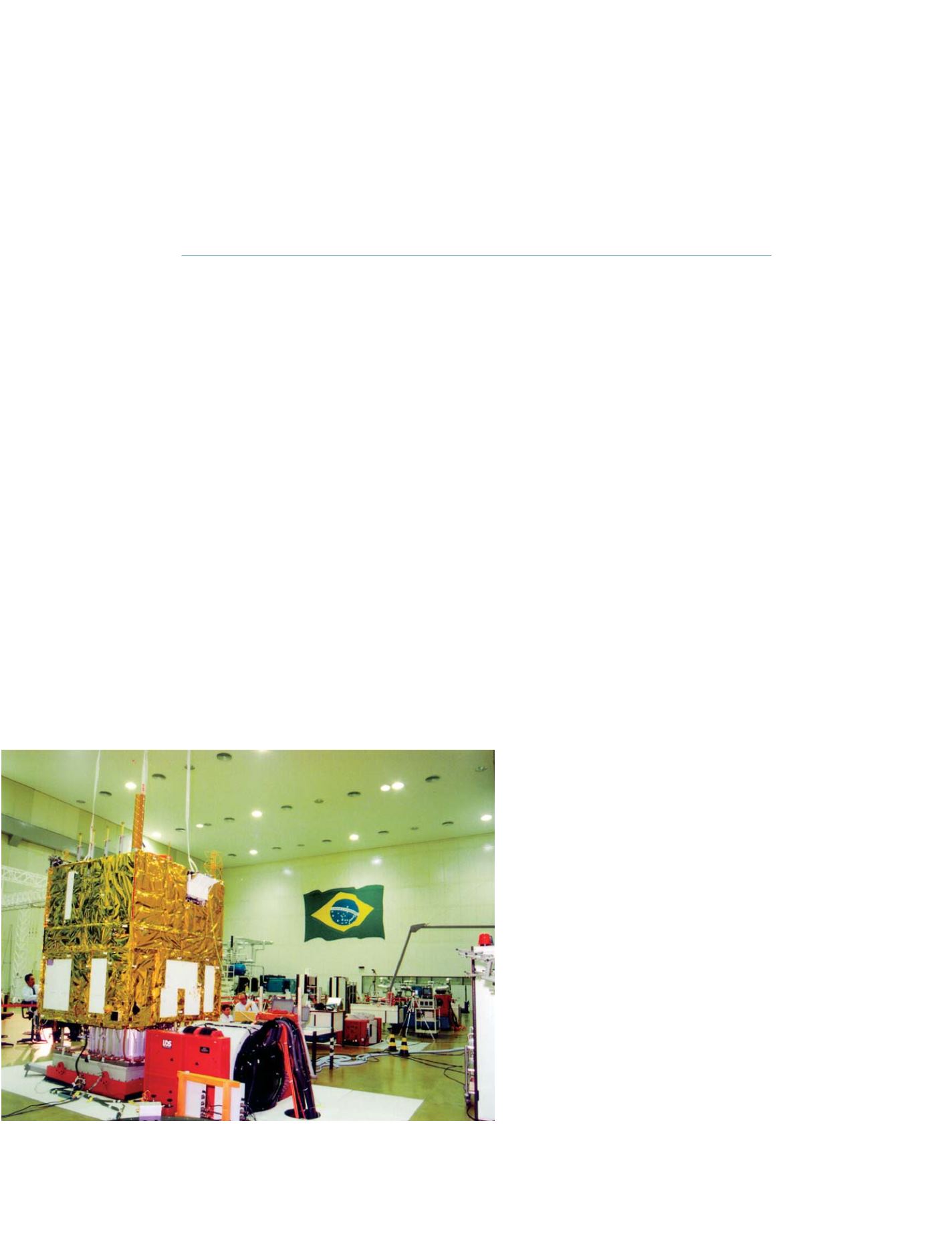
CBERS satellite being integrated and tested at INPE’s assembly facility
Photo: INPE Press
GEOSS C
OMPONENTS
– D
ISSEMINATION
/I
NFORMATION
S
YSTEMS