


 120 / 280

[
] 120
Capacity building networks for
Earth observation and geo-ICT:
a first step towards a virtual university
Martien Molenaar and Chris Mannaerts,
International Institute for Geo-Information Science and Earth Observation (ITC)
E
arth observation and geo-information are essential for the
monitoring of spatial processes that affect the sustainable
development of our living environment. The management
of these processes requires decision power at different adminis-
trative and political levels ranging from local to global scale.
A worldwide scientific and professional community develops and
implements tools and methods to deal with these issues. They
develop indicators at different resolution levels and their specifica-
tions based on profound knowledge of these processes and of the
technology for earth observation and geo-information processing.
Such a community should ideally be a worldwide one for several
reasons. Three of the most important are:
• The awareness that these processes are of a supra-national and
even a global scale implies that world wide efforts are required to
deal with these scientific problems, and that all
nations should contribute.
• The globalization of the economy implies the devel-
opment of global delivery chains products and
services.
1
Partners in these chains must have a
common understanding of the specifications and
conditions for product and service delivery. This
should be developed through a global involvement in
research, technology and service development.
• The fact that it is impossible for national economies
to maintain sufficiently high investment levels over
the full range of modern research sectors implies that
national and regional priorities will be set for fields
of interest. We will see an increasing regional or even
(inter) continental spread of fields of expertise, first
for research but consequently also for technology
development and consequently for higher education.
Problems faced by geo-information providers
Until twenty years ago production processes for geo-
data, or maps, were quite stable and the development
mapping technology and concepts allowed time hori-
zons for investments to the order of 15 to 25 years.
Presently the development of technology requires a time
horizon for investments in hardware of three to five
years and concepts for information products and
services have to be adjusted every five to eight years.
Consequently GI-providers and users must adjust their
geo-ICT architectures continuously, which has techno-
logical, organizational and institutional consequences.
2
The technology aspect concerns the development and
application of concepts for spatial data modelling, for
the information extraction from image data and for the
processing, analysis, dissemination, presentation and
use of geo-spatial data. The organizational and institu-
tional aspects concern the development and
implementation concepts for the structuring, organiza-
tion, management and institutional arrangements of
processes for geo-spatial data production and the provi-
sion, as well as the use of geo-information services.
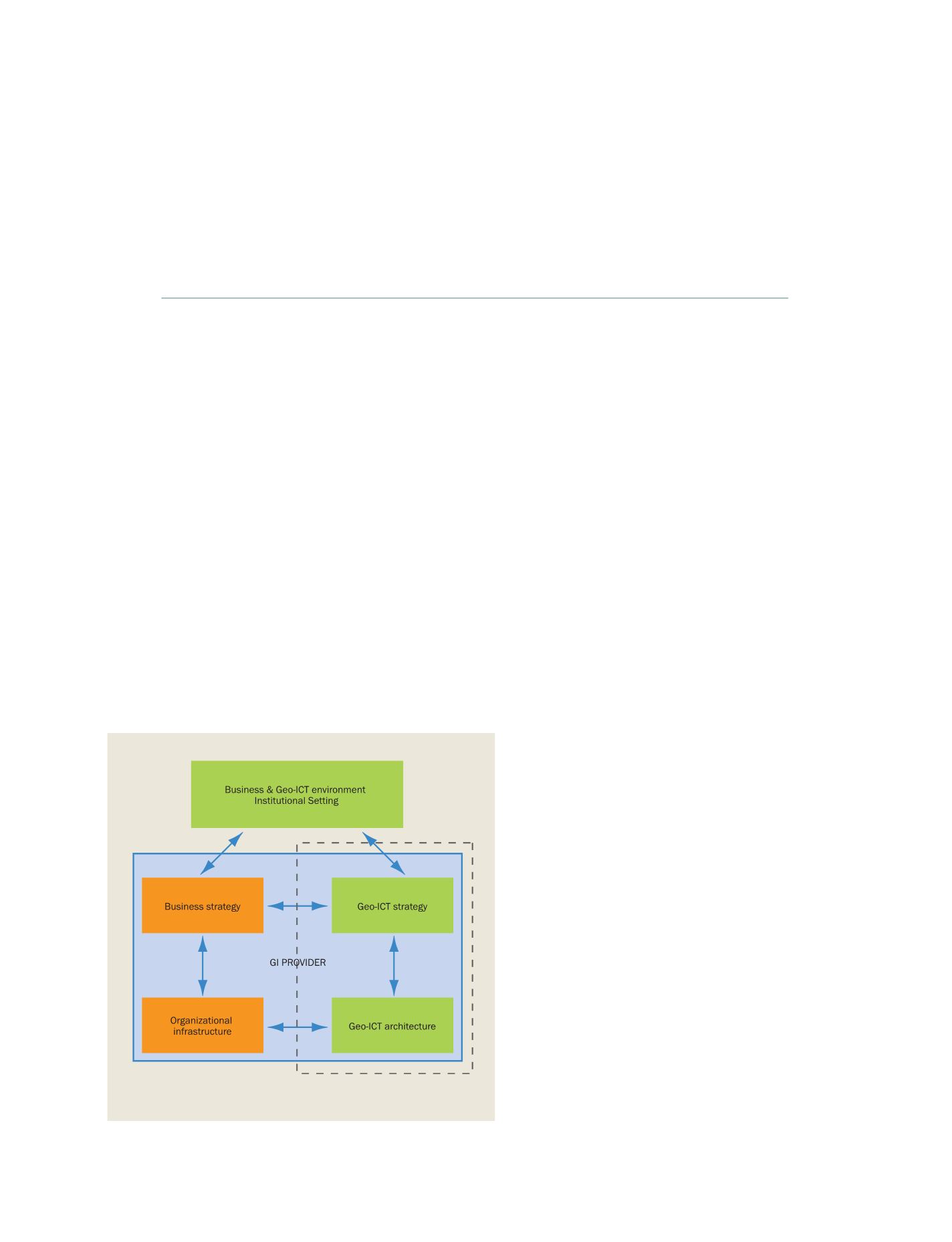
Source: ITC
GI-providers and users must adjust their geo-ICT architectures continuously,
which has technological, organizational and institutional consequences
Strategic alignment model, after (Henderson et al, 1992)