


 119 / 280

[
] 119
system to monitor forests fires. This system comprises three
components.
The first enables the daily identification of forest fire risk
areas, through a global and dynamic cartography of sensi-
tive and vulnerable zones. The approach is based on the
combination of two indicators derived fromNDVI and land
surface temperature, namely: vegetation drought index and
vegetation regression index. The second component is the
following-up of fires by the detection and characterisation
of hot spots. The developed algorithm is based on a thresh-
old of thermal channels and reflectance channels from
NOAA images. The third element of this system involves
the evaluation of damage through the cartography of the
burned areas. Both low (NOAA/AVHRR) and medium
(SPOT) resolution images are used in this task.
Drought and desertification
Drought occurs very frequently in the Mediterranean coun-
tries, with severe environmental, economic and social
consequences. Policy makers need information and tools
to improve drought preparedness and to mitigate impacts.
Within the framework of cooperation between North-
African countries (Morocco, Algeria and Tunisia), CRTS is
conducting, in cooperation with departments of agricul-
ture and forestry, a project called SMAS (SystemMaghrebin
d’Alerte contre la Secheresse). Based on a combination of
satellite data, meteorological measurements and in-situ
observation, the proposed system aims to provide decision
makers with sustainable information on the status of agri-
culture areas.
GEOSS to support sustainable resources management
The evaluation of the impact of the use of Earth observa-
tion data shows many direct and indirect benefits, including
cost and time saving, which result from efficiency and effec-
tiveness in planning and monitoring activities. In all these
fields, the analysis of systems, such as hydrologic, forest
and groundwater still requires information of a spatial
and/or in-situ nature, as well as various methods, includ-
ing modelling and geophysics. In this respect, GEOSS is
considered by the user community as an opportunity to
bring together several sources of information to offer a
cooperative instrument to share knowledge end expertise.
In spite of these positive aspects, users still face signifi-
cant hurdles, such as the availability of, and access to, space
satellite data, as well as the gap between available data and
end-user needs. GEOSS and its ten years implementation
plan will bring, from our point of view as a developing
country, a great step towards addressing such concerns.
The most important of which is its impact on political
awareness. Indeed, the participation of Morocco in the
GEO summits at a ministerial level shows the political
commitment of our country to contribute to this interna-
tional challenge. Nevertheless, the full potential of GEOSS
for economic and social development can be accomplished
only with an enhanced level of international cooperation.
One of the key elements for active participation in the
GEOSS implementation by developing countries is their
capacity to act as contributor and not only as beneficiary.
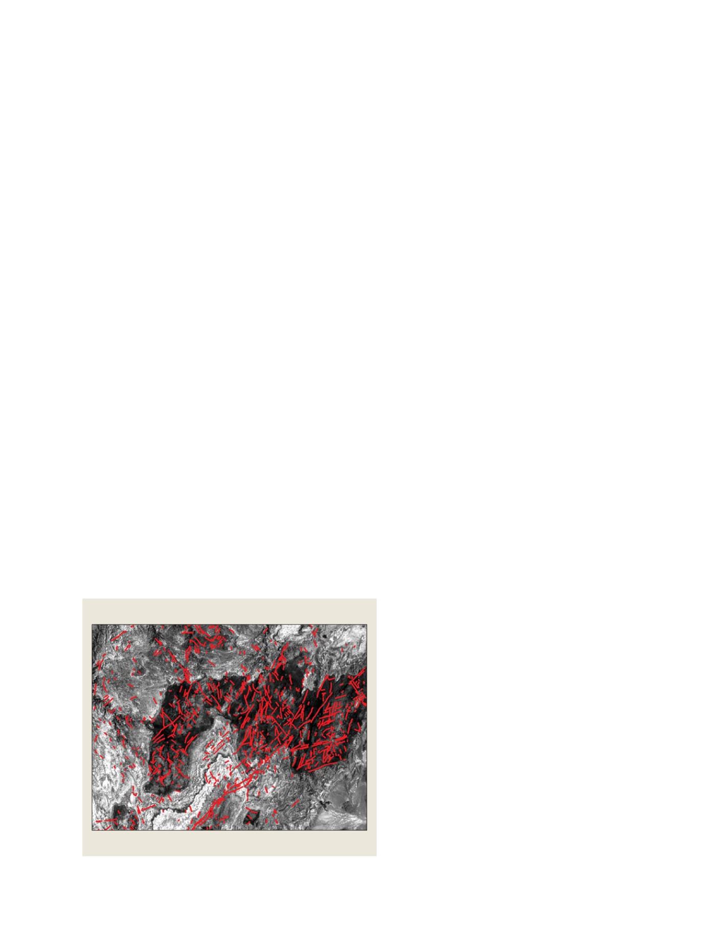
The analysis methodology was based on the identification of a series of
indicators, including land use, moisture, fractures and lithography.
In addition the use of radar images was very helpful in understand-
ing the interaction between water and soil. The combination of
interpreted information collected from two images, resulted in a map
of run off and infiltration zones. It also enabled a better understanding
of the geomorphology and mechanisms of recharge. The result of this
study was the identification of favourable sites for the establishment of
boreholes with high yields.
Forestry
Morocco’s forests play a major role in the environment and the
economic well-being of the country. Defining these roles on a sustain-
able basis requires information, and there is strong evidence that the
types and requirements for information are increasing. Earth obser-
vation images are technological tools that can assist practitioners and
researchers in the mapping and monitoring of forest ecosystems at a
variety of scales.
Most of the national forests are not adequately mapped. So main-
taining accurate and up-to-date information is an ongoing challenge to
understand the changes affecting forest areas, as well as determining
factors of degradation. In order to monitor forest resources, to complete
the national inventory and to up-date the existing maps at a low cost,
the CRTS in cooperation with the Forest Department, conducts studies
based on Earth observation images.
The availability of time series, covering three decades, was very helpful
in establishing ‘evolution maps’, as well as in quantifying the spatial and
temporal distribution of change in forest areas. A second study, which
covered more than 75 per cent of the national territory, gave the Forest
Department a complete picture of the National Forest Inventory. More
than 200 maps were elaborated at different.
Forest fire assessment
Forest fires are a permanent problem in Morocco during the summer
season. Annually, burned surface amounts to approximately 3,000
hectares. The project consists of the implementation of an operational
Ground water
Geological feature for potential ground water location/Ighrem village, Morocco
Source: Royal Centre for Remote Sensing (2007)
GEOSS C
OMPONENTS
– D
ISSEMINATION
/I
NFORMATION
S
YSTEMS