


 118 / 280

[
] 118
GEOSS: a platform for sharing
information and expertise for sustainable
management of natural resources
Driss Elhadani, Director, the Royal Centre for Remote Sensing
P
opulation growth and subsequent socio-economic develop-
ment create tremendous pressures on natural and
environmental resources. On the other hand, decision makers
are aware of a need to manage these resources in a sustainable and
environmentally sensitive manner. Geoinformation, particularly
Earth observation data, has demonstrated to be a powerful tool for
addressing national sustainable development issues. Earth obser-
vation resources are used to produce comprehensive and
operational information and therefore contribute to enhance deci-
sion-making processes.
Since it creation in 1989, the Royal Centre for Remote Sensing (CRTS)
has prioritized three strategic actions. Firstly, to promote and develop the
exploitation and the use of space technologies, notably remote sensing
in development projects. Secondly, to ensure all users accessibility to
Earth observation data and other geo-space information. Thirdly, to rein-
force national capacity building and knowledge dissemination though
an integrated training program, and to support to research
and development activities.
Using these axes, a wide range of operational projects
were developed to answer ministerial department needs in
several fields. These applications include water resources
management, forestry monitoring, city and urban growth,
agriculture and drought and disaster management. This
paper highlights some of the major and recent applications
related to water resources and forest monitoring and
management.
Integrated system for water resources management
The use of remote sensing data in water related applica-
tion has increased significantly over the last decade. This
is mainly due to the fact that Earth observation images offer
the unique opportunity to attain spatially distributed infor-
mation over large, remote and inaccessible areas. The
integrated management of water resources at national, as
well as river basin scales, is a complex problemwith regard
to its multidisciplinary nature. It requires not only the rele-
vant information, but also models and decision support
systems fitting the needs of the water administrators.
The Souss-Massa region is one of the most important
areas in Morocco for agriculture and tourist activities. The
region contributes more than 50 per cent of Morocco’s agri-
cultural production and is also the second most
economically productive region in the country. The devel-
opment of agricultural activities is creating a huge demand
on water resources, and the recurrent periods of drought
require a proactive approach to manage the available
resources.
CRTS, in cooperation with the water authority in the
region (ABHSM), has developed a decision support system
that provides value added information to the ABHSM for
integrated water management. Cartography of land use
changes, assessment of the development of soils under irri-
gation and mapping of geological lithology and structures
were all used as input data sets for the hydrological models.
New resources were also identified to supply remote
villages with fresh water.
The developed systemwas largely based on the exploita-
tion of Earth observation products such as SPOT, Landsat,
RADARSAT and ERS, combined with modelling processes.
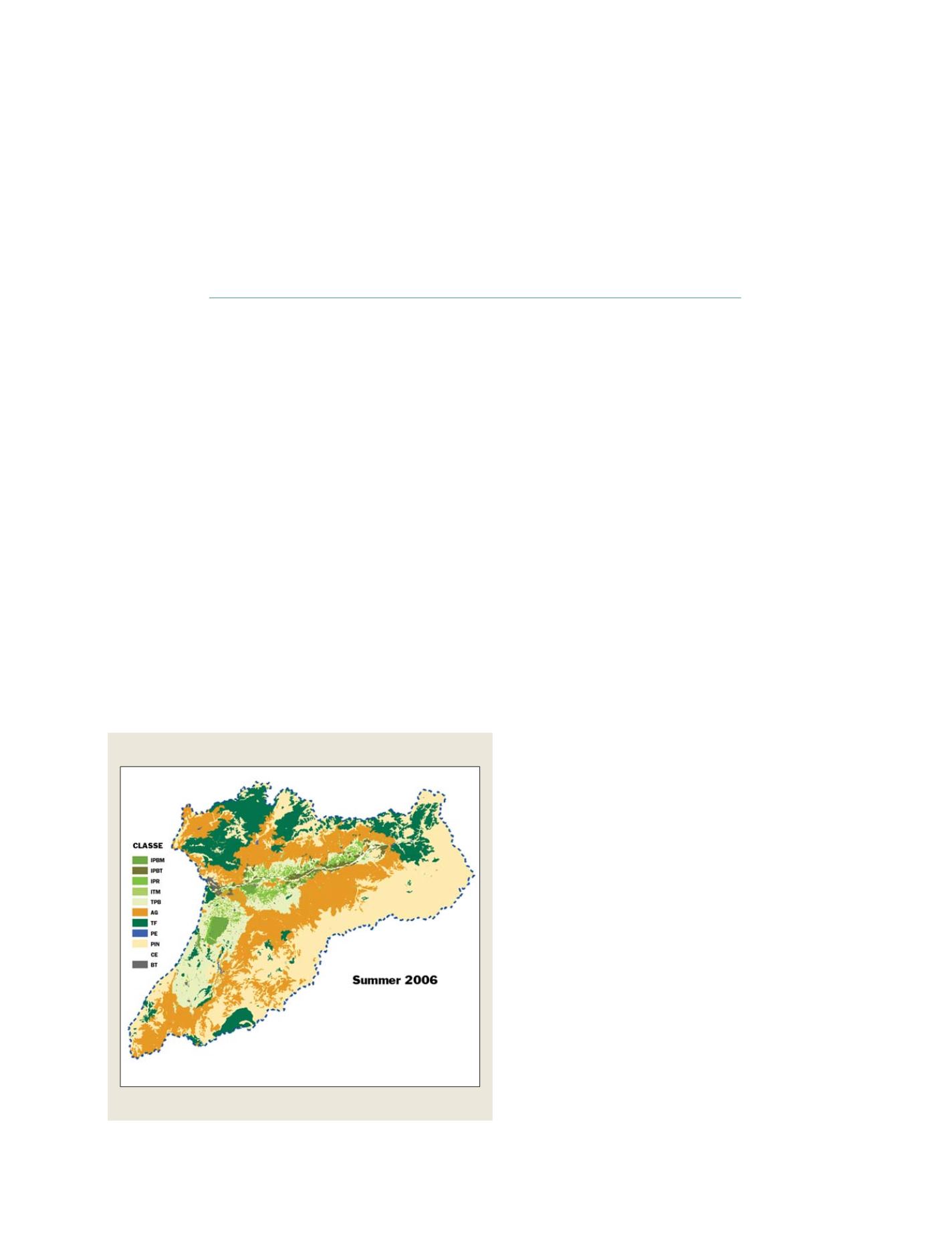
Water resources
Land use map for irrigated soils assessment/Agadir region, Morocco
Source: Royal Centre for Remote Sensing (2007)
GEOSS C
OMPONENTS
– D
ISSEMINATION
/I
NFORMATION
S
YSTEMS