


 149 / 280

More recently a storm surge on the South African east coast
resulted in damage totalling hundreds of millions of rands.
Furthermore, ongoing financial loss is being experienced by the large
tourist industry because the exposed coastline continues to lose sedi-
ment. Although fixed structures obviously cannot be moved, much
of the property loss could have been prevented if there had been
sufficient warning to enable residents to relocate movable objects.
An ocean model run in hindcast mode can calculate the long-term
likelihood of such an event, providing coastal authorities with advice
on reasonable limits to coastal development.
Despite the drive to move away from fossil fuels, the fact is that the
oil and gas industry continues to explore for new offshore reserves
in increasingly deeper water. Ocean prediction models will be called
upon to ensure that these new developments do not threaten the
sustainability of other activities in the region. One of the major
requirements is a need for ocean current information throughout the
water column. Off the southern coast of Namibia is one of the richest
offshore
diamond
fields in the world. Numerical ocean modelling
supported by data from the GEOSS network and also any additional
locally-collected information, would help to predict more accurately
the effects of new developments on the environment, as well as to
optimize operations in the high wave energy environment.
Coastal populations are rising rapidly and Cape Town is no excep-
tion, with the municipal population rising by over 15 per cent in the
past decade. This puts increasing pressure on the coastal environ-
ment, particularly when it comes to getting rid of sewage and waste
products from industry. Outfall pipes need to be designed to with-
stand the heaviest wave and current conditions. In the
latter case particularly, actual data is usually very sparse
and consists of short records. The only way to generate
sufficient data for design purposes is to model the circu-
lation and then run the model in hindcast mode. In May
1984 a very intense low-pressure system southwest of
Cape Town resulted in significant wave heights of over
ten metres, which caused one of the City’s main outfall
pipes to rupture.
The role of the smaller maritime NMS in GEOSS
and ocean prediction systems
National Meteorological Services with limited resources
cannot be expected to run their own ocean models and
indeed there should be no need for them to do so. The
resolution of global models is ever-improving as
computing power increases and it is generally accepted
that ocean prediction, like GEOSS, is a global partner-
ship. Smaller NMS are not in a position to contribute to
extremely expensive satellite programs. Where they can
still play a significant role however, is the collection of
quality marine data in their own waters, and by ensur-
ing that they maintain close contact with their
international community. Even ocean data which is not
available real-time can still perform a vital role by
providing verification data for the models, especially in
data-sparse waters.
[
] 149
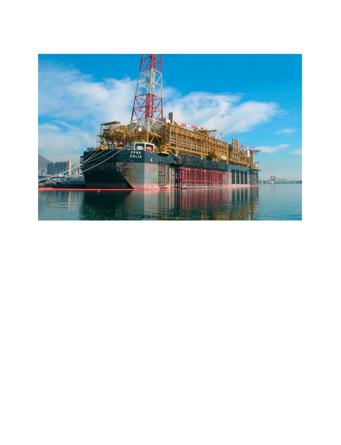
The FPSO (floating production storage offloading) platform
Dalia
. Cables parted in rough seas off the South African coast as the newly built 300 metre
vessel was being towed to Angola
Photo: Sydney Marais, South African Weather Service
GEOSS C
OMPONENTS
– P
REDICTION
S
YSTEMS