


 148 / 280

[
] 148
modelling and prediction of tsunamis has no connection with mete-
orology at all. Yet the WMO’s GTS is utilized to disseminate tsunami
warnings, with several NMS having an even more direct involvement
in tsunami warning systems. Thus it is quite possible that some NMS
may be called upon to run the ocean models when they become fully
operational.
The assimilation of data, in situ and satellite-derived, into predic-
tion models is not a simple matter. The introduction of new types of
input data may render a model unstable, or even
adversely
affect
predictions. Nevertheless the science has progressed such that most
of the available real-time data is successfully assimilated into the
short-term prediction models: satellite-derived sea temperatures and
scatterometer winds into the atmospheric models; altimeter wave
heights, salinity and temperature profiles and sea level data into the
ocean prediction models. It is also important to remember that the
two types of model need to be fully coupled.
Benefits of short-term ocean forecasting
One of the major benefits of the development of ocean prediction
models is the new capacity for the analysis and forecasting of ocean
circulation, throughout the water column. Some examples follow.
Wave and current interaction, the development of abnormally high
waves and the danger to shipping are issues particularly pertinent to
the east coast of South Africa (beyond Port Elizabeth, most vessels
move inside of the Current, aiming to round Cape Agulhas). There
is a long history of vessels suffering major hull damage or even
foundering in this region. Wave prediction models have developed
to such an extent that their predictions are usually within 0.5-1 metres
of the measured wave height and their timing accurate to
a matter of hours (the air pressure data from the drifting
buoys far off to the southwest play a significant role).
SAWS was one of the first NMS to provide warnings of
possible abnormal wave conditions. However, with
predictions of the position and curvature of the Agulhas
Current, much more accurate warnings will be possible
and with fewer false alarms. Ten per cent of the vessels
rounding the Cape are large tankers – a major oil spill
on the coast could have a devastating effect on coastal
economies formal and informal.
On a shorter time scale, over smaller distances and in
relatively shallow water it is possible to predict oil spill
trajectories when the oil is close to the coast. The bene-
fits of these forecasts range from planning the
prepositioning of booms to evacuating sensitive marine
animal populations. Cape Town has been particularly
unfortunate in this regard. In June 2000 a large ore
carrier, the
Treasure
, sank at the entrance to Table Bay.
Even though this was not a tanker, its 1344 tons of heavy
fuel oil affected over 20,000 African Penguins, which are
a threatened species. A similar incident occurred in June
1994 when the
Apollo Sea
sank in the same area. This
was also a large ore carrier, but the fuel oil was sufficient
to pollute a large portion of the pristine Peninsula coast-
line, and oil over 10,000 penguins. A synthetic aperture
radar flying on Radarsat 1 showed clearly the extent of
the oil, even through cloud cover.
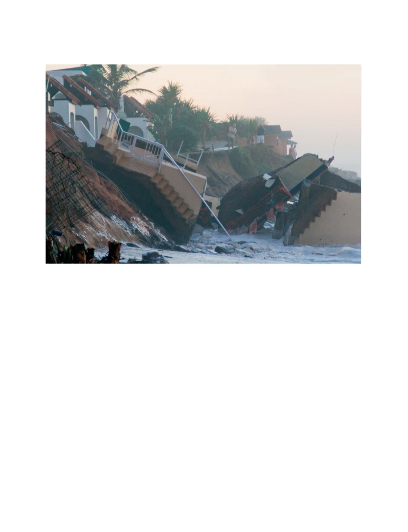
Storm surge damage on the east coast of South Africa, March 2007
Photo: Ken Mann
GEOSS C
OMPONENTS
– P
REDICTION
S
YSTEMS