


 163 / 280

[
] 163
Furthermore, in the area of early warning systems,
WMO has initiated a number of projects such as severe
weather forecasting in Southern Africa, flash flood guid-
ance systems in Central America and Southern Africa,
sand and dust storm warning systems in Middle-East and
Northern Africa, drought monitoring and warning systems
in South-East Europe and Sub-Saharan Africa, national
integrated flood risk management programmes around the
globe, and several projects (e.g. France, Shanghai,
US/Canada transboundary) to demonstrate and share good
practices of early warning systems, supported by strong
governance, legislation, organizational and operational
frameworks, particularly pertaining to the role of NMHS.
Finally, WMO, in close collaboration with partners
from catastrophe insurance and weather risk manage-
ment markets as well as humanitarian agencies, is
developing concrete requirements of these sectors for
weather-, water- and climate-related information.
Linkages to GEO and GEOSS
Currently, renewed efforts are underway to address limita-
tions with respect to data quality and consistency, as well
as availability and accessibility of relevant data for critical
applications such as risk assessment on regional and subre-
gional scales that can support risk identification, risk
reduction and risk transfer decision processes. The goal of
the international Group on Earth Observations (GEO) is to
ensure comprehensive and sustained Earth observations.
This initiative builds on, and adds value to, existing Earth
observation systems by coordinating their efforts, address-
ing critical gaps, supporting interoperability, sharing
information, reaching a common understanding of user
requirements and improving delivery of information to
users. This international initiative aims to establish a Global
Earth Observation System of Systems (GEOSS) built upon
existing capacities and new initiatives over the next decade.
GEOSS is intended to achieve comprehensive, coordinated
and sustained observations in order to improve monitor-
ing of the state of the Earth, increase understanding of its
processes, and enhance prediction of its behaviour. GEOSS
seeks to meet the need for timely, quality, long-term global
information as a basis for sound decision-making, and to
enhance delivery of benefits to society for nine high-prior-
ity societal areas – of which one is reducing impacts from
natural and human-induced disasters to life and property.
WMO, through its DRR Programme, is leading activities
in the GEOWork Plan, particularly related to early warning
systems and risk assessment.
Governments that recognize the importance of disas-
ter risk management can commit themselves by
contributing to GEOSS. Actions include appropriate data-
access policies, and legislation and measures to enhance
the institutional capacity and operational services of their
technical agencies such as NMHS. Furthermore, through
close national, regional and international collaboration
and exchange of relevant data and information, all coun-
tries can benefit from enhanced understanding of the
hazards and their impacts, and forecasting capacities,
contributing to all aspects of disaster risk management.
• Strengthening of NMHS cooperation with civil protection author-
ities and other economic sectors
• Capacity development and public awareness.
This strategy is being implemented through concrete operational
national and regional projects initiated in nearly 30 countries. These
efforts are supplemented with initiatives at political and institutional
level to promote effective governance, legislation and legal framework
for national to local disaster risk management planning; raise awareness
to the benefits of hydrometeorological services and role of the NMHS
in disaster risk management decision processes, and facilitate NMHS
participation in related regional and national coordination mechanisms.
Specifically, WMO has initiated a number of projects in support of
modernization of the observing networks and institutional capacities
of the NMHS for disaster risk management; hydrometeorological risk
assessment; early warning systems with a multi-hazard approach, and
utilization of hydrometeorological information for sectoral planning
with initial focus on catastrophe insurance and weather risk manage-
ment markets, as well as humanitarian preparedness and contingency
planning.
WMO, together with international development agencies such as the
World Bank and its Global Facility for Disaster Reduction and Recovery,
is working on modernization of NMHS in South-Eastern Europe and
developing a four-year plan for modernization of an additional 20 NMHS.
In collaboration with the Global Risk Identification Programme
(GRIP), a consortium involving UNDP, World Bank, Provention
Consortium, Munich Re and international financial agencies, WMO
will be leading major projects on flood, drought and tropical cyclone
risk assessment. These projects involve a wide range of activities such
as standardization of hazard databases and metadata, mapping and
analysis tools and supporting national risk identification projects
through facilitation of cooperation and capacity development of agen-
cies involved in the process. This is complemented by ongoing
improvements of regional and global flood, drought and tropical
cyclone hazard and disaster impact databases.
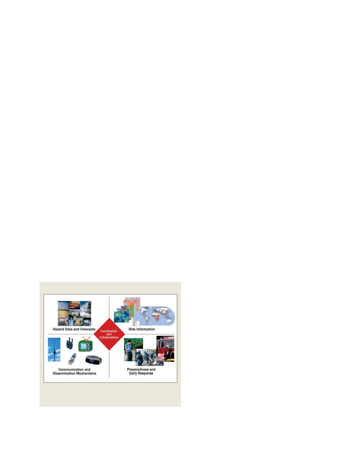
Four elements of an end-to-end early warning system
Source: First WMO Symposium on Multi-Hazard Early Warning Systems (May 2006,
Geneva) and Platform for Promotion of Early Warning System
End-to-end early warning systems must coordinate collaborative hazard data
and forecasts; risk information; communication and dissemination
mechanisms, and preparedness and early response efforts
S
OCIETAL
B
ENEFIT
A
REAS
– D
ISASTERS