


 168 / 280

[
] 168
The advanced fire information system
Philip Frost and Dr Bob Scholes, South African Advanced Fire Information System
T
he South African Advanced Fire Information System
(AFIS) is the first near real-time satellite-based fire moni-
toring system in Africa. It was originally developed for,
and funded by, the electrical power utility Eskom, to reduce the
impact of wild fires on regional electricity supply.
1
Fires under-
neath the 28,000 km of power lines can cause flashovers which
severely affect electricity supply. The loss of life and destruction
of property caused every year by wildfires further emphasised
the need to develop an operational, early warning fire informa-
tion system that could alert the disaster management,
firefighting, farming and forestry communities on the location
and trajectory of blazes, as well as capturing information on the
frequency and distribution of fires for researchers. In 1999 the
Terra polar-orbiting satellite was launched, with Aqua follow-
ing in 2002. Both have a MODIS sensor on board that can detect
fires with high precision four times a day. These data are coupled
with observations from Meteosat Second Generation (MSG), a
geostationary weather satellite that provides slightly coarser and
less sensitive fire location information every 15 minutes. Eskom
implemented AFIS in June 2004, scanning every 15 minutes
within a buffer of 5 km along all transmission lines, searching
for any fire hotspots. With the detection of a fire, e-mail and
SMS text messages are immediately sent to affected parties. AFIS
was first implemented using propriety GIS technology, but has
now been reengineered as an Open Geospatial
Consortium-compliant Sensor Web application
which is currently being developed.
Hotspot detection
AFIS currently relies on contextual algorithms for
hotspot detection using the two MODIS sensors and the
SEVERI sensor aboard the geostationary METEOSAT-8
satellite. Though the SEVERI provides almost near real-
time hotspot detection, it can only resolve large hotspots
(five hectares or more in extent), whereas MODIS can
resolve hotspots less than a hectare in size.
The hotspot detection algorithm was originally devel-
oped for the Advanced Very High Resolution Radiometer
(AVHRR) sensor flown aboard the TIROS satellites. The
algorithm uses the short wave infrared and thermal
bands to discriminate fire pixels from background pixels.
The algorithm first classifies a pixel according to a fixed
threshold, e.g. $T > 310K$, to identify potential fire
pixels, and the remaining pixels are called background
pixels. The neighbourhood of this pixel is then searched
for background pixels, growing the neighbourhood if
necessary to ensure that at least 25 per cent of the neigh-
bourhood pixels are background pixels. From this set
Advanced fire warnings
The MODIS active fires are incorporated into the weather report
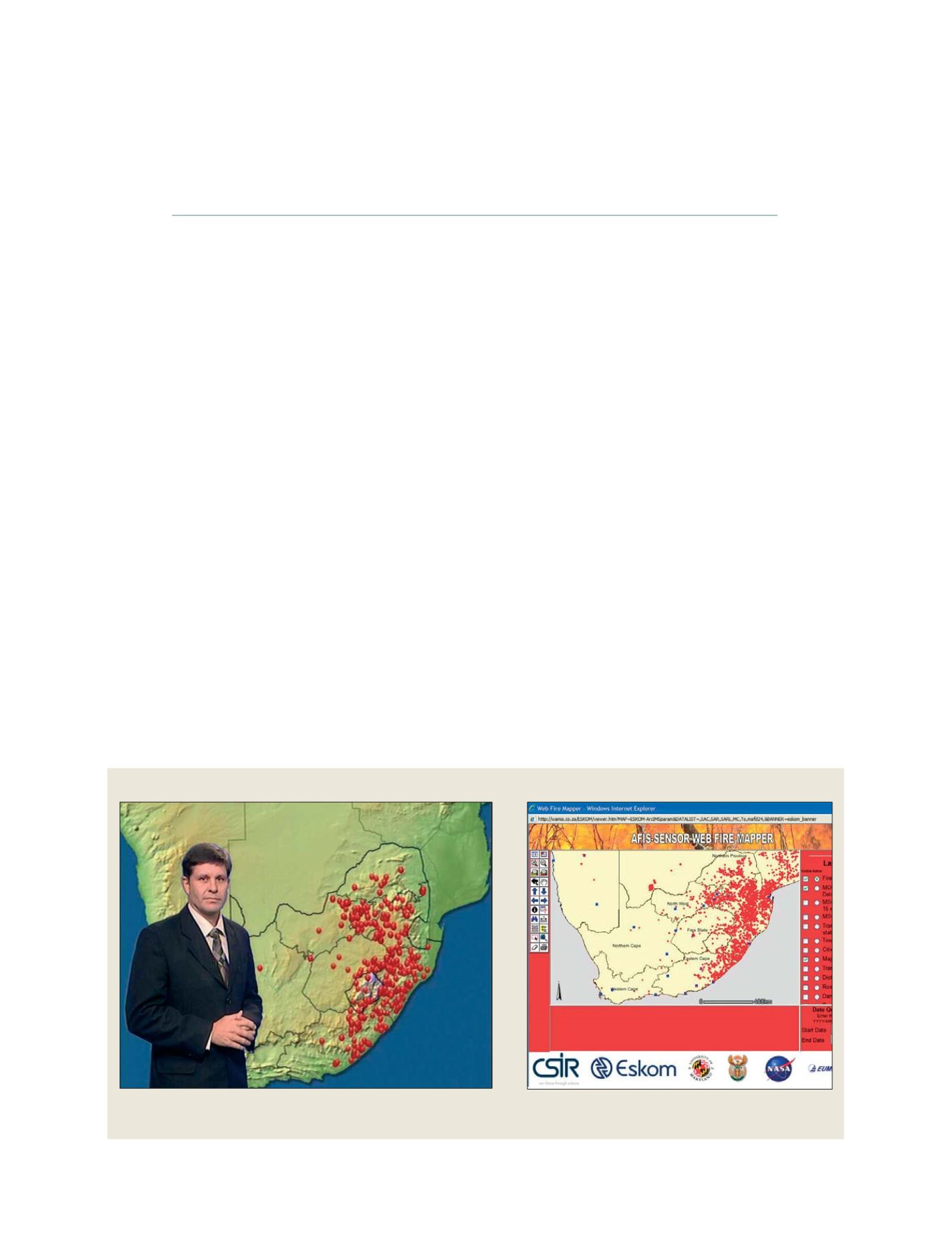
once a week on national television
The AFIS web mapper enables people to view fire locations
via the Internet
S
OCIETAL
B
ENEFIT
A
REAS
– D
ISASTERS