


 166 / 280

[
] 166
In an effort to coordinate international geostationary fire moni-
toring efforts, the GOFC-GOLD Fire Monitoring and
Implementation Team and the European Organization for the
Exploitation of Meteorological Satellites (EUMETSAT) hosted two
workshops on geostationary fire monitoring and applications in
Darmstadt, Germany in 2004 and 2006. The 2006 workshop was
attended by over 45 representatives from 18 countries in Europe,
Africa, Asia and the Americas.
10
This workshop included many
presentations on current research and applications of GOES, Met-
8, FY-2C, and MTSAT-1R, demonstrating the capabilities of these
instruments for fire detection and monitoring. The use of Met-8
SEVIRI data for fire applications has grown significantly through-
out Europe and in Africa. FY-2C and MTSAT-1R were launched in
2004 and 2005. Over the past two years, FY-2C and MTSAT-1R
have been used to some extent for fire detection and monitoring in
Asia and Australia. Furthermore, several operational agencies (e.g.
NOAA/NESDIS, EUMETSAT, INPE, UK Met Office, China
Meteorological Administration, and India) plan to develop or
expand existing geostationary fire detection and monitoring
programmes. NOAA/NESDIS and the UK Met Office plan to imple-
ment a real-time global geostationary fire monitoring system in
2008 and 2009, respectively. Furthermore, fire detection and moni-
toring is a requirement for the next generation GOES-R Advanced
Baseline Imager (ABI) and the Meteosat Third Generation geosta-
tionary platforms.
One of the primary recommendations from the 2006 workshop
addressed the need to become more closely connected to interna-
tional working groups and inter-agency efforts to gain better insight
into the needs of the global user community, to enable better coor-
dination of data sources and products, and to provide input for future
missions. Both international and inter-governmental activities
provide suitable forums for reaching a consensus on sensor and algo-
rithmic requirements. In particular, the relationship between the
GOFC-GOLD-Fire Global Geostationary Network, the Coordination
Group for Meteorological Satellites (CGMS) and the Committee on
Earth Observation Satellites (CEOS) was discussed. CGMS, primar-
ily through its working groups, promotes standardization and
coordinated operational production by operational agencies. The
recently emerged CEOS constellations are aimed at fostering the
international planning process for space-based obser-
vations. Major elements of the concept include a clear
and common statement of requirements defined by the
target user communities, definition of a series of virtual
satellite constellations that satisfy these requirements,
definition of a series of standards for a mission to be
included in the constellation, and a process for recog-
nition and acceptance. The standards include
requirement of sensor capabilities, calibration and vali-
dation and data production and distribution. Many
elements of the CEOS constellation process should be
adapted by the geostationary fire monitoring network.
A strong relationship with the CEOS Working Group
on Calibration and Validation also needs to be main-
tained to ensure ongoing cal/val activities in the
community.
Global early warning system for wildland fire
The success of fire management programmes in reduc-
ing or preventing wildfire disasters is highly
dependent on the ability to predict and prepare for
those situations. To do this, forest and land manage-
ment agencies, as well as landowners and
communities, require an early warning system to iden-
tify critical periods of extreme fire danger in advance
of their occurrence. Early warning of these conditions,
with high spatial and temporal resolution, allows fire
managers to implement fire prevention, detection, and
pre-suppression plans before fire problems begin.
Considering that most uncontrolled and destructive
wildfires are caused by humans as a consequence of
inappropriate use of fire in agriculture, pastoralism
and forestry, it is crucial that international wildland
fire early warning systems are developed to comple-
ment relevant national fire danger warning systems
where they exist, to provide early warning where
national systems do not exist, and to enhance warn-
ings applied or generated at the local community level.
This will ensure delivery of targeted information
reflecting specific local conditions and allowing the
involvement of local communities in wildland fire
prevention.
Fire danger rating is a mature science and has long
been used as a tool to provide early warning of the
potential for serious wildfires. Fire danger rating systems
(FDRS) use basic daily weather data to calculate wildfire
potential. FDRS early warning information is often
enhanced with satellite data, such as hotspots for early
fire detection, and with spectral data on land cover and
fuel conditions. Normally, these systems provide a four
to six-hour early warning of the highest fire danger for
any day for which the weather data is supplied.
However, by using forecasted weather data, as much as
two weeks of early warning can be provided, depend-
ing on the length of the forecast. Ensemble weather
prediction systems through multiple realizations of fore-
casts provide distributions of weather forecasts and
capture the inherent predictability and uncertainty asso-
ciated with such forecasts.
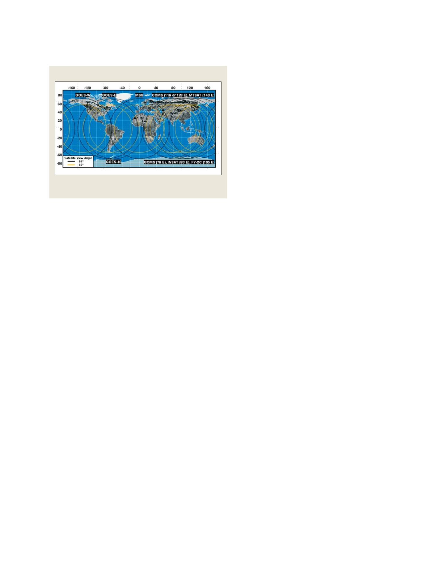
Components of a global geostationary fire monitoring system
Current and future network of operational geostationary meteorological
satellites with active fire detection capabilities
Source: University of Wisconsin-Madison SSEC/CIMSS
S
OCIETAL
B
ENEFIT
A
REAS
– D
ISASTERS